Elevation: 9,500 ft
Prominence: 360
This peak is not in the book. Published November 2021
Peak 9500 is located at the head of Juliette Creek and Happy Hollow. It is overshadowed by Peak 10100 to its east and Bald Mountain (10,313 feet) to its northeast and the ridge that connects them. Peak 9500 is most easily climbed via FSR-025 and the northwest ridge. This climb covers 8.0 miles with 1,850 feet of elevation gain round trip. USGS Clayton
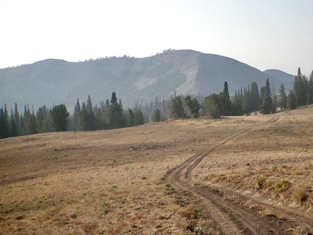
Peak 9500 as viewed from the long, flat section of the northwest ridge. The summit is just right of center. Livingston Douglas Photo
Access
Bayhorse Lake Road/FSR-051 is located along ID-75 exactly 7.9 miles south of the junction of US-93 and ID-75 just south of Challis. Turn right/west onto Bayhorse Lake Road and reset your odometer. At 3.2 miles, reach the Bayhorse townsite. At 4.4 miles, reach the Challis National Forest boundary. At 6.7 miles, reach a signed road junction. Go left to stay on Bayhorse Lake Road. At 7.7 miles, reach an unsigned junction with FSR-025/Juliette Basin Road. Drive about 100 yards down FSR-025 to a parking pullout just before the road drops to ford Bayhorse Creek. Park here (8,260 feet).
Map Errors
The USGS topo map errantly shows the beginning of FSR-025 at a sharp bend in Bayhorse Lake Road. Its junction with Bayhorse Lake Road is about 0.2 miles farther up Bayhorse Lake Road. FSR-025 initially drops to ford Bayhorse Creek. It then heads east then south to cross a shoulder and begin its journey southwest up a wet drainage and then onto the northwest ridge of Peak 9500. FSR-025 reaches a signed junction with FST-4096 at about 9,020 feet. FST-4096 heads southwest off the ridge here. The USGS topo map does not show a road junction here, but it should. A 2-track road continues southeast along the ridge all the way to a small, forested notch at the base of the rocky summit hump of Peak 9500.
Northwest Ridge, Class 2
The Climb
This climb is mostly Class 1. From the parking pullout on FSR-025, hike along FSR-025 and, at the outset, jump across [small] Bayhorse Creek. The rugged jeep road (only suitable for ATVs and MCs) goes east then south around a shoulder and soon passes signed junctions with FSR-023 (left) and FSR-022 (right). Continue straight on FSR-025 at these early junctions. The road goes steeply up through a forested section to reach more open ridge terrain above. It bends left-ish/south and then left-ish/southeast later as it goes over (or skirts) a number of ridge humps.
The ridge terrain is mostly open or semi-open. FSR-025 ends at a notch in a patch of pine forest along a fence row at the base of the rocky, open, elongated summit hump/ridge of Peak 9500. From this unceremonious end of the 2-track ridge road (9,020 feet), scramble left/southeast up somewhat-steep, loose boulders and talus/scree to reach the crest of the ridge. The slope eases a little higher up. Continue this boulder/talus scramble up the ridge. The final push to the summit is up a final section of pure boulders. The summit high point is the westernmost of three summit humps on the elongated summit ridge. The semi-open summit has a small cairn. The extra ups and downs on this climb amount to 600 extra feet of elevation gain round trip.
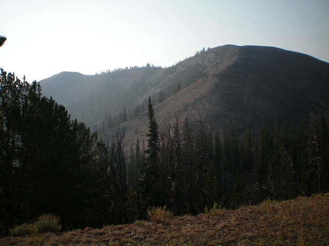
Peak 9500 (summit is right of center) and the final talus scramble to the top of the northwest ridge (center of photo). Livingston Douglas Photo
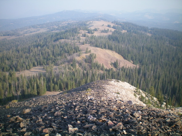
Looking down the northwest ridge from near the summit. Notice the 2-track road on the long, undulating ridge. Livingston Douglas Photo
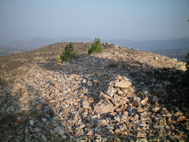
The talus-covered summit of Peak 9500. Livingston Douglas Photo
Additional Resources
Regions: Eastern Salmon River Mountains->Salmon River Mountains->Southeast Corner Peaks->WESTERN IDAHO
Mountain Range: Eastern Salmon River Mountains
Longitude: -114.38119 Latitude: 44.35639