Elevation: 9,557 ft
Prominence: 549
This peak is not in the book. Published November 2022
Peak 9557 is located on a massive, lengthy ridgeline that separates Trail Creek from Lake Creek. It can be climbed from either drainage but fording/crossing Trail Creek can be problematic. Peak 9557 is a ranked hump (like Peak 8398 to its southwest) on the southwest ridge of Rock Roll Peak (10,458 feet). USGS Rock Roll Canyon
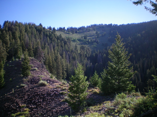
Looking up the west ridge (left of center), my ascent route. The summit is in dead center on the high, forested ridge. Livingston Douglas Photo
Access
Lake Creek Road is located along ID-75 exactly 3.2 miles north of Sun Valley Road in Ketchum. It is signed with a small street sign. Reset your odometer at the start of Lake Creek Road. At 0.7 miles, reach the National Forest boundary. At 4.1 miles, reach a signed junction with a side road (right) that goes a short distance to the Lake Creek Lakes parking area. Continue straight on Lake Creek Road. At 4.4 miles, reach a small pullout at the mouth of a gully that is close to the base of the west ridge of Peak 9557. Park here (6,640 feet) or on a knoll/campsite (6,670 feet) just before the road drops to the rougher pullout at the mouth of the gully.
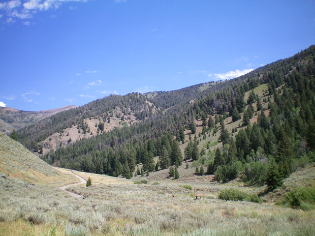
Peak 9557 (summit is just right of center in the distance) and its west ridge (diagonal ridge left of center in mid-ground, semi-open) as viewed from Lake Creek Road. Livingston Douglas Photo
West Ridge, Class 2
The Climb
From the roadside pullout at the base of the gully, walk briefly north up Lake Creek Road to find a good entry point into the forested ridge that is on the left/north side of the gully. This is the toe of the west ridge of Peak 9557. By this point, the road has crossed to the right/east side of Lake Creek (a small creek) so no creek fording/crossing is necessary. Leave the road and bushwhack east up through the steep, thick pine forest and move right/south onto the semi-open, sometimes rocky, ridge crest. The ridge follows a major gully all the way to the summit ridge. Remember this on the descent in order to return to Lake Creek Road at the proper point.
The ridge is semi-open and never loses its ridge pines. The blowdown can be annoying but there is a narrow, rocky ridge spine that heads left-ish/northeast about midway up. At a minor saddle in this rocky ridge section, there is a large hunter’s cairn and a hunter’s trail up the ridge from here for a while. Higher up, the terrain is mostly open grass/scrub with ridge pines nearby. Near the top, drop 20 feet to a minor saddle and the remains of an old mine/cabin. Follow an old trail up the ridge to the forested summit area and bushwhack through the forest to the cairned, semi-open high point. There are limited views from the summit due to the nearby pine forest. Contrary to the USGS map, there is NO ridge trail high up on Peak 9557.
The west ridge is mostly a scrub/grass/forest climb. There are no navigational issues. Just stay on the well-defined ridge crest and keep the massive gully on your right side (on ascent) and on your left side (on descent). If you’re lucky (as I was), you’ll find a nice shed elk antler to reward you for your hard work.
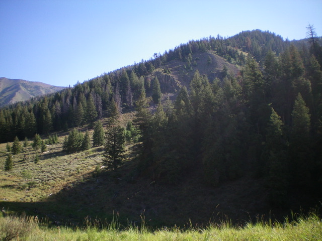
The bottom section of the west ridge (diagonal in mid-ground) as viewed from Lake Creek Road. Livingston Douglas Photo
Additional Resources
Regions: Boulder Mountains->EASTERN IDAHO
Mountain Range: Boulder Mountains
Longitude: -114.29859 Latitude: 43.78049