Elevation: 9,617 ft
Prominence: 517
This peak is not in the book. Published November 2021
Peak 9617 towers over Trail Creek and Trail Creek Summit. It has a magnificently rugged northeast face, visible from Trail Creek Road. It separates Basin Gulch from Cold Canyon. This is the first leg of a 3-peak adventure that includes Peak 9617, Peak 10334, and Rock Roll Peak (10,458 feet). It covers 9.0 miles with 3,950 feet of elevation gain round trip. USGS Rock Roll Canyon
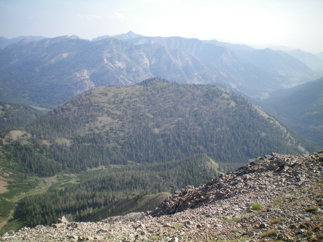
Peak 9617 (forested in mid-ground) as viewed from the south. Livingston Douglas Photo
Access
From the junction of US-93 and [signed] Trail Creek Road (15.3 miles north of Main Street in Mackay), turn left/southwest onto Trail Creek Road. Drive 26.8 miles southwest on Trail Creek Road to a signed junction with FSR-140/Park Creek Road. This junction is about 100 yards past the turnoff for the [signed] Park Creek Campground. Turn right/west onto FSR-140 and drive 1.2 miles to an unsigned junction. Go left/west onto a 2-track road and drive 0.1 miles to the [signed] trailhead for FST-124/High Ridge Trail which heads up Cold Canyon from here. The trailhead (7,760 feet) has parking for several vehicles and a turnaround area.
Approach
From the trailhead, follow the trail down to Trail Creek. Ford Trail Creek at a wide, shallow spot to pick up FST-124 on its west side. FST-124 is well-maintained and is heavily used by hikers. It heads south-southwest up Cold Canyon from Trail Creek. It goes up through a pine forest then out into open scrub high up to cross [small] Cold Canyon Creek in a wide, open gully on the north side of Peak 10334. Continue southeast up the trail as it switchbacks its way to a saddle at 9,100 feet at the base of the west ridge of Peak 9617.
West Ridge, Class 2
The Climb
From the 9,100-foot saddle at the base of the west ridge, leave FST-124 and bushwhack northeast through pine forest (not too bad) to quickly reach the open terrain of the crest of the west ridge. Scramble east up the somewhat steep ridge and soon navigate through a mix of ridge pines and blowdown. Reach a flat, narrow ridge section at 9,520 feet. Stay mostly on the left/north side of the ridge crest for the easiest going here, albeit on angled, loose gravel and scrub.
The summit hump is semi-open and has a small cairn on the high point. The west ridge is NOT the thick forest that the USGS topo map implies. It is mostly open terrain with short scrub and loose scree/gravel and scattered pines on the ridge crest. The ridge offers a magnificent view of Peak 10334 and Peak 10458 (see photo), the next two peaks on today’s multi-peak journey. From the summit, descend back to the 9,100-foot saddle, which connects Peak 9617 to Peak 10334. This concludes the first leg of today’s 3-peak adventure. Peak 10334 is up next.
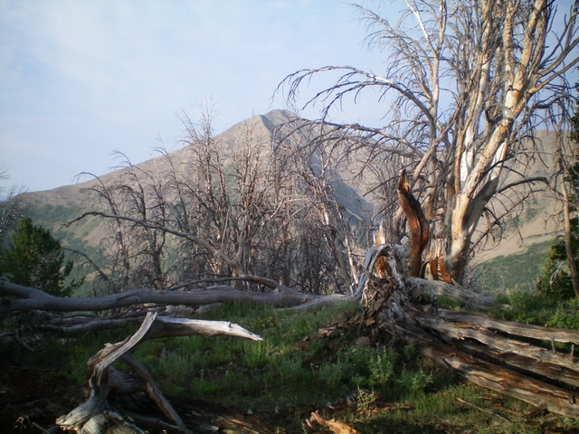
The summit of Peak 9617 with Rock Roll Peak in the distance. Livingston Douglas Photo
Additional Resources
Regions: Boulder Mountains->EASTERN IDAHO
Mountain Range: Boulder Mountains
Longitude: -114.28279 Latitude: 43.81789