Elevation: 9,620 ft
Prominence: 800
This peak is not in the book. Published November 2021
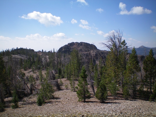
Peak 9620 is located southwest of Mill Creek Summit. Like many peaks in the Eastern Salmon Rivers, it has a significant area of burnt forest. The summit block sits back to the west and makes for an exciting finish. USGS Bayhorse Lake
Peak 9620 (summit block is in distance, left of center) and its north ridge (skyline, right of center) as viewed from the northeast. Livingston Douglas Photo
Access
From the junction of US-93 and Main Street in Challis, drive west on Main Street (which becomes Garden Creek Road) for 4.9 miles to a signed junction with the Custer Motorway/FSR-070. Turn right onto the Custer Motorway and reset your odometer. At 1.7 miles, reach the Challis National Forest boundary. At 8.9 miles, reach the Mill Creek Campground. At 11.7 miles, reach a pullout on the left/west side of the road. This pullout is 0.3 miles south of Mill Creek Summit. Park here (8,635 feet). GPS coordinates: 44⁰28’02”N, 114⁰29’21”W.
East Face/North Ridge, Class 3
The Climb
This climb is entirely Class 2 until the final scramble up the summit block. From the parking pullout, walk a short distance up the Custer Motorway then drop west a short distance to a meadow and a stream crossing. Jump the stream and bushwhack west up a steep, forested face with lots of blowdown. Find a minor shoulder and follow it southwest up through a steep, charred pine forest to reach the north ridge just north of Point 9567. As you climb, the forest thins and is more charred but still has scattered, tedious blowdown to navigate. Just below the ridge crest, there is more of a scree/gravel mix underfoot.
Once on the north ridge, head south up over Point 9567 and drop 55 vertical feet to a minor saddle. Continue south to where the ridge bends right-ish/southwest. The north ridge is a combination of scattered pines, areas of gravel/sand, and some boulders/rocky outcrops. Skirt the right/west side of a final ridge outcrop to reach the ominous summit block. Drop 20 feet to a notch then climb up the east ridge of the summit block via a Class 3 chute. Once on the crest of the summit block, scramble west on the top of ridge blocks/boulders to reach the high point, which is the final rocky outcrop at the west end of the ridge.
The summit block of Peak 9620 as viewed from Point 9567 on the north ridge. Livingston Douglas Photo
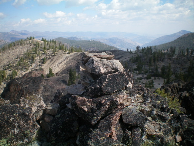
The summit cairn atop Peak 9620 with the north ridge immediately behind the cairn in mid-ground. Livingston Douglas Photo
Additional Resources
Regions: Eastern Salmon River Mountains->Salmon River Mountains->Southeast Corner Peaks->WESTERN IDAHO
Mountain Range: Eastern Salmon River Mountains
Longitude: -114.50039 Latitude: 44.46039