Elevation: 9,631 ft
Prominence: 491
This peak is not in the book. Published November 2022
Peak 9631 sits above the confluence of Hyndman Creek and the North Fork Hyndman Creek. It is a ranked hump on the southwest ridge of Duncan Ridge (11,755 feet). Peak 9631 makes for a great ridge scramble from the Hyndman Creek trailhead via either the south ridge or the southwest ridge. USGS Hyndman Peak
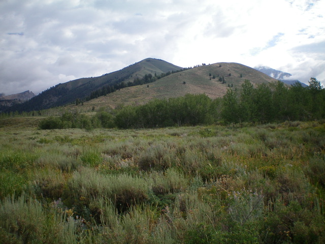
Peak 9631 (hump in dead center) and Point 8400+ (hump right of center) as viewed from the southwest, near the Hyndman Creek Trailhead. Believe it or not, Point 8400+ connects nicely to Peak 9631 with only a 15-foot drop in between. Livingston Douglas Photo
Access
Hyndman Creek trailhead/FST-165 [(B)(2)(b) on Page 259]
South Ridge, Class 2
The Climb
From the Hyndman Creek Trailhead (7,055 feet), follow FST-165 across the raging North Fork Hyndman Creek on an excellent footbridge. Leave the trail when it reaches a cattle fence crossing soon after the creek crossing. You can now see Peak 9631 in the distance to the northeast from here. But what is the peak/ridge in between? It is the lower section of the south ridge that goes up to a bend in the ridge at 8,200 feet. It connects beautifully to the main south ridge heading directly to the summit, but from FST-165, it looks like there must be a big gap between the peak/ridge and Peak 9631. That is not the case.
From the cattle fence crossing, you have two options. First, continue up the trail for another 0.4 miles then bushwhack north up onto the south ridge (South Ridge Route) OR leave the trail immediately and follow the fence row north to reach the base of the southwest ridge (Southwest Ridge Route). Both routes are discussed here. First, the South Ridge Route.
Continue hiking up FST-165 for another 0.4 miles then leave the trail and bushwhack north through a patch of gapped aspens to reach a steep sagebrush slope. Scramble northeast up through the steep scrub to intercept the south ridge, on its southwest spur. Once on the south ridge, follow it northeast to a ridge corner at 8,240 feet in gapped sagebrush. Continue left/north up the ridge with a 15-foot drop initially then a 20-foot drop off Point 8400+. Go through a patch of pine forest to reach the base of almost 1,000 feet of ill-defined ridge (it becomes more of a face climb) and somewhat-thick sagebrush just below the summit. The summit of Peak 9631 had no cairn so I built a modest one.
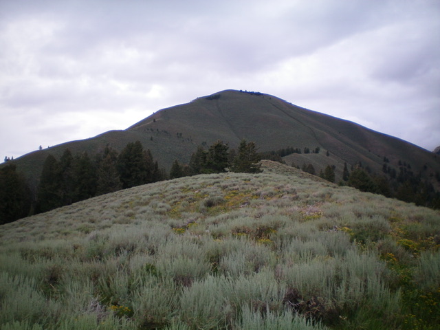
Peak 9631 as viewed from the 8,200-foot ridge corner on the south ridge. Livingston Douglas Photo
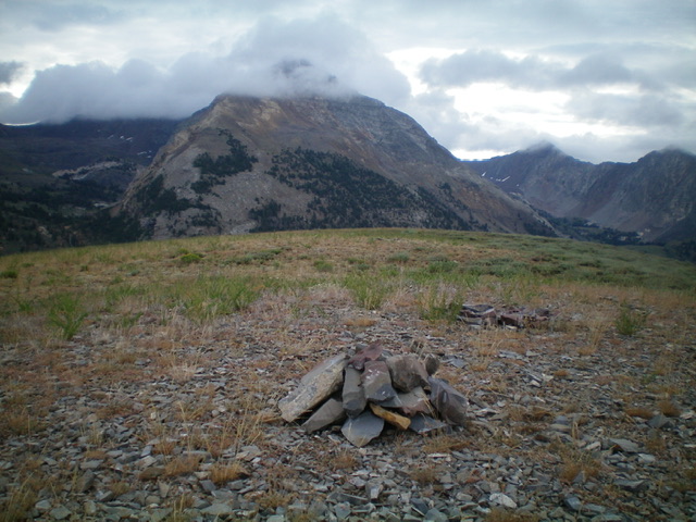
The summit cairn atop Peak 9631 with cloud-shrouded Cobb Peak in the distance. Livingston Douglas Photo
Southwest Ridge, Class 2
The Descent
From the summit, descend southwest on a magnificent open ridge of short scrub and reasonable scree/gravel. The ridge weaves a bit but is open and easy to follow all the way down to the North Fork Hyndman Creek. The sage and other brush gets thicker in the bottom half of the ridge but isn’t too bad. Stay in the easy, open scrub on the left/east side of the raging creek until you reach the old fence row. Follow the fence row back in reasonable scrub to intercept the Hyndman Creek Trail at the departure point. Hike about 0.2 miles back to the large trailhead parking lot. Having done both ridges, the southwest ridge is far better than the south ridge. It is a much more direct, open, straightforward route to the summit.
Additional Resources
Regions: EASTERN IDAHO->Pioneer Mountains
Mountain Range: Pioneer Mountains
Longitude: -114.16449 Latitude: 43.72129