Elevation: 9,654 ft
Prominence: 514
This peak is not in the book. Published November 2021
Peak 9654 is located on a ridgeline that separates Elevenmile Creek from Ninemile Creek. It is most easily climbed from Elevenmile Creek Trail/FST-4148 and its northeast side. Peak 9654 has a steep, forested west face that has numerous hidden rock faces and gullies. Have good navigational skills before undertaking the climb detailed below. USGS Elevenmile Creek
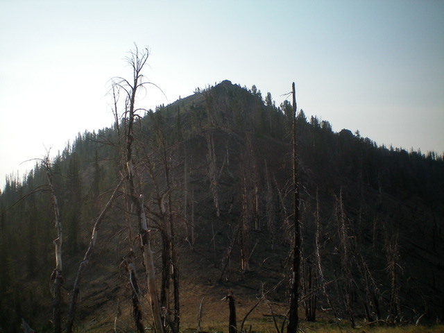
The summit hump of Peak 9654 as viewed from the northwest. Livingston Douglas Photo
Access
From the junction of US-93 and Main Street in Challis, drive west on Main Street (which becomes Garden Creek Road) for 4.9 miles to a signed junction with the Custer Motorway/FSR-070. Turn right onto the Custer Motorway and reset your odometer. At 1.7 miles, reach the Challis National Forest boundary. At 12.0 miles, reach Mill Creek Summit. At 20.8miles, reach a bridge crossing of and campsite along Yankee Fork, just north of Ninemile Creek. Park at this dispersed campsite (7,000 feet). GPS coordinates: 44⁰26’46”N, 114⁰36’19”W. This campsite is 1.9 miles south of the well-signed Elevenmile Trailhead parking area along the Custer Motorway/Yankee Fork Road.
West Shoulder/North Ridge, Class 2+
The Climb
From the bridge crossing, cross to the east side of Yankee Fork and briefly follow a use trail downstream. Leave the trail and bushwhack left/east up a steep, gravelly, forested slope to reach the crest of a shoulder. Bushwhack east up the rounded ridge through a pine forest with lots of deadfall. Reach a flat area at 7,440 feet and continue left/northeast to a minor hump. From this hump, drop 30 vertical feet right/southeast to a flat, saddle-like area with impossible amounts of deadfall. Bash your way southeast at a visible talus field/headwall. Exit the forest and scramble southeast to the top of the headwall/talus slope at 7,800 feet.
From there, bash your way east through another flat, thick section of forest and deadfall. Continue east up a rounded ridge in more dense forest and deadfall. To get some relief, head right/southeast to reach a semi-open ridge at about 8,000 feet. Compared to the wicked forest so far, this ridge is NIRVANA. Cruise northeast up the easy, open scrub on the right/east edge of the thick pine forest and continue east up the rounded, forested ridge (with a few rocky ridge outcrops) to reach the north ridge at Point 9160. The pine forest in this section is not too difficult. From Point 9160, follow the rocky, narrow, up-and-down ridge crest to reach the rocky ridge crest summit of Peak 9654. The north ridge has a few rocky ridge outcrops (Class 2+) and some ridge trees and blowdown to navigate. The summit had no signs of previous ascent, so I built a decent summit cairn.
When descending from Point 9160, do your best to stay on course. It is difficult, however, due to the thick forest. Find that magnificent semi-open ridge section that follows the north side of a steep gully. But if you follow it too far down (as I did), you will have a difficult bushwhack contouring right/northwest (at 7,800 feet) to get back to the top of the headwall/talus slope that you climbed on the ascent. Retrace the ascent route from the bottom of that headwall back down to the bridge crossing. Avoid a descent into the Ninemile Creek drainage to the south. It is narrow and very thick with trees and deadfall. You will not be able to see the road (and bridge crossing) until you are almost on top of it, so have good navigational skills to get close. If you avoid the Ninemile Creek drainage, you may come out a bit upstream of the bridge crossing on the road. No problem. Just walk down the road to the bridge crossing and your parked vehicle at the dispersed campsite. This is definitely not the easiest way to climb Peak 9654.
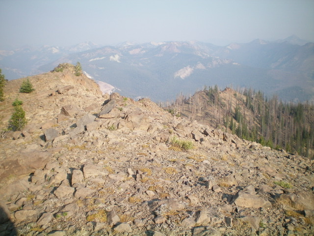
Looking down the north ridge (ascent route) from the summit. The ridge heads left then bends right in the photo to emerge on the rocky ridge below (right of center). Livingston Douglas Photo
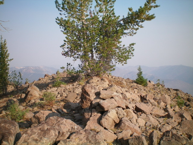
The newly-built summit cairn atop Peak 9654. Livingston Douglas Photo
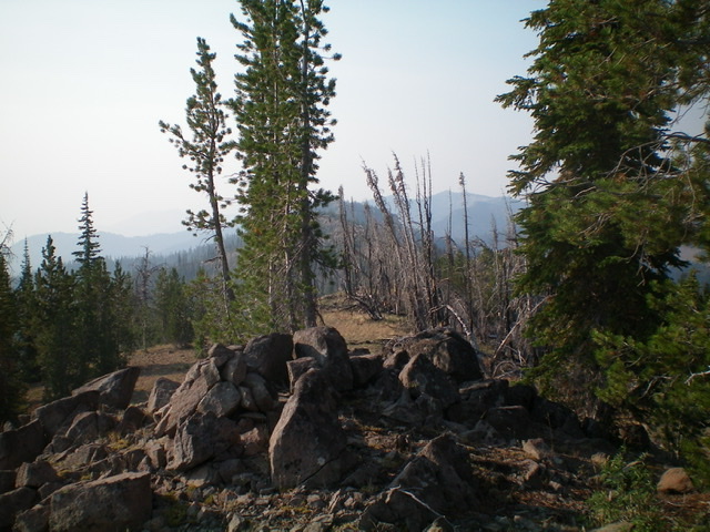
Looking south along the ridgeline from the summit. Livingston Douglas Photo
Additional Resources
Regions: Eastern Salmon River Mountains->Salmon River Mountains->Southeast Corner Peaks->WESTERN IDAHO
Mountain Range: Eastern Salmon River Mountains
Longitude: -114.57059 Latitude: 44.43669