Elevation: 9,681 ft
Prominence: 741
This peak is not in the book. Published April 2018
This peak is located due south of Pyramid Peak on the Continental Divide. USGS Shewag Lake
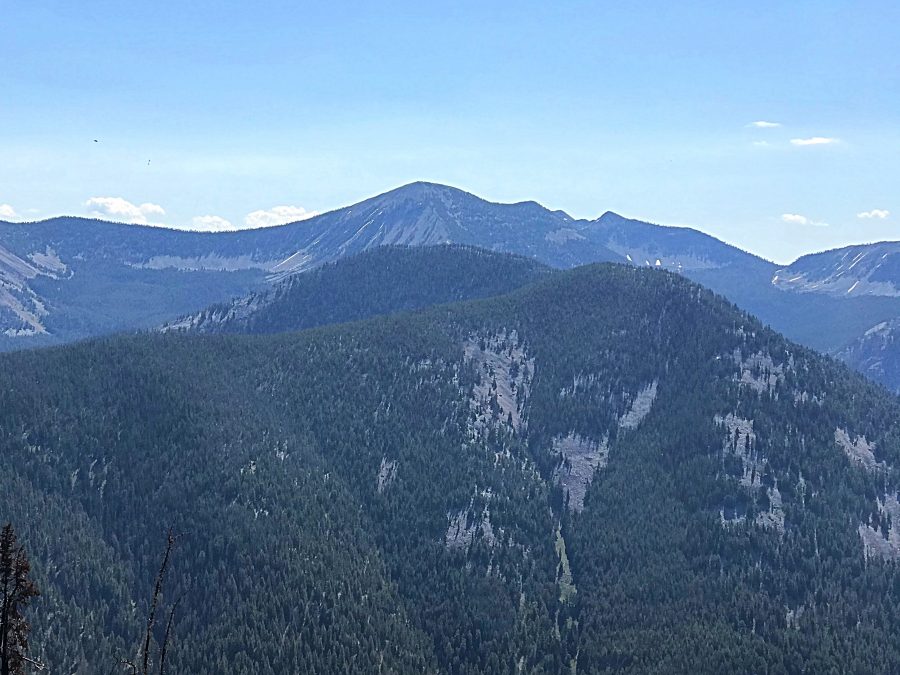
Peak 9681 on the horizon and Peak 8910 in the foreground as viewed from N Mountain.
West Ridge Route, Class 2
Access
Fourth of July Creek Road/FSR-071 (on Page 328) modified as follows: From the US-93/Fourth of July Creek Road junction, drive 10.4 miles up Fourth of July Creek Road to a road junction; turn R onto FSR-256 (for access to the CDT); drive 0.6 miles on FSR-256 and park just before a deep mud hole that covers the entire road (7,620 feet). With a high-clearance 4WD, you can drive another 1/4 mile to reach the ATV road that is the TH for this climb.
The Climb
From the mud hole parking area, hike 1/4 mile to a road junction. Go left onto FST-6129, which begins as an ATV road. The ATV road turns into a hiking trail after 1-1/4 miles. After a brief 2-3 minute hike on the trail, you’ll reach an unmarked “T” junction. This the CDT. Turn R and follow the CDT. At 8,360 feet, the CDT reaches treeline and turns sharply R. It then ascends up onto the West Ridge of Peak 9681. The CDT follows the R side of the ridge crest.
When the CDT begins to move away from the ridge, leave the CDT and scramble up onto the ridge. Follow the ridge E up to the nondescript summit of Peak 9681. The ridge steepens but is never harder than Class 2. Stay near the N edge of the ridge crest to avoid vegetation and short pines and krummholz on the S side of the ridge. No evidence of previous ascent of the West Ridge, but the peak has been climbed previously via the North Ridge. The peak is at the headwaters of Rock Creek.
North Ridge, Class 2
The Descent
This segment of my journey to three summits [Rock Creek Peak, Jumbo Mountain (MT), and Pyramid Peak] begins on the summit of Rock Creek Peak and follows the Continental Divide northward down to the Rock Creek Peak/Pyramid Peak saddle at 9,060 feet. The terrain on the North Ridge is a combination of broken scree and tundra. It is an easy Class 2 stroll. Expect to find snowdrifts on the east side of the ridge, even in mid-July. The massive hulk of Jumbo Mountain (MT) looms to the northeast. Jumbo Mountain is a worthy objective, even for climbers focused on Idaho peaks. It is a challenging scramble from the Continental Divide.
Additional Resources
Regions: Beaverhead Range->EASTERN IDAHO
Mountain Range: Beaverhead Range
First Ascent Information:
- Other First Ascent: West Ridge
- Year: 2016
- Season: Summer
- Party: Livingston Douglas
Longitude: -113.77719 Latitude: 45.43589