Elevation: 9,728 ft
Prominence: 1,148
This peak is not in the book. Published November 2022
Peak 9728 sits on a high ridgeline that overlooks the Baker Creek drainage. It is at the head of Cunard Gulch. Peak 9728 has a very rugged, rocky north face. It is most easily climbed from the nearby Osberg Ridgeline Trail/FST-147 and its south ridge. USGS Boyle Mountain
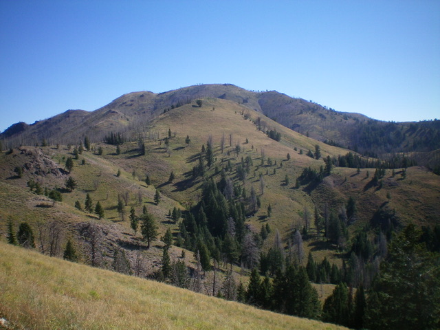
Peak 9728 (hump in mid-ground) as viewed from the ridgeline trail to its west. Livingston Douglas Photo
Access
From ID-75 north of Ketchum, turn left/south onto [signed] Baker Creek Road/FSR-162. Drive 9.2 miles up Baker Creek Road to its end at the trailhead parking area for the Baker Lake Trail/FST-138 and the Osberg Ridgeline Trail/FST-147. Park here (7,935 feet).
Map Errors
The USGS topo map fails to show the Osberg Ridgeline Trail from the Baker Lake trailhead parking area over to the upper reaches of Lost Shirt Gulch. The USGS topo map fails to show the upper section of the Castle Rock Trail/FST-140 which comes up Castle Creek from Slide Rock Canyon then heads northeast up to a ridgeline west of Point 8905 and then skirts around the north side of Point 8905 to reach a signed junction with FST-147. The Sawtooth National Forest map shows all of the aforementioned trails correctly. Both the USGS map and the Sawtooth National Forest Map show FST-147 climbing up over Point 8917. It actually skirts the south side of the ridge point.
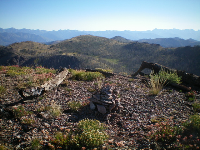
View from the summit of Peak 9728. Livingston Douglas Photo
Southwest Spur/North Ridge, Class 2
The Climb
From the trailhead parking area, follow the Osberg Ridgeline Trail/FST-147 as it drops 55 feet to cross Baker Creek on a nice footbridge then heads left/east around a shoulder then right/south up Lost Shirt Gulch to a signed trail junction with Castle Rock Trail/FST-140. Continue straight on FST-147 as it crosses the head of Lost Shirt Gulch and reaches the ridge crest. Follow FST-147 as it meanders its way (with some ups and downs) east toward Peak 9728. The trail drops diagonally right to cross a major dry gully to reach the base of the massive, obvious Peak 9728.
Continue hiking along the trail as it rises north out of the gully and soon turns right/east to cross a narrow side gully. Leave the trail here and climb steeply northwest up a slope of scrub and loose gravel to a ridge crest just above Point 8884. Follow the easier, less-steep terrain of the ridge (scrub/scree with scattered pines) northeast then east. Skirt the south side of Point 9696 to reach a ridge saddle. Continue south up the ridge on scrub and easy scree/gravel to reach the open summit of Peak 9728. The summit has a decent cairn.
Southwest Shoulder, Class 2
The Descent
From the summit, descend southwest on the loose, rocky face (talus/scree) to find a semi-forested shoulder (easier terrain) to intercept FST-147 just right/east of where the trail crosses the narrow gully (departure point for the ascent route). There is a lot of loose rock on this descent, but it makes for a shorter route than my ascent route. Follow FST-147 for 0.1 miles to the gully crossing then about 3.0 miles to the initial trail junction and another 1.5 miles back down to the trailhead parking lot.
Additional Resources
Regions: Smoky Mountains->WESTERN IDAHO
Mountain Range: Smoky Mountains
Longitude: -114.60301 Latitude: 43.69279