Elevation: 9,755 ft
Prominence: 535
This peak is not in the book. Published November 2021
Peak 9755 is a forested hump that is located north of Elbow Canyon and due southwest of Sunrise Peak (10,618 feet). Its south and east aspects are wickedly steep and are a mix of forest, rocky buttresses, and cliff faces. They should be avoided at all costs. Stay on course with this climb and have good navigational skills. USGS Sunset Peak
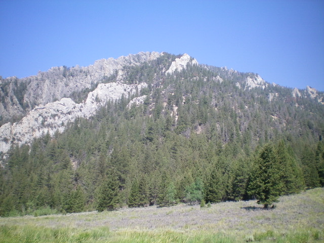
Peak 9755 (mid-ground, left of center) as viewed from Sunrise Peak. Livingston Douglas Photo
Access
Pass Creek Road/CR-122 is located along US-93 south of Mackay and is signed as 3900W. This junction is exactly 7.4 miles south of Main Street in Mackay and 18.3 miles north of the junction of US-93 and US-20 in Arco. Turn north onto [signed] Pass Creek Road and drive 3.4 miles to a signed junction with FSR-273/Elbow Canyon Road. Turn right/east onto Elbow Canyon Road and reset your odometer. At 0.8 miles, go straight/east at an unsigned junction. At 2.1 miles, go left/northeast at a signed junction for “Elbow Canyon.” At 3.0 miles, reach a “T” junction; go left/north here. At 3.7 miles, reach the Challis National Forest boundary at a road junction. Go right/northeast here. At 4.8 miles, reach an unsigned road junction. This is the junction with FSR-421 (left). Park here (6,870 feet).
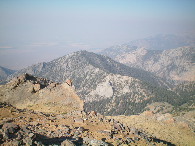
Peak 9755 as viewed from the meadow in Elbow Canyon to its southeast. Peak 9755 is riddled with impossible cliffs and buttresses. Livingston Douglas Photo
South Spur/Southwest Face, Class 2
The Climb
From the road junction, hike about 0.4 miles northwest up FSR-421 to just past the rocky outcrops that surround this narrow canyon. Leave the road and scramble right/east up onto the obvious ridge/spur. This is a steep, loose climb up gravel and scrub with some mountain mahogany thrown in for good measure. Once on the crest of the south spur, follow the semi-open ridge crest left/north in a mix of scattered mountain mahogany and, higher up, scattered fir trees. The ridge crest often has ridge trees, so side-hilling in loose gravel is necessary at times.
Keep a large gully on your right/east side at all times. At about 7,900 feet, reach a large, open area (shown on the USGS topo map) of short scrub with a few scattered pines. It ends at a right/east turn in the ridge at about 8,100 feet. It is critical to find this open area and ridge turn on the descent. From the top of the open area, bushwhack east-northeast up a rounded, forested ridge that soon becomes a forested face (the southwest face) with some minor ribs and gullies hidden in the pine forest. The pine forest is somewhat open that is consistently steep but not overly steep. The terrain is scattered pines and blowdown with a scree/gravel base. Higher up, find a minor ridge to the right/south and follow it east to reach the high summit ridge.
Go left/northeast onto the summit ridge and work up through more pines, blowdown, gravel, and some minor rocky outcrops to reach the small, gentle summit perch. There is a small summit cairn near the high point. Perhaps the small cairn is on the high point and the “higher” hump is just an optical illusion. The summit offers nice views of sunset Peak to the north and Sunrise Peak to the northeast. When you descend this route, maintain a steady line down the southwest face. Use a buttress on the far side of the canyon (to the west) to help you maintain that line. Do not stray south into a gully (it cliffs out lower down) and do not wander north into another gully on the southwest face because it has some very steep sections on its south side. You simply must thread this needle well.
When you reach the large open area at the ridge turn (impossible to see from the steep forested face above), you will be quite relieved. Be sure to stay to the left/east side of the open area when descending back into the forest in order to find the south spur. Do not drop into the gully on the left/east side of the spur and do not wander too far right/west into steep terrain there. Once again, thread this needle well. Look for the massive gully on the left/east side of the spur and that should help you find, and remain on, the south spur. Lower down, you must exit the south spur to the right/west to reach the jeep road (FSR-421) because the south spur cliffs out near its base.
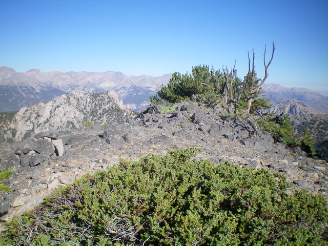
The summit of Peak 9755. Livingston Douglas Photo
Additional Resources
Regions: EASTERN IDAHO->Lost River Range
Mountain Range: Lost River Range
Longitude: -113.37209 Latitude: 43.95749