Elevation: 9,766 ft
Prominence: 426
This peak is not in the book. Published November 2020
Peak 9766 is located on the Continental Divide and is an easy climb (mostly on the CDT) from Goldstone Pass. The southeast summit is the high point (9,766 feet) but by only a measly foot as compared to its northwest summit (9,765 feet). Peak 9766 towers over two beautiful Montana lakes: Cowbone Lake and Darkhorse Lake. Combine Peak 9766 with a climb of nearby Peak 9755, a rocky pyramidal-shaped summit to its southwest that is entirely in the State of Idaho. USGS Goldstone Pass
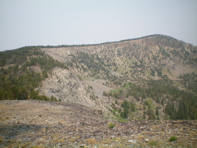
Peak 9766 and its LONG southeast ridge. The summit is right of center. Livingston Douglas Photo
Montana Access
From Jackson (MT), drive south on MT-278 for about a mile to a signed junction with Skinner Meadows Road/FSR-381. Turn right onto Skinner Meadows Road and reset your odometer. At 0.7 miles, bear right/south at an unsigned junction. At 9.0 miles, reach the NF boundary. At 11.6 miles, reach a signed road junction. Go left to stay on FSR-381. At 16.9 miles, reach Skinner Meadows. There is an information sign and pullout on left side of the road. At 19.0 miles, reach a 3-way road junction (7,640 feet).
Park at this junction or drive up FSR-7327/Goldstone Pass Road (a double-right turn here). It is about 3.5 miles to Goldstone Pass from this junction. A 4WD vehicle with good tires can probably make it to the pass since the road has been improved over the past few years with logging activity along the road. Please note that FSR-7327 doesn’t actually go to Goldstone Pass. It crosses the ridgeline just above the pass. The CDT descends southwest to Goldstone Pass from this road crossing.
The Approach, Class 1
Reach the CDT just above Goldstone Pass by either hiking or driving up Goldstone Pass Road/FSR-7327. The road crosses a ridge northeast of Goldstone Pass at about 9,100 feet and almost immediately intersects the [well-signed] CDT just to the west of the ridge crest. This is where the climb begins.
Southeast Ridge, Class 2
The Climb
From the intersection of the CDT and Goldstone Pass Road (9,100 feet), follow the [well-marked] CDT northbound as it heads northwest to reach the southeast ridge of Peak 9766 just above (and west of) the connecting saddle between Peak 9766 and Peak 9582 (MT). This entire section of the CDT is not shown on the USGS topo map but it is correctly shown on the most recent Salmon-Challis National Forest Map (2017). Continue hiking on the CDT as it heads west then bends right/north to approach the summit of Peak 9766.
When the CDT flattens out and begins to head left/northwest to skirt the southwest face of Peak 9766, leave the trail and bushwhack north up the ridge in semi-open pine forest to the summit area. The CDT gets you within 80 vertical feet of the top. The semi-open summit area of Peak 9766 has two cairns. The large cairn at the east end of the summit area is not on the high point. The high point is about 70 yards to the west and also has a cairn. The west summit is the true summit as confirmed by altimeter measurement (by five feet) and by the USGS topo map’s positioning of the measured high point.
Southwest Ridge, Class 2
The Descent
From the true/west summit, descend west then southwest to intersect the CDT. The terrain here is a combination of rock and scattered pines then sagebrush. Follow the CDT as it heads northwest to cross the southwest ridge of Peak 9766 just below Point 9765. Leave the CDT when it reaches the southwest ridge and follow the steep, rocky ridge southwest to a small, 9,260-foot saddle that connects Peak 9766 to Peak 9755. The descent of the southwest ridge is full-on Class 2. It is steep and includes loose talus/scree/gravel, rocky ridge outcrops, and krummholz to clog things up. This concludes the first leg of today’s two-peak journey. Peak 9755 is up next.
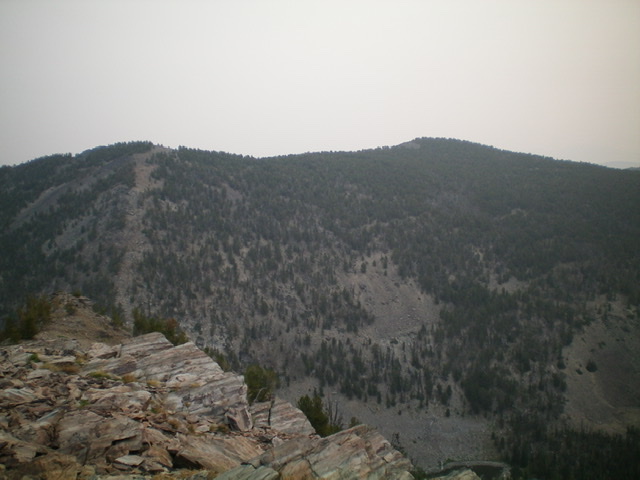
Peak 9766 (right hump) and Point 9765 (left hump) as viewed from the west. Livingston Douglas Photo
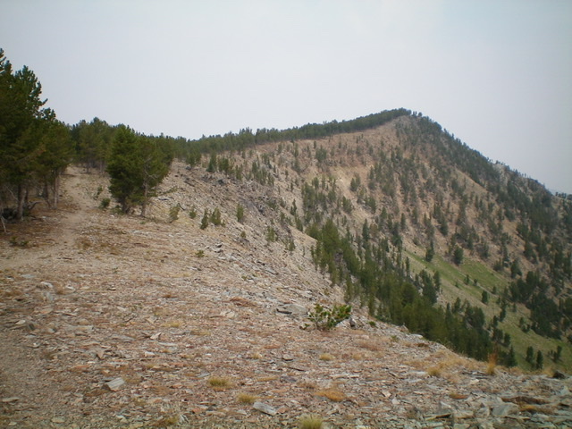
The southeast ridge of Peak 9766. The summit is right of center. Livingston Douglas Photo
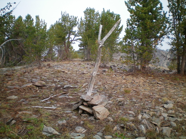
The summit cairn atop the true/west summit of Peak 9766. Livingston Douglas Photo
Additional Resources
Regions: Beaverhead Range->EASTERN IDAHO
Mountain Range: Beaverhead Range
Longitude: -113.58349 Latitude: 45.15379