Elevation: 9,785 ft
Prominence: 605
Peak 9785 is a handsome, pyramidal-shaped summit on the long southeast ridge of Peak 10263. It sits at the head of the Wade Creek drainage. Peak 9785 is a corner point, as the ridge forks here. One fork heads northeast to Peak 9523. Another fork heads south to the confluence of Cold Creek and Morse Creek. A third fork heads east and drops to the upper reaches of Morse Creek. If you climb Peak 9785 from Morse Creek on your way to Peak 10263, you will climb it again on your way back to Morse Creek. Please refer to the Morse Creek Trifecta for a full trip report. USGS May Mountain
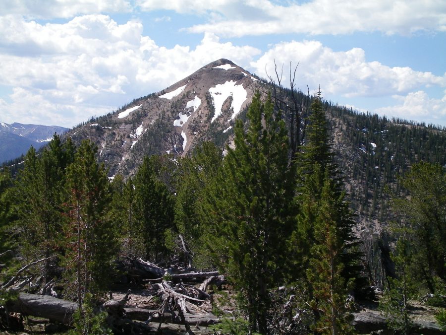
Peak 9785 as viewed from the summit of Peak 9319. Livingston Douglas Photo
South Ridge, Class 2+
Access
Morse Creek Road/FSR-094 is located exactly 10.2 miles south of US-93 on the [paved] Pahsimeroi Highway. From the signed turnoff on the east side of the highway, drive 4.3 miles to the Challis National Forest boundary. At 6.5 miles, reach the end of Morse Creek Road at a trailhead parking area (6,290 feet). This is the trailhead for the Morse Creek Trail/FST-4072.
The Climb
Hike up FST-4072 (an old jeep road) on the left/northwest side of raging Morse Creek for about 1-1/2 miles to a fording of Cold Creek. There are some wet logs and rocks to help you cross this on foot, but bring hiking poles in order to maintain your balance for this crossing. From the north side of Cold Creek, leave FST-4072 and begin the steep uphill climb to Peak 9785. The south ridge is quite steep initially but the forest isn’t too bad. The slope soon eases and the forest opens up.
The terrain quickly becomes stable, broken scree with scattered pines and not too much blowdown. Higher up, ridge rock requires scrambling (Class 2+) but is enjoyable. Very high up, there is a section of loose, steep talus/scree. This is not much fun, but it is only for a short stretch. The summit of Peak 9785 is rocky and open. It is a ridge crest summit with a decent cairn.
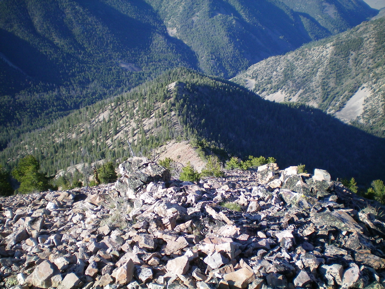
Looking down the south ridge from the summit of Peak 9785. Livingston Douglas Photo
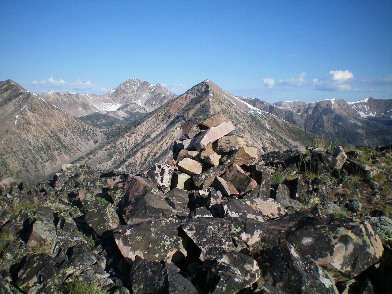
The summit cairn atop Peak 9785 with Peak 10263 in dead-center behind the cairn. Livingston Douglas Photo
Northwest Ridge, Class 2
Access
Same as for the south ridge. This route is the first leg of a ridge traverse from Peak 9785 to Peak 10263.
The Descent
From the summit of Peak 9785, follow the ridge crest northwest to a saddle (9,284 feet) then up over Point 9457. From Point 9457, descend west to another saddle at 9,180 feet. This saddle is the low point between peak 9785 and Peak 10263. This is the terminus of the northwest ridge of Peak 9785.
Northeast Shoulder/Northwest Ridge, Class 2
Access
Same as for the south ridge. This route is the final leg of a ridge traverse from Peak 9319 to Peak 9785.
The Climb
From the 8,820-foot connecting saddle, scramble southwest straight up through the steep pine forest to intercept the northwest ridge of Peak 9785. Follow the rocky ridge crest southeast back to the open summit of Peak 9785.
Southeast Shoulder, Class 2+
Access
Same as for the south ridge. This route is the final leg of a loop route that begins and ends on Morse Creek Road.
The Descent
From the summit of Peak 9785, descend southeast on a shoulder of steep, loose talus/scree/gravel in open terrain then in semi-open terrain with scattered pines. Be sure to not mistakenly descend east to cliffed Point 9128 or you will get hung up. You can see this wicked point from the southeast shoulder. The southeast shoulder bends right/south as you descend toward the valley floor and becomes more of a face descent.
The terrain is still steep but it goes quickly and the forest is open enough to retain good visuals. When you reach the valley floor, you must cross a wet drainage. Jump across a small stream and climb south up onto a shoulder to quickly intercept FST-073. Follow FST-073 down to Morse Creek. Ford the creek (shallow and wide) then follow a weak 2-track jeep road through field grass to get back to FST-4072 and another fording of Morse Creek. Follow FST-4072 back to the Morse Creek trailhead parking area.
Additional Resources
Regions: EASTERN IDAHO->Lemhi Range
Mountain Range: Lemhi Range
Longitude: -113.75719 Latitude: 44.66829