Elevation: 9,795 ft
Prominence: 335
This peak is not in the book. Published November 2022
Peak 9795 is located on a rugged ridgeline on the east side of Norton Creek. It is also a ridge corner, with the northeast ridge extending down into the Newman Creek drainage. The shortest route to the summit is via its steep southwest face from the Norton Creek Road. However, the easiest route to the top is from Baker Creek Road and the southeast ridge. USGS Boyle Mountain
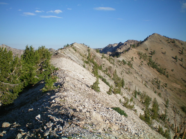
Looking up the rocky upper section of the southeast ridge (my ascent route). The summit of Peak 9795 is at far right. Livingston Douglas Photo
Access
Park at a large dispersed campsite at the junction of Baker Creek Road/FSR-162 and Norton Lakes Road/FSR-170. This junction is 5.9 miles up Baker Creek Road from ID-75. The elevation at the campsite is 7,315 feet.
Southeast Ridge, Class 2+
The Climb
From the dispersed campsite, you have two options to reach the crest of the southeast ridge. First, scramble directly north up a STEEP, gravel-and-scrub slope (with scattered pines). Second, bushwhack east through an easy pine forest then northeast up a more moderate scrub-and-pines slope to reach the ridge crest at a lower point. I did the former on my ascent and the latter on my descent.
Once on the ridge crest, follow it steeply up through a semi-open pine forest with underlying scrub and gravel. Midway up, work through some rocky outcrops. High up, reach a flat, rocky ridge section which has a 65-foot drop from a ridge hump then curls to a final Class 2+ scramble up ridge rock to the small summit area. The summit had a modest cairn which I built up considerably. On the descent, stay on the ridge longer to find a gentler forest bushwhack back to the campsite rather than the steep, gravel-and-scrub slope of the ascent route.
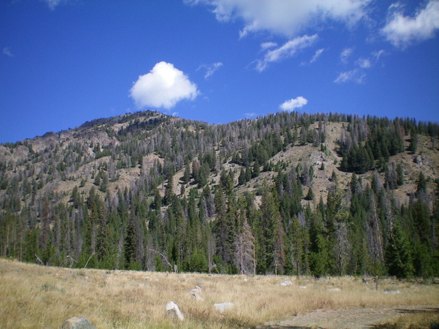
Peak 9795 as viewed from the south. The summit is left of center. The southeast ridge (ascent route) is the right skyline. Livingston Douglas Photo
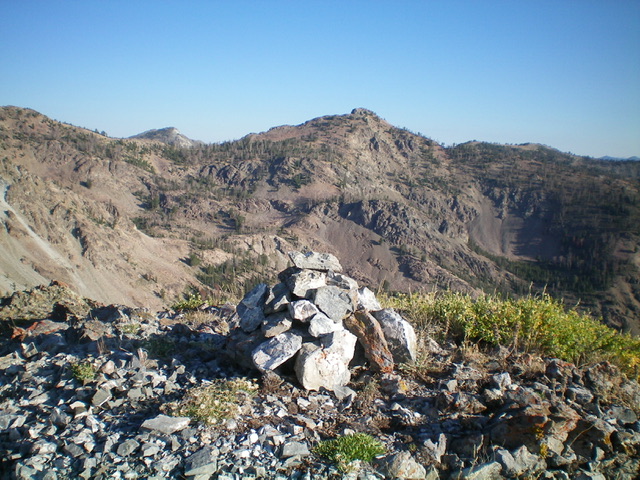
The summit cairn atop Peak 9795. Livingston Douglas Photo
Additional Resources
Regions: Smoky Mountains->WESTERN IDAHO
Mountain Range: Smoky Mountains
Longitude: -114.62379 Latitude: 43.74129