Elevation: 9,980 ft
Prominence: 560
This peak is not in the book. Published November 2022
Peak 9980 is one of two ranked summits located on a high ridgeline that sits west of Prairie Creek in the Smoky Mountains. The peak is most easily climbed from the Prairie Lakes Trail/FST-134. It is often climbed in combination with Peak 9885, its ridgeline neighbor to the north. USGS Galena
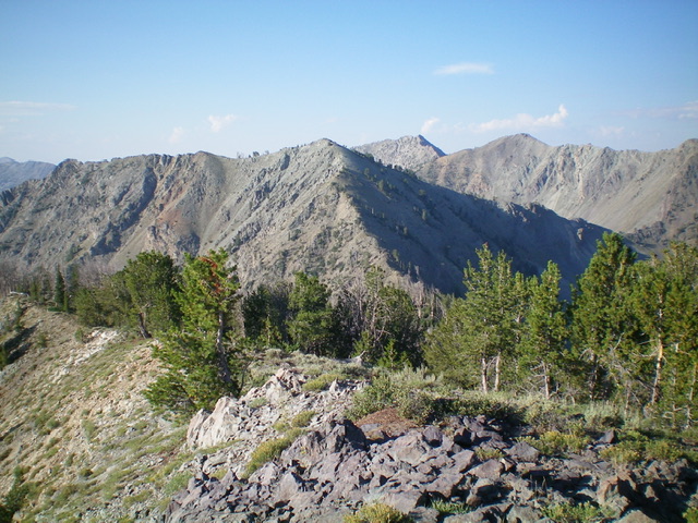
Peak 9980 (dead center in mid-ground) as viewed from Peak 9885 to its northeast. Livingston Douglas Photo
Access
Same as for Peak 9885. This is the second leg of a 2-peak adventure that includes Peak 9885 and Peak 9980.
North Ridge, Class 2+
The Climb
From the 9,540-foot connecting saddle, scramble south up the open, rocky ridge (with some ridge pines to skirt) to the small, rocky summit of Peak 9980. There was a minimal cairn on top so I built a new summit cairn atop the highest boulder.
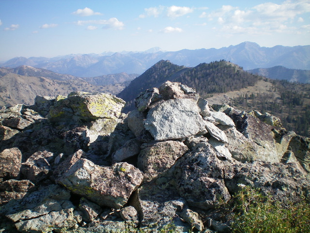
The summit cairn atop Peak 9980 with Peak 9885 in mid-ground. Livingston Douglas Photo
North Ridge/East Gully, Class 2
The Descent
From the summit, descend the loose talus/scree on the north ridge then leave the ridge before reaching the Class 3 ridge towers in the connecting saddle. Descend right/northeast down a STEEP, loose chute of scree/gravel and ledges to reach the massive gully that separates Peak 9980 from Peak 9885. Once in the main gully, boot-ski down a steep slope of scree/gravel to reach gentler talus/scree slopes below. From the flatter “basin” area, descend the center of the gully in rock and scrub. Pine forest soon joins the mix on the right/south side. Stay just left/north of the thick forest in rock or semi-open forest.
The gully bends right/southeast farther down and is a mix of angled scree (left side) or pine forest/veg with underlying talus/scree (center and right side). It is a bit tedious to descend. Lower down, the gully now has a stream and willows. Stay to its left/north side in open rock and scrub. Eventually, Prairie Creek becomes visible below you. The final descent is through thick-ish veg with some underlying talus/scree on a face that leads down to Prairie Creek Trail just on the west side of the creek. Follow the narrow, well-beaten trail for about 1.8 miles back to the trailhead.
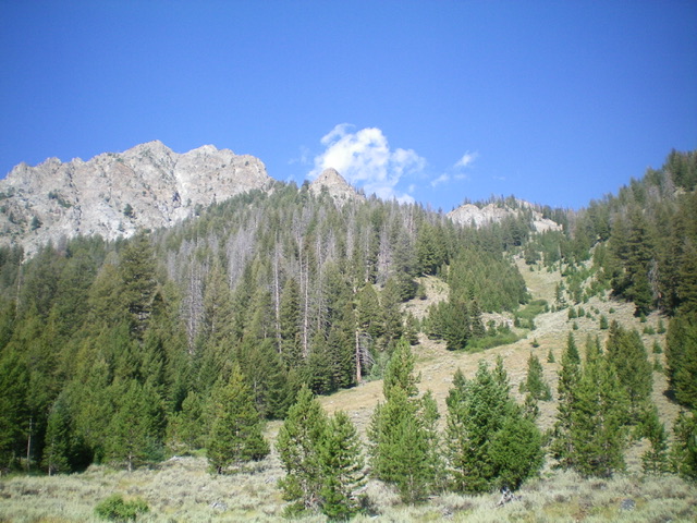
The rugged east face (left of center) of Peak 9980 as viewed from the base of the east gully (right of center). Livingston Douglas Photo
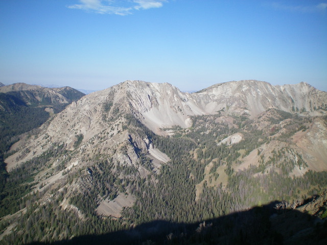
Peak 9980 (left of center in mid-ground) and its east ridge (my descent route) coming at the camera (left of center). Livingston Douglas Photo
Additional Resources
Regions: Smoky Mountains->WESTERN IDAHO
Mountain Range: Smoky Mountains
Longitude: -114.68169 Latitude: 43.79059