Elevation: 9,885 ft
Prominence: 345
This peak is not in the book. Published November 2022
Peak 9885 is one of two ranked summits located on a high ridgeline that sits west of Prairie Creek in the Smoky Mountains. The peak is most easily climbed from the Prairie Lakes Trail/FST-134. It is often climbed in combination with Peak 9980, its ridgeline neighbor to the south. USGS Galena
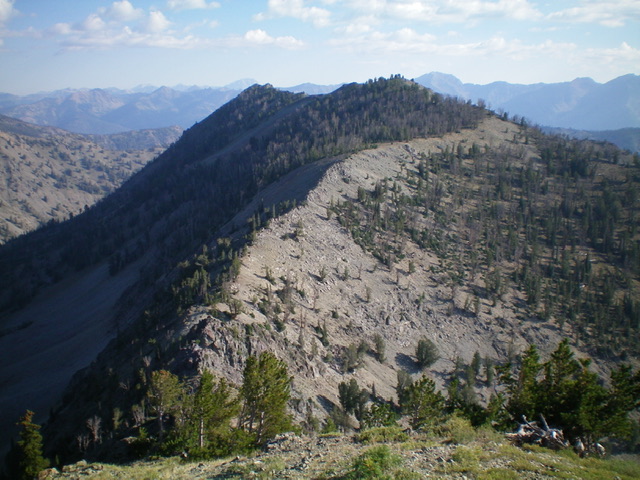
Peak 9885 as viewed from the southwest. Livingston Douglas Photo
Access
From ID-75 north of Ketchum, turn left/west onto [signed] Prairie Creek Road/FSR-179 and drive 2.5 miles to the end of the road at the trailhead parking for Prairie Lakes Trail/FST-134 and the West Fork Prairie Creek Trail/FST-133.
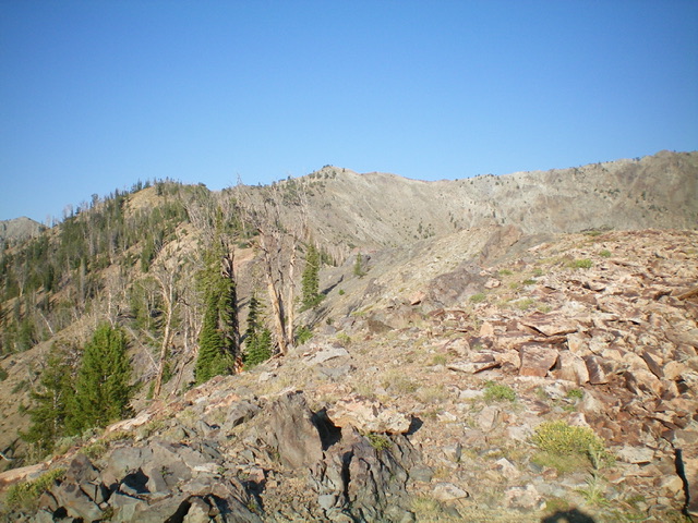
Looking up the rocky east ridge of Peak 9885. The summit is just left of center. Livingston Douglas Photo
East Ridge/Southeast Shoulder, Class 3
The Climb
From the trailhead, hike southwest up Prairie Lakes Trail/FST-134 for just over a mile to an area just past the east cliffs of Peak 9885 at about 7,465 feet. There is a face/shoulder here with a critical narrow gully on its left/south side. This area is thickly forested so it is difficult to get a clear view of the open rock terrain on the east side of Peak 9885. Leave the trail and bushwhack through the pine forest (not too difficult) to reach open terrain at the base of the east face/southeast shoulder. Scramble northwest up STEEP rock and scrub (Class 3 due to rock bands/boulders) and angle diagonally right/north-ish as you move higher.
The gully and shoulder gain definition as you gain elevation and you enter a pine forest. The slope is steep for quite a while. There is no ridge definition until about 8,200 feet. The slope of the ridge crest finally eases at about 8,650 feet and the ridge bends left-ish/west-northwest. There is a massive gully to the right/north to assure you that you are on the correct shoulder. High up, the trees disappear and it becomes a pure rock scramble—sometimes on a talus slope/heap and at other times on narrow, rocky ridge outcrops (Class 3 if you climb them). The ridge bends left/west and the slope eases considerably as you approach the summit. The summit has a small cairn. Point 9878 (very close in elevation) lies about ½ mile north on the ridge crest. Don’t be fooled. It is NOT a higher point.
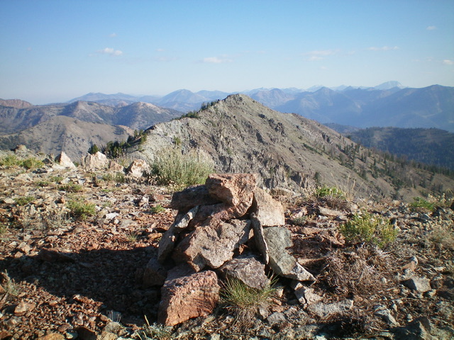
The summit cairn atop Peak 9885 with Point 9878 in the distance (dead center). Livingston Douglas Photo
South Ridge, Class 2-3
The Descent
From the summit, follow the narrow ridge crest as it descends south then southwest then south to a narrow saddle at 9,540 feet. The ridge terrain is mostly open rock but has some ridge pines to skirt. There are two ridge towers to navigate in the saddle. The towers are Class 3 to climb over or Class 2 to skirt them. This is the connecting saddle with Peak 9980. It concludes the first leg of today’s 2-peak adventure. Peak 9980 is up next.
Additional Resources
Regions: Smoky Mountains->WESTERN IDAHO
Mountain Range: Smoky Mountains
Longitude: -114.67601 Latitude: 43.67601