Elevation: 8,033 ft
Prominence: 1,932

Climbing and access information for this peak is on Page 361 of the book. However, the information is dated and should be ignored. Access to this peak is problematic due to private property issues. As a result, the crux of reaching this summit may be finding your way onto BLM land.
The original page was written by Margo Mandella. Due to changing access issues her route, like the route in the book, is no longer accessible. Most recently Keith Miller climbed the peak starting from a new access point. Livingston Douglas climbed the peak in 2023. I have left the older information down the page because who knows whether the access situation will change in the future. Updated April 2026
Petticoat Peak (8,032 feet) is located northeast of Lava Hot Springs and is the highest point in the Fish Creek subrange of the Portneuf Range. The peak is located on Bureau of Land Management (BLM) land and has 1,932 feet of prominence, dominating this small mountain range. The west ridge/west face and southeast ridge are rugged, choppy, and thickly forested with rocky outcrops. However, it is the north ridge that is the most accessible and easiest route to the summit. In addition to this update, use the link below to read Rick Baugher’s trip report. USGS Bancroft
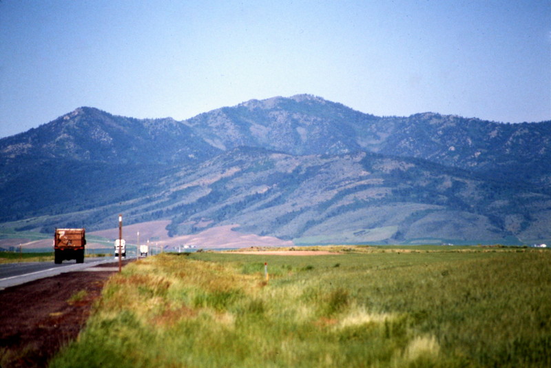
Petticoat Peak as viewed from the west. Tom Lopez Photo
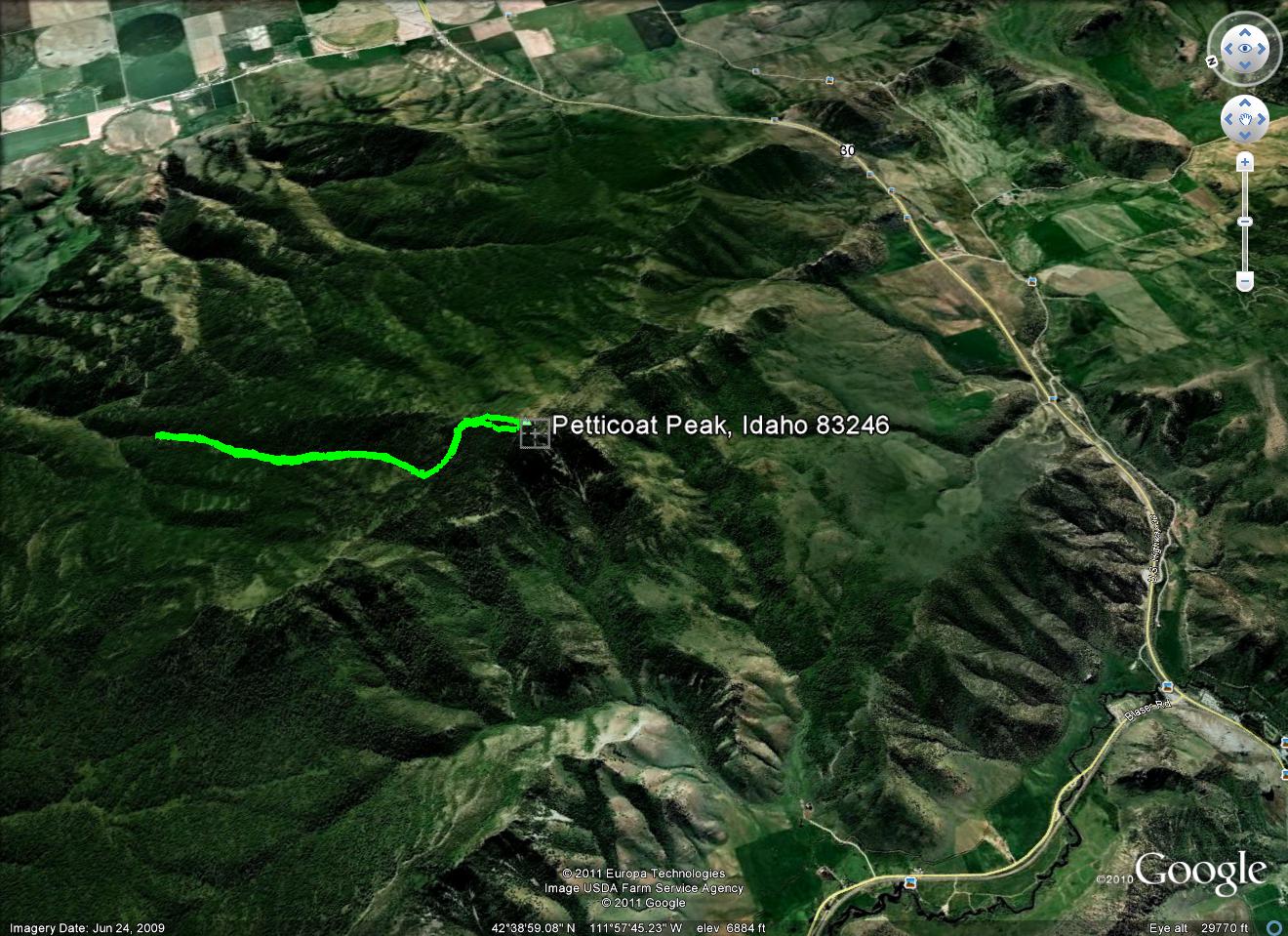
Route to the summit of Petticoat Peak via the now closed Mill Creek access. Note the compass at upper right of track for “north.” Margo Mandella GPS Track
Underpass Route by Keith Miller
Access
I climbed the peak via the mentioned underpass. It has the advantage of parking right off a paved road with no private land to cross. The parking spot is at 42.61700, -111.97232. My route was 4 miles with about 3000 feet of gain. The underpass is a deer crossing, so there is a gap in the deer fence that would be an obstacle elsewhere along that south edge of BLM land.
Route, Class 2
I walked north on the ridge until I got around the top corner of a block of private land at 42.63541, -111.97591. From there, an old two-track gave me a break from the miserable bushwhacking. I followed it up a small canyon to 42.64010, -111.96442, where I climbed north to the ridge. This ridge has some difficult parts through thick woods with some minor terrain obstacles. At 42.64603, -111.95501 I contoured to the left, crossing a small quartzite ridge, to the saddle south of the peak at 42.65023, -111.95101. There are already descriptions of the climb from that point.
East Shoulder/Southeast Ridge and East Face Routes by Livingston Douglas
Petticoat Peak as viewed from Peak 6540 to its south. Livingston Douglas Photo
Access
From US-30 east of Lava Hot Springs, turn north onto [signed] Lund Road. This junction is located 6.5 miles east of the [signed] highway to the “Pebble Area” and 6.9 miles east of the main turnoff for Lava Hot Springs at the east end of town. Drive 1.3 miles north on Lund Road to a signed junction with Neibaur Mountain Road. Go left/west onto Neibaur Mountain Road and drive 0.5 miles to a gated road closure and a small, grassy parking area. Park here (5,665 feet; 42⁰40’05”N, 111⁰53’54”W).
The road becomes a poorly-maintained ATV road from this point. It is narrow, rutted, and overgrown. This area is a mix of private and public land, so be careful. This climb is entirely on BLM land. Please note that Neibaur Mountain Road used to be signed as Rindlishbaker Canyon Road since the road heads up Rindlishbaker Canyon. Neibaur Mountain is nowhere on the USGS maps of this area. So why the change in road name?
Map Errors
Both the Caribou-Targhee National Forest map and the USGS topo map show Neibaur Mountain Road as a jeep road that extends well up into Rindlishbaker Canyon. However, it is a poorly-maintained ATV road/trail. And it ends at a fence gate in a meadow at about 6,300 feet, over a mile north of (and before) the road’s end on the maps. And that closure gate has been there for decades. The field grass around it is six feet high.
East Shoulder/Southeast Ridge, Class 2
The Climb
From the gated road closure, hike west then southwest then south up Neibaur Mountain Road for about 1-3/4 miles to a point where there is a decent open scrub slope on the right/west side of the road. This opening allows easy entry up onto the east shoulder (one of several east shoulders) of Petticoat Peak. Leave the road here (6,220 feet) and bushwhack in steep, open scrub up onto the shoulder. The shoulder quickly becomes densely forested and heads southwest then west-southwest toward the high summit ridge.
The bushwhack up through the thick pine forest is simply brutal. There is so much deadfall and brush. In addition, the shoulder loses its definition at several spots. It is rounded lower down and wiggles around often. Aspens and willows soon join the miserable mix on the ridge. In addition, the ridge narrows and has rocky outcrops to contend with. And, yes, there are some ups and downs. Minor as they may be, they add to the misery. At about 6,600 feet, the ridge flattens and the bushwhacking is very rough.
Higher up, the ridge steepens and narrows. There are occasional open patches of scrub on the left/south side of the ridge crest. At about 7,200 feet, the terrain opens up considerably and the scrub is shorter. You can now see the summit ridge to the west. Push up through this steep, open section and finish the grind to the summit ridge in forested terrain. The shoulder ends at a juncture with the semi-open terrain on the summit ridge. Head right/northwest up the narrow ridge crest in a mix of ridge pines, ridge rock, scrub/brush, and willows. There are a few minor ups and downs as well.
The final scramble to the summit hump is in easy, open scrub. The summit is a rocky area on the ridge crest. There is a large, rusty old milk can on top with lots of triangulation wood nearby on the ground. There is no summit cairn. The views from the summit are splendid. I could not find the primary “Lund” USGS benchmark but I found two supporting USGS benchmarks nearby that point to where the benchmark is (or used to be).
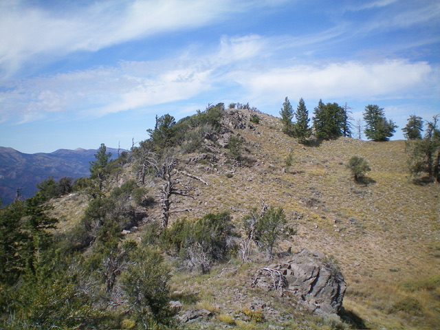
The rocky summit hump of Petticoat Peak as viewed from high on the southeast ridge. Livingston Douglas Photo
East Face, Class 2
The Descent
From the summit, descend northeast briefly in open scrub on a ridge that soon becomes a narrow, thick mess of rocky outcrops, brush, and trees. Head due east and descend a steep face of aspen bushes to reach a gully that a copious quantity of deadfall and brush. Angle right-ish to exit the gully and reach a ridge of sorts and suffer eastward down it until it ends in another dry gully. Sometimes the gullies on the east face are easier and faster than the ridges/shoulders.
Just go with what works best at that moment and continue the eastward descent. Eventually, emerge from the forest into a large, grassy, north-south meadow. Head left/north down the gentle slope of the wide meadow and soon reach a rusty, old road closure fence that extends all the way across the vast meadow. This closure gate/fence is like a split-rail fence except it has three horizontal pipes in each fence section rather than three slats of wood. A very unusual sight to see. Just past this steel pipe fencing, find the old road bed on the left/west side of the meadow.
Get on the overgrown 2-track road bed and follow it for two miles back to the road closure gate where this torturous climb began. Your welcome vehicle awaits. There is no easy route on the east face. The forest bushwhack is simply brutal and the terrain is constantly changing from ridge to gully to face with no previous notice. Too bad that the Mill Creek jeep road/trail is blocked by private property from the north because that is the best and easiest way to reach the summit of Petticoat Peak.
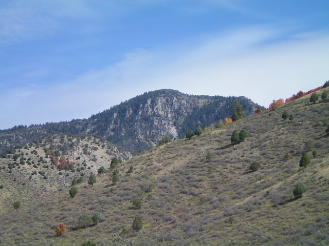
Petticoat Peak (dead center) and its rugged west face. Livingston Douglas Photo
Older Access and Route Information
Access
Access has changed a lot in the past few years. The following access information was provided in July 2023 by Jeff Cundick, outdoor enthusiast and retired BLM Pocatello Field Office Mining Resources Manager.
Other Accesses
Rindlishbaker Canyon Access
From Lava Hot Springs, travel east on US-30 for 7.1 miles, driving over Fish Creek Summit and descending to the valley floor. Here, you will reach a signed junction with Central Road/Lund Road, signed as “Bancroft 5 miles.”
Turn left (north) onto Central Road/Lund Road and continue north for 1.4 miles. Turn left (west) onto Neibaur Mountain Road and continue along the road until you reach BLM land. Continue further, or park here, based on your vehicle’s capabilities.
Northwest Route via Rindlishbaker Canyon, Class 2
From where you park along Neibaur Mountain Road, hike along the road to the wilderness boundary. There is a trail at the end of the road that leads to the summit of Petticoat Peak.
North Ridge Route (Mill Creek Historical Approach), Class 2
Follow the trail out of the kiosk area (south) at the end of Mill Creek Road as it parallels the base of the north ridge. Towards the end of the canyon, the trail heads up to the ridge. You may have to bushwhack to the ridge. This canyon is well vegetated and can be really muddy in the early season. Thus the trail may be overgrown and difficult to find at times. When you reach the top of the ridge, continue south to the obvious summit. No matter how you get to the summit, hopefully you will still find the milk can summit register.
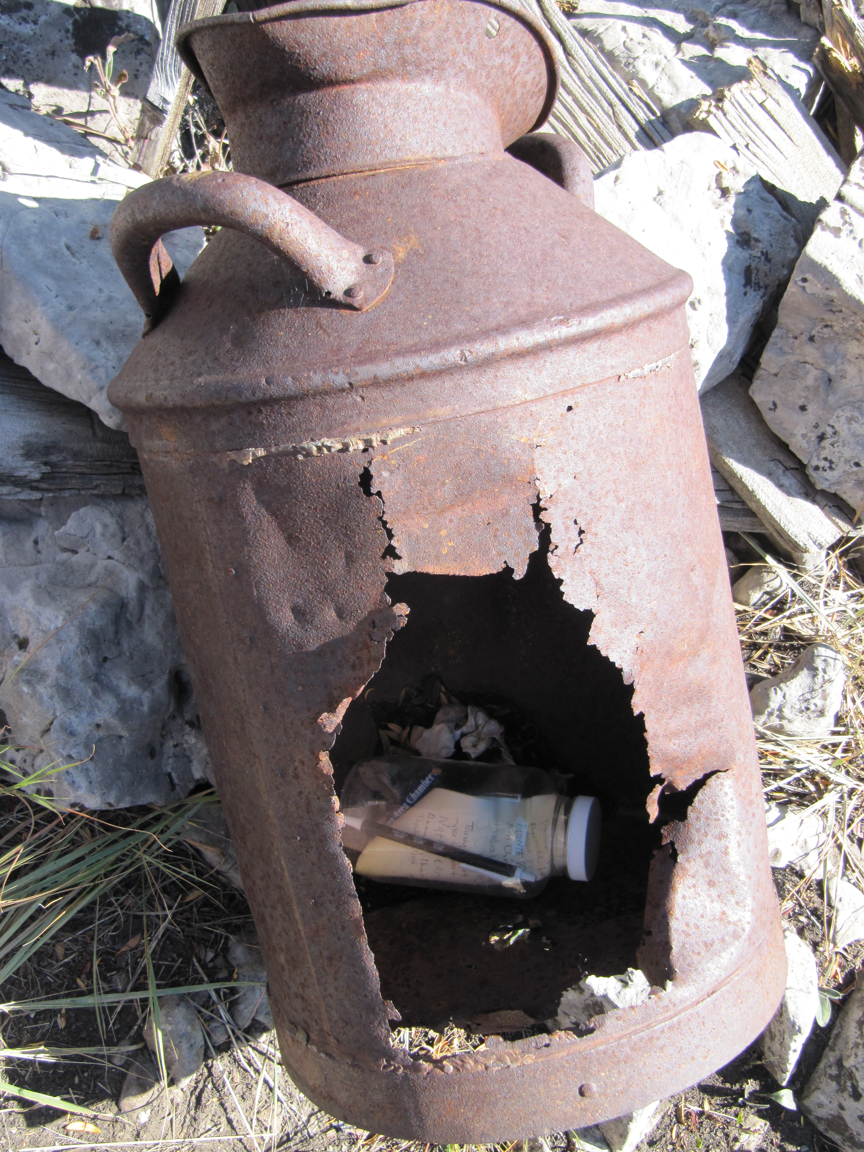
The rusty milk can atop Petticoat Peak. Steve Mandella Photo
Additional Resources
Regions: Fish Creek Range->Portneuf Range->SOUTHERN IDAHO
Mountain Range: Portneuf Range