Elevation: 7,710 ft
Prominence: 730

This peak is not in the book.
Pike Mountain is located northeast of the Magic Mountain Ski Area. It is the highest point on the North Side of the South Hills. It was once the home of a fire lookout and, as one would expect, it a great place to survey the surrounding country. USGS Pike Mountain
Pike Mountain as viewed from Deadline Ridge.
Access and Route, Class 1
The peak can be reached from I-84 at Exit 182. Google Maps works well when you are approaching from the freeway. Just search for Pike Mountain, Cassia County. This approach starts on the Rock Creek Road, FS-515 which is paved until just past the Magic Mountain Ski Area.
FS-507 leads from the Magic Mountain Ski Area to the summit in 1.8 miles with 642 feet of elevation gain. The road is improved and passable for most vehicles when dry. The road does not see much use and is good for hiking or mountain biking. Access the road at an unsigned junction just south of the ski area. This turn is just before the pavement ends and leads into a large parking area. The road departs the parking area at its north end. An alternative route is to follow the jeep trail shown on the map below. This route is steep in places and the best for those wanting to hike the peak without using the main road.
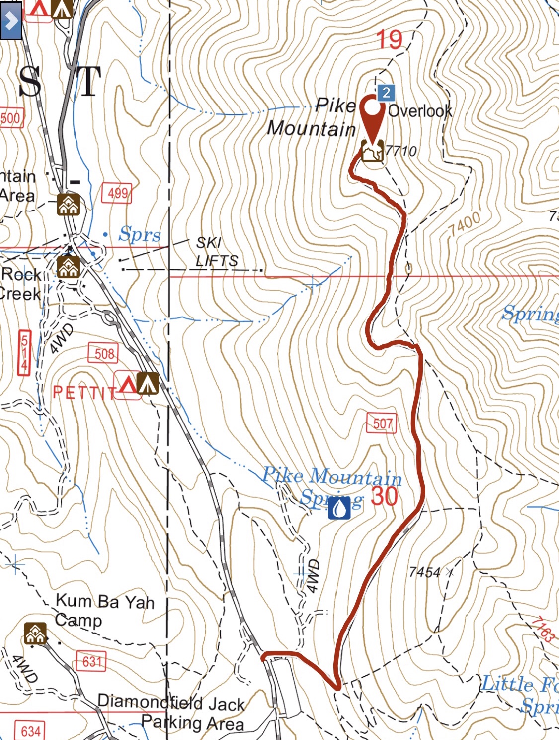
My GPS track for the road to the top of Pike Mountain. One-way distance is 1.8 miles with 642 feet of elevation gain.
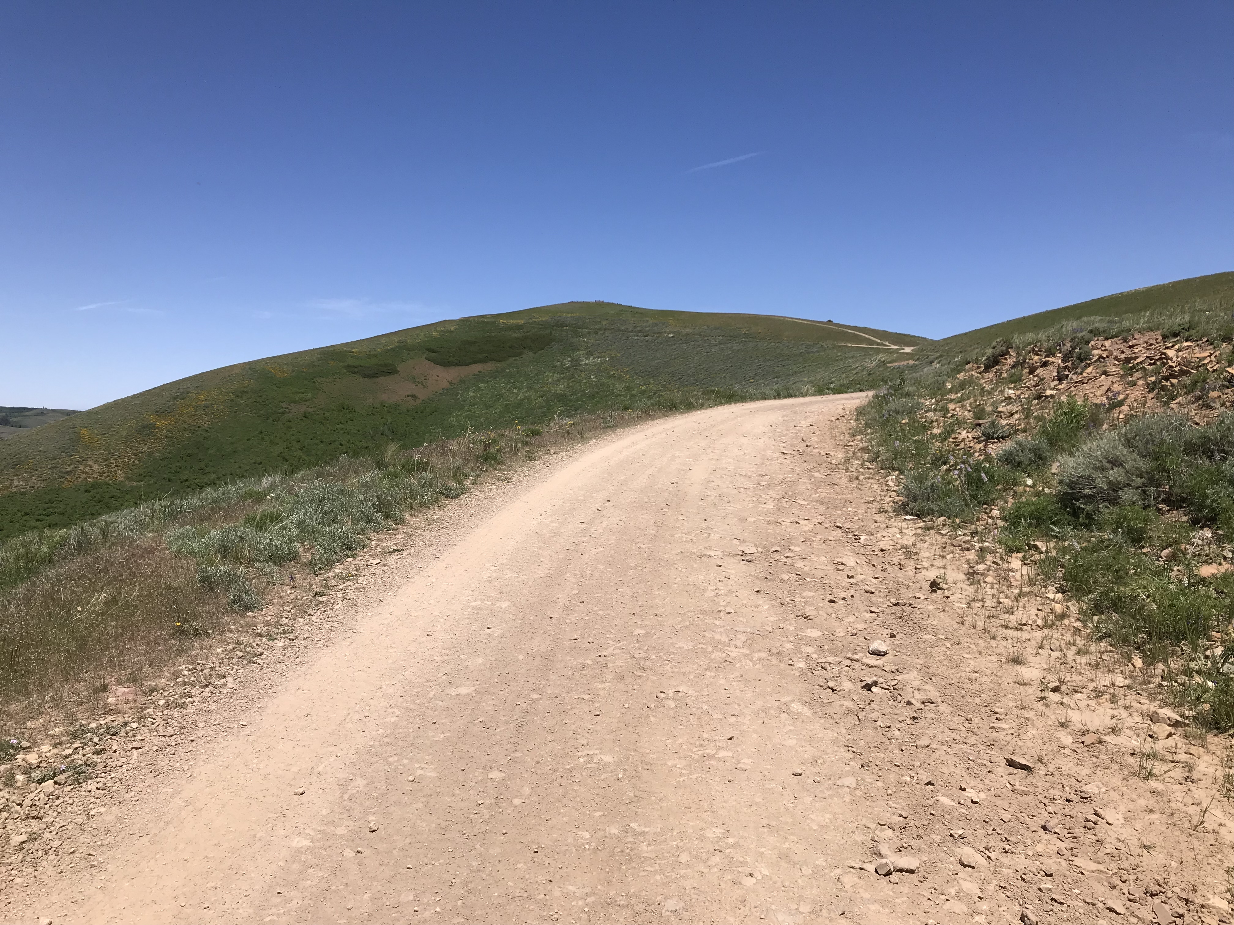
The Pike Mountain Road is improved and passable to passenger cars with normal clearance when dry.
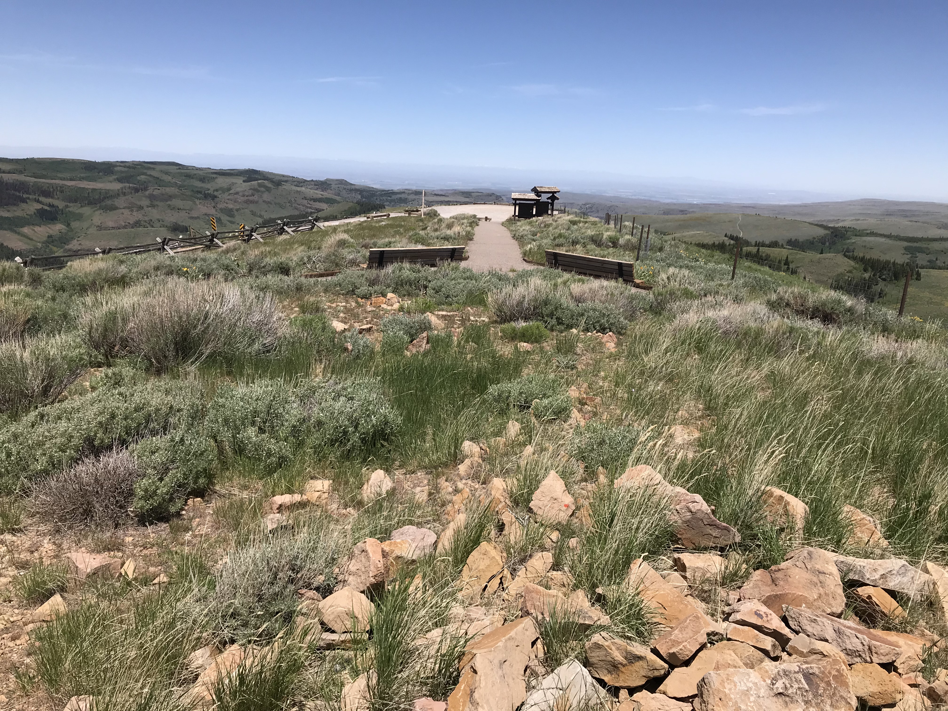
The summit is adorned with a large parking area, interpretive signs and benches.
Additional Resources
Regions: South Hills->SOUTHERN IDAHO
Mountain Range: South Hills
Year Climbed: 2018
Longitude: -114.27279 Latitude: 42.18989