Elevation: 7,332 ft
Prominence: 912
This peak is not in the book. Updated January 2023
Pine Mountain towers over nearby Fish Creek Reservoir. It is the highest peak in this area. Unlike the other scrub hills around here, Pine Mountain has a patch of pine trees on its northern aspects. Consequently, its name. The easiest ascent route is via Timber Butte Spring and a shoulder that leads up to the docile south ridge. You are likely to see black-tailed deer in this area. USGS Fish Creek Reservoir
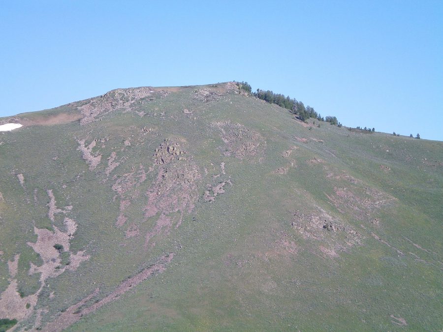
The east face of Pine Mountain as viewed from Peak 6667. Livingston Douglas Photo
West Ridge, Class 3
Access
Fish Creek Road is located along US-20. It is 17.2 miles west of the entrance to Craters of the Moon National Monument and 25.4 miles east of the junction of US-20/ID-75. The junction is signed. Reset your odometer at the base of Fish Creek Road at US-20. At 2.9 miles, cross to the right/east side of Fish Creek. At 3.5 miles, reach BLM land (signed). At 3.9 miles, reach an unsigned road junction. Park here (5,287 feet). This road junction is at the base of the west ridge of Pine Mountain.
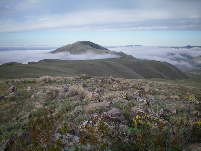
Pine Mountain as viewed from Peak 7180 to its northeast. Livingston Douglas Photo
The Climb
From Fish Creek Road, bushwhack northeast up through thick sagebrush to reach the rockier, less sage-infested west ridge of Pine Mountain. Scramble up the easy, short scrub of the west ridge over Point 5862. Drop 40 vertical feet to a saddle. Resume the uphill trek to merge with the northwest ridge at about 6,400 feet. The ridge steepens noticeably here and turns right-ish/southeast.
The next couple hundred feet of climbing is tedious. There are ridge sections of talus/boulders and taller, thicker scrub. An unpleasant combination of rocky ribs/outcrops and pines/scrub greets you next, as the ridge narrows. Skirt the rocky outcrops whenever possible. You will be grateful to reach the final, gentler summit area. A short stroll on tundra leads you to the summit of Pine Mountain.
The summit has some scrub, boulders, and protruding ground rock. There is a USGS benchmark on the highest boulder. A modest summit cairn and a triangulation post/wiring is nearby. The north side of the west ridge and the northeast face/ridge has pines on it, giving the mountain its name.
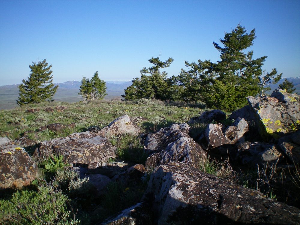
The summit boulders and pine trees atop Pine Mountain. Livingston Douglas Photo
Northeast Ridge/East Face, Class 3
Access
Same as for the west ridge. This route is the first leg of a traverse from Pine Mountain to Peak 6667.
The Descent
From the summit, descend northeast down steep, rocky, thick terrain to reach gentler terrain below. This upper section of the northeast ridge is a clogged, steep mess of pines, boulders, scrub, and blowdown. It’s short but challenging. It’s much better to simply descend the open, easy east face here. Avoid the northeast ridge.
Once below the nasty upper section of the northeast ridge, leave the ridge and descend the east face on relatively easy, open sagebrush. Aim for a saddle on the northwest side of Point 6249. Descend across a few minor dry gullies to reach the saddle. When you reach this saddle, either skirt the north side of Point 6249 or climb to the top of Point 6249 and descend northeast to another saddle. This second saddle is east-northeast of Point 6249 and has a jeep road crossing it. It sits at the base of the north ridge of Peak 6667. The next leg of today’s journey begins here.
East Gully, Class 2
Access
Same as for the west ridge. This is the next leg of a loop route that begins and ends on Fish Creek Road.
The Climb
From the base of the east gully alongside Huff Creek, follow the remnants of an old 2-track jeep road heading up the dry gully. This old track gets you about halfway up the gully and ends there. Stay in the center of the gully and grind your way up through sagebrush to reach a ridge saddle at 6,580 feet. This saddle is on the south ridge of Pine Mountain and is at the head of the west gully, the descent route.
West Gully, Class 2
Access
Same as for the west ridge. This is the final leg of a loop route that begins and ends on Fish Creek Road. This journey includes a climb of both Pine Mountain and Peak 6667.
The Descent
From the 6,580-foot saddle southwest of Pine Mountain’s summit, you can see Timber Butte Spring down below. It is in a small, green, grassy area. You can also see a 2-track jeep road leading up to it from Fish Creek Road. Your objective now is to get to Timber Butte Spring and that road. From the saddle, bushwhack northwest through thick sagebrush down a face section to reach a prominent dry gully.
This gully is jammed with thick sagebrush and should be avoided. Move right/north onto an obvious shoulder on the side of the gully. Descend this shoulder to reach Timber Butte Spring. The shoulder has less scrub and more rock/scree on it than the nearby gully. It goes quickly. When you reach Timber Butte Spring, you will find an old, overgrown 2-track jeep road. Follow the old track west to reach Fish Creek Road. Walk north on Fish Creek Road for ¼ mile to reach your parked vehicle.
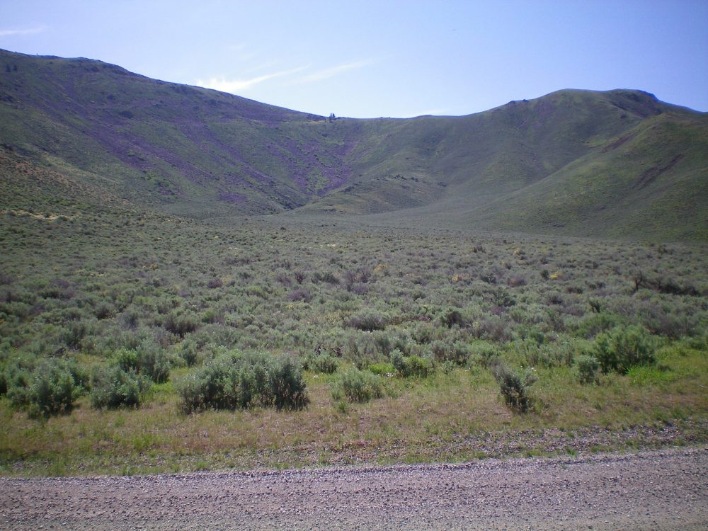
The south ridge, ridge saddle, and west gully of Pine Mountain as viewed from Fish Creek Road. Livingston Douglas Photo
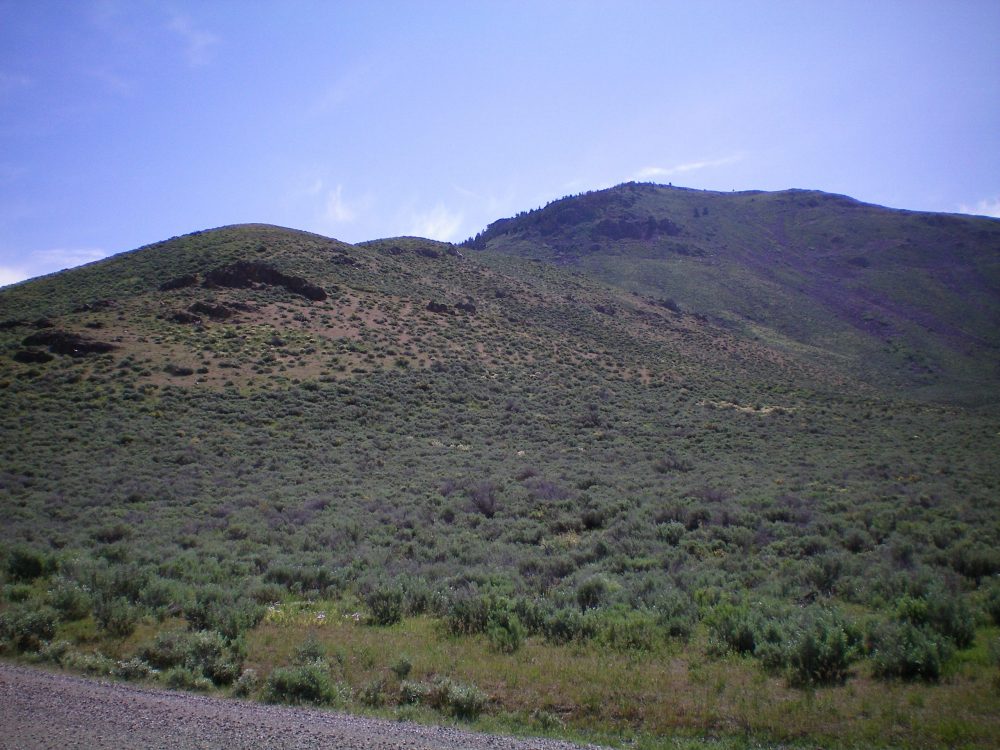
The west ridge (left skyline) of Pine Mountain as viewed from Fish Creek Road. The summit is just right of center Livingston Douglas Photo
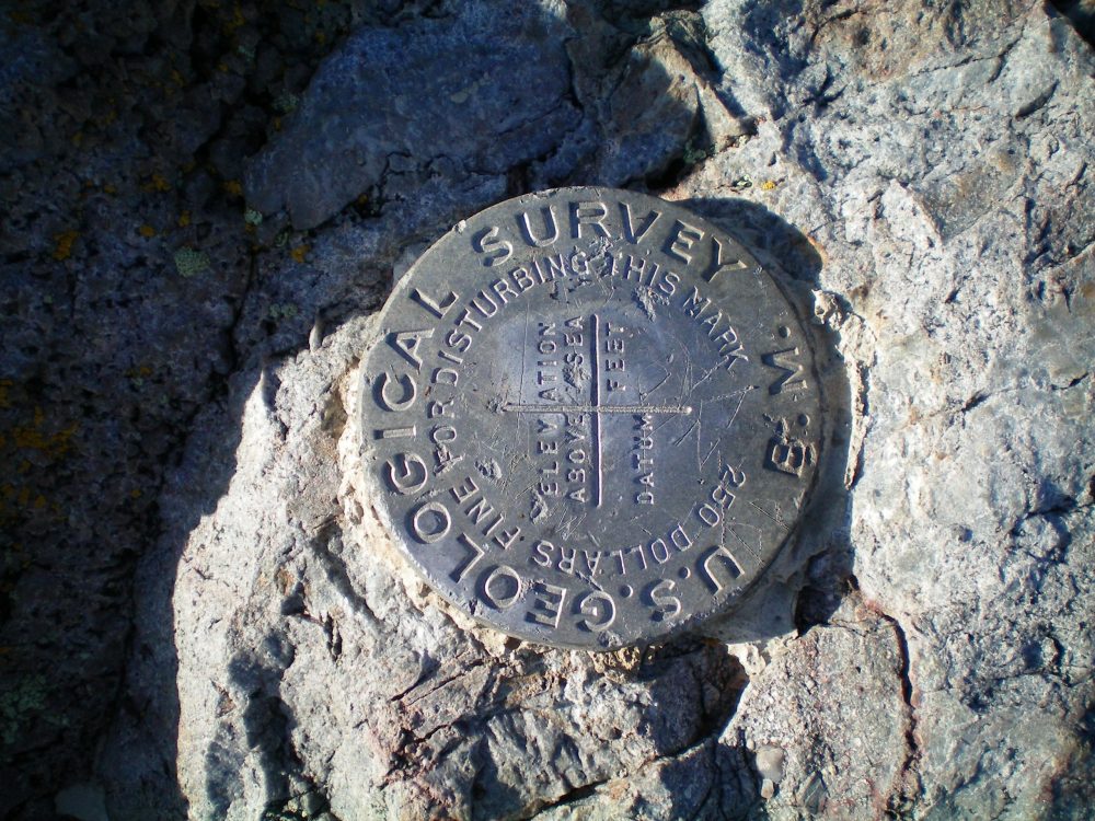
The USGS benchmark on the summit of Pine Mountain. Livingston Douglas Photo
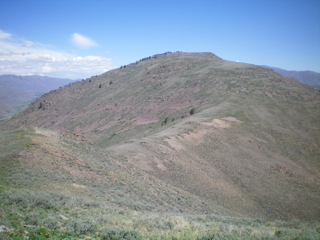
Pine Mountain as viewed from Peak 6862 to its southwest. Livingston Douglas Photo
Additional Resources
Regions: EASTERN IDAHO->Pioneer Mountains
Mountain Range: Pioneer Mountains
Longitude: -113.79259 Latitude: 43.41379