Elevation: 8,571 ft
Prominence: 351
This peak is not in the book. Published November 2023
Porphry Ridge HP is the high point on lengthy Porphry Ridge. Unlike its ranked cohorts at the southeast end of Porphry Ridge (Peak 7248, Peak 7112, and Peak 7220), the HP on Porphry Ridge is a wicked bushwhack that sits well off the main north-south ridge crest of the Yellowjacket Mountains. That being said, this route is probably the easiest way to get to the high point of Porphry Ridge. USGS Blackbird Mountain
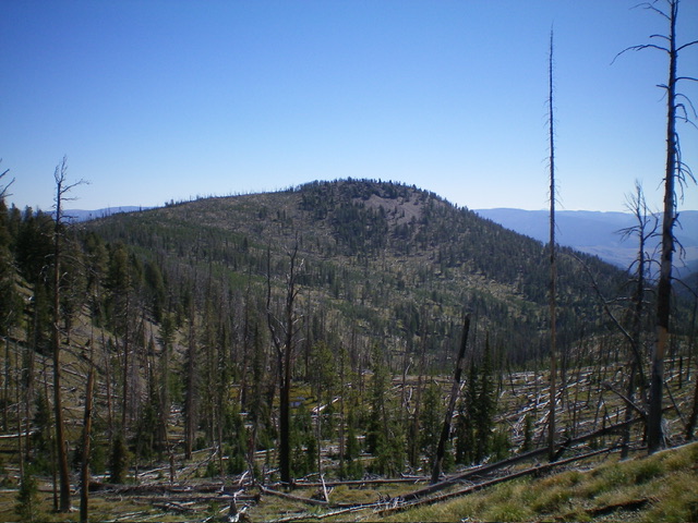
Porphry Ridge as viewed from the west. Livingston Douglas Photo
Access
From Panther Creek Road, drive west up FSR-112/Porphry Creek Road for 6.8 miles to a signed 4-way road junction. From the junction, drive north up FSR-113 for 3.6 miles to a minor roadside pullout on the left/west side of the road, just before the road crests. This pullout is at 8,575 feet and 45⁰04’23”N, 114⁰26’54”W).
West Ridge, Class 2
The Climb
This is a punishing bushwhack and I do not recommend it. There is an enormous amount of deadfall to navigate on the entire route. It is exhausting. The only “easy” sections are the open terrain on the east face of Point 8600+ (early on) and a few short patches on the east ridge of Point 8360+. From the roadside pullout (meager as it is), bushwhack east-southeast through a burn area. Head up over a gentle hump (Point 8600+) in a mix of open terrain and semi-open pine forest. The entire summit cap of Point 8600+ is strewn with tedious deadfall and brush/grass.
Head east to find a surprisingly open east face (not forested as the USGS topo map suggests) that leads down to an 8,300-foot saddle that sits above the headwaters of Porphry Creek. This face is somewhat steep and is a mix of open grass, scattered deadfall, and a few standing snags. From the saddle, scramble east-northeast up through a semi-open pine forest with a fair amount of deadfall to reach the top of gentle Point 8360+.
Follow the ridge east then southeast in much thicker pine forest and more serious deadfall to reach a wicked, elongated saddle of young, live pines and intense quantities of deadfall. Bash your way southeast through this [almost-impossible] mess in flat terrain with no visibility to finally reach the uphill and easier terrain of the north ridge of Porphry Ridge HP. Bushwhack southeast then south to the semi-open, ridgeline summit. The north ridge is easier terrain and is a mix of pines, ridge rock, field grass, and a modest amount of deadfall.
The summit area has two humps of similar height. The north summit is the HP according to the USGS topo map and I believe it is. The south summit (which is not too far away) is equal or lower in height, according to my altimeter. I built a decent cairn atop the north summit then suffered a sense of dread about having to return via the ascent route, my only way back to FSR-113. But I somehow persevered and got it done. It took just as long to descend this mountain as it did to ascend it. That’s how difficult and time-consuming the terrain is.
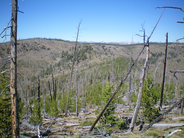
Looking back along the ascent route from high on Porphry Ridge. Lots of snags, deadfall, and young pines. The route climbs up the face left of center to return to the road. Livingston Douglas Photo
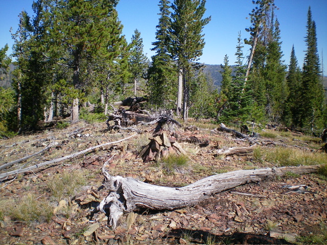
The summit of Porphry Ridge and its newly-built summit cairn. Livingston Douglas Photo
Additional Resources
Regions: Eastern Salmon River Mountains->Salmon River Mountains->WESTERN IDAHO->Yellowjacket Mountains
Mountain Range: Eastern Salmon River Mountains
Longitude: -114.4215 Latitude: 45.0659