Elevation: 5,032 ft
Prominence: 62
This peak is not in the book. Published November 2023
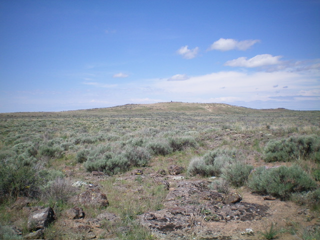
Potter Butte is located southeast of Laidlaw Park and northwest of Bear Den Butte in the desolate southwest section of Craters of the Moon National Monument. Potter Butte has a 7-foot tall cairn atop it that can be seen from miles away. USGS Bear Den Butte
Potter Butte (dead center with the tall cairn atop it) as viewed from the east. Livingston Douglas Photo
Access
From US-20 east of Carey, turn right/south onto [signed] North Laidlaw Road. This junction is 0.2 miles west of Fish Creek Road, which is well-signed. Drive south on North Laidlaw Road for 1.2 miles to an unsigned “T” junction. This is Laidlaw Park Road. It can also be approached directly from farther west on US-20 and the road quality should be fine. Turn left/southeast onto Laidlaw Park Road and drive 13.6 miles to reach a signed 4-way junction (5,078 feet on the USGS map).
Continue straight/east for another 4.5 miles to an unsigned road junction. Go diagonally right/southeast onto Bear Den Butte Road (unsigned). At 5.4 miles, the road bends right/south. At 8.1 miles, cross a cattle guard. At 8.6 miles, reach an unsigned junction with Bear Den Butte Spur Road. This junction is at 43⁰13’28”N, 113⁰31’43”W. Park here (4,945 feet).
East Face, Class 2
The Climb
From the road junction, bushwhack northwest through easy, gapped sagebrush for about ¾ mile to cross a stiff cattle fence (shown on the USGS topo map). Once across the fence, head west directly at the well-cairned summit. The terrain here is easy scrub then a final annoying mix of field grass and tumbleweeds. The summit has an impressive 7-foot tall cairn.
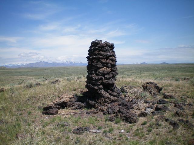
The 7-foot summit cairn atop Potter Butte. Livingston Douglas Photo
Southeast Face, Class 2
The Descent
From the summit, descend southeast, aiming directly at Lava Butte in the distance. Cross dried-up Zada Reservoir and continue southeast to intercept the 2-track road about 0.2 miles southwest of the road junction. Walk northeast on the road briefly to return to your parked vehicle. The terrain on this descent route is mostly sagebrush and requires some weaving, but nothing too onerous.
Additional Resources