Elevation: 8,020 ft
Prominence: 120
This peak is not in the book. Published November 2020
Prospect Peak is a small, rugged outcrop that towers over Beartrap Canyon to its south. It is most easily climbed via its north ridge from FST-121. The northeast face is a sheer cliff. The summit perch offers superb views. Climb Prospect Peak in combination with nearby Red Butte (8,108 feet) and Temple Peak WY (8,219 feet) to make it a fuller adventure. USGS Temple Peak
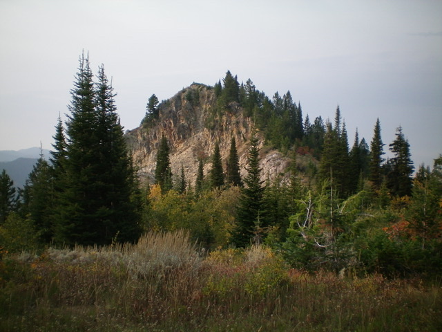
Prospect Peak as viewed from the north. It is a rugged outcrop with a combination of pines, aspens, rock, and brush. Livingston Douglas Photo
Access
From the Caribou-Targhee National Forest office on US-26 at the north end of Idaho Falls, drive 13.6 miles east on US-26 to a signed junction for the Kelly Canyon ski area. Turn left/north onto a paved road. Set your odometer to 0.0 here. At 1.9 miles, go right at an unsigned junction. At 3.1 miles, cross the Snake River on a bridge then immediately reach a “T” junction. Go right/east here onto Heise Road.
At 5.4 miles, go left at a signed fork in the road. At 7.9 miles, enter the Caribou-Targhee National Forest. You are now on FSR-218. At 8.9 miles, reach a signed junction with FSR-217 (the “Y” junction). Go straight here to stay on FSR-218. At 19.4 miles, reach a signed junction with FSR-651 (right). Go right onto FSR-651 and drive 1.8 miles east on FSR-651 to its end at the trailhead parking area for FST-077 (an ATV trail). The trailhead elevation is 7,220 feet.
North Ridge, Class 2
The Climb
Hike up FST-077 for 1.2 miles to a [signed] trail junction. Go right onto FST-121. Follow FST-121 east for 0.8 miles to a [signed] trail junction. Go right to remain on FST-121. FST-121 is now a narrow MC trail. Hike 0.4 miles up FST-121 to a ridge saddle that sits between Red Butte and Prospect Peak. Leave the trail and bushwhack south up the ridge crest in a combination of pines, thick brush, and patches of aspens.
The ridge crest soon becomes very clogged with bushes and brush, so move to its right/west side for angled, but better, going. Higher up, there is a dense section of aspens that is best crossed on the ridge crest rather than on the right/west side. Just below the summit, bash through a thick patch of willows to reach the small, rocky summit of Prospect Peak. I rebuilt the torn-down summit cairn. The open summit offers a magnificent view of both Red Butte to the north and Temple Peak (WY) to the east.
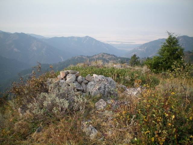
The summit area of Prospect Peak, looking south. Livingston Douglas Photo
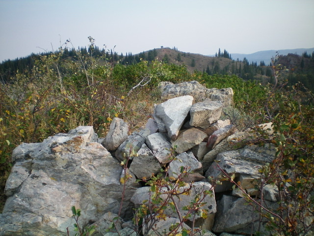
The rebuilt summit cairn atop Prospect Peak, looking north. Red Butte is in the background. Livingston Douglas Photo
Additional Resources
Mountain Range: Big Hole and Snake River Mountains
Longitude: -111.41611 Latitude: 43.65489