Elevation: 8,180 ft
Prominence: 1,440
This peak is not in the book. Published November 2023
Ramsey Mountain is the high point on a ridgeline that sits south of Cruikshank Creek and east of Railroad Canyon in the Beaverhead Mountains. It rises significantly off the valley floor northeast of Leadore and has over 1,000 feet of prominence. USGS Lemhi
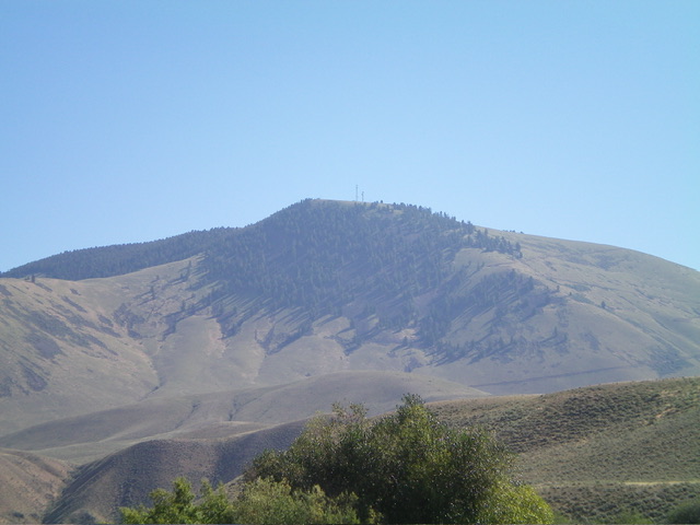
Ramsey Mountain as viewed from Hayden Creek Road to its southwest. Livingston Douglas Photo
Access
From the small hamlet of Lemhi along ID-28 about 18 miles north of Leadore, drive southeast on [signed] Lemhi Road for 0.3 miles to a signed junction with Ramsey Mountain Road (“Ramsey Mountain 5” sign). Drive 1.3 miles up this maintained dirt road (4WD is required due to its steepness) to a minor saddle just east of Point 6025. There are two cattle cisterns and a nice parking pullout here. Park here (5,990 feet; 44⁰51’33”N, 113⁰35’41”W).
Southwest Face, Class 1-2
The Climb
This is a Class 1 road hike if you follow the service road all the way to the summit area. If you shortcut the long road switchbacks and climb up the steep, grassy slope, it is Class 2 (which is the route that I followed). From the roadside pullout on the 5,990-foot saddle, hike about 0.3 miles north on Ramsey Mountain Road. Leave the road just after it passes a narrow gully on the right/east side of the road. Scramble east-northeast up through grass and sagebrush on the left/west side of the dry gully to cross Ramsey Mountain Road after one of its long switchbacks.
Hike about 100 feet southeast on the road then leave it to scramble up a STEEP slope of grass/sagebrush and a few small patches of scree, staying left of a series of powerline poles. Higher up, reach Ramsey Mountain Road just east of a major, long switchback at 7,400 feet. Hike briefly northwest on the road to the switchback then continue east on the steep road about 0.1-0.2 miles to get just right/east of the forest edge. Leave the road and scramble north up the steep face in grass/sagebrush and a few minor sections of scree, staying on either side of the powerlines as the terrain dictates.
High up, the powerlines end and you are just left/west of them. Do a final scramble up the unending grass and scrub to reach the antenna-clad summit area. Cross Ramsey Mountain Road and head right/east to a small antenna facility and the rocky high point. There is a summit cairn on another rocky outcrop just below the high point. Lemhi Benchmark (the lower, measured summit) is at the northwest end of the summit area, next to a larger antenna facility. Lemhi Benchmark measures 10 feet lower than the true/southeast summit. LOJ got this one right.
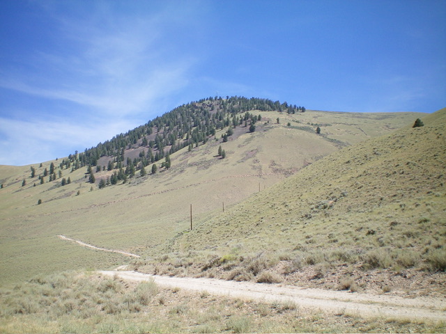
Ramsey Mountain as viewed from Ramsey Mountain Road. This photo shows my ascent route. Livingston Douglas Photo
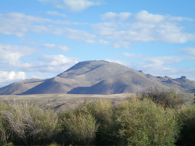
Ramsey Mountain as viewed from ID-28 to its south. Livingston Douglas Photo
Additional Resources
Regions: Beaverhead Range->EASTERN IDAHO
Mountain Range: Beaverhead Range
Longitude: -113.5784 Latitude: 44.8724