Elevation: 9,895 ft
Prominence: 1,155
Climbing and access information for this peak is on Page 132 of the book. There is now a good set of trails (mostly ATV) in the Bayhorse and Bayhorse Lake Area. It is no longer difficult to reach the summit of Ramshorn Mountain from the Little Bayhorse Lake area. Please consult the online DeLorme Trails Map for the Land of the Yankee Fork. Published November 2021
Ramshorn Mountain sits high above Garden Creek, west of Challis. It separates Bull of the Woods Gulch from Merrimac Gulch. It is one of the few Idaho mountains that has an unranked MOUNTAIN (Keystone Mountain) as one of its RIDGES (the northeast ridge). Ramshorn Mountain can be reached on ATV trails from both Garden Creek Road to the northeast and from Little Bayhorse Lake to the southwest. The shortest access is from the latter. USGS Bayhorse
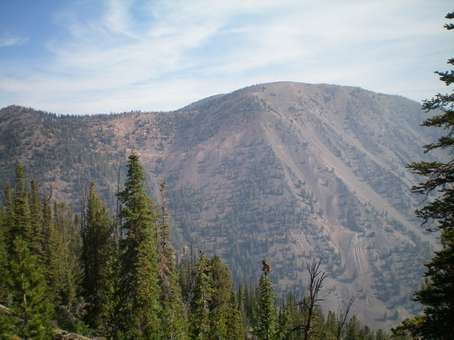
Ramshorn Mountain as viewed from the south. The summit is just peeking out from behind the main ridge in the distance. The Skylark Mine is right of center. The 2-track road switchbacks its way up toward the mine then heads diagonally left up to the ridge crest. Livingston Douglas Photo
Access
Bayhorse Lake Road/FSR-051 is located along ID-75 exactly 7.9 miles south of the junction of US-93 and ID-75 just south of Challis. Turn right/west onto Bayhorse Lake Road and reset your odometer. At 3.2 miles, reach the Bayhorse townsite. At 4.4 miles, reach the Challis National Forest boundary. At 6.7 miles, reach a signed road junction with Little Bayhorse Lake Road. Park in a roadside pullout just below this junction (7,975 feet).
Map Errors
The USGS topo map fails to show the decent jeep road that heads northwest from the Skylark Mine area up onto the main ridge crest to reach a junction with ATV trail FST- 021. This road segment was an unexpected blessing to an aging hiker.
South Face/South Shoulder Approach, Class 2
With an ATV or MC, you can ride up to the west ridge roads described below. Otherwise, you must either hike the approach roads/trails or scramble directly up the south face and south shoulder to intersect the west ridge roads as I did. From the roadside pullout near the road junction of Bayhorse Lake Road and Little Bayhorse Lake Road, scramble north up a steep slope of sagebrush and loose underlying scree/gravel. Angle diagonally left/northwest to intercept a somewhat-forested shoulder and a bit easier terrain. Once on the crest of the shoulder, follow it steeply north-northeast to intercept the Skylark Mine Road/FSR-380 at a signed junction with FSR-021 (shown on maps).
West Ridge, Class 1
The Climb
Go right/east onto FSR-380 and follow it to a sharp bend near the Skylark Mine. A foot trail continues east to the mine. The road does a sharp left switchback here and heads diagonally upward to the main ridge crest. This section of the road is only open to ATVs and MCs.
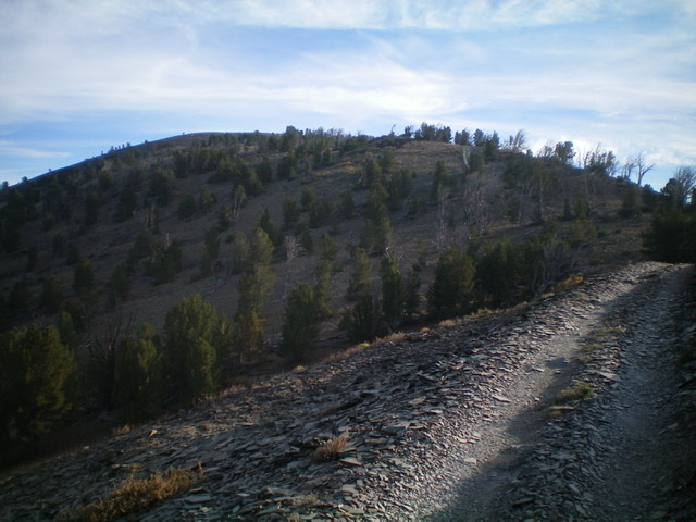
The summit of Ramshorn Mountain (left of center) as viewed from the 2-track road to its south. Livingston Douglas Photo
The road makes a right/east switchback upon reaching the ridge crest and quickly reaches a signed junction with FSR-021 (left). Continue straight/east on FSR-380 and follow it all the way to the saddle between Ramshorn Mountain and its [lower] south summit, Point 9782. At this saddle, the road becomes [signed] FST-4260, an ATV trail. It heads north to the summit of Ramshorn Mountain. The summit has a large cairn and a triangulation post/wiring. The ATV trail continues north and east to Keystone Mountain, where it connects with the Keystone Mountain Trail, another ATV trail.
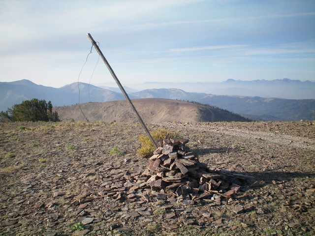
The summit cairn atop Ramshorn Mountain with Point 9782 in mid-ground. Livingston Douglas Photo
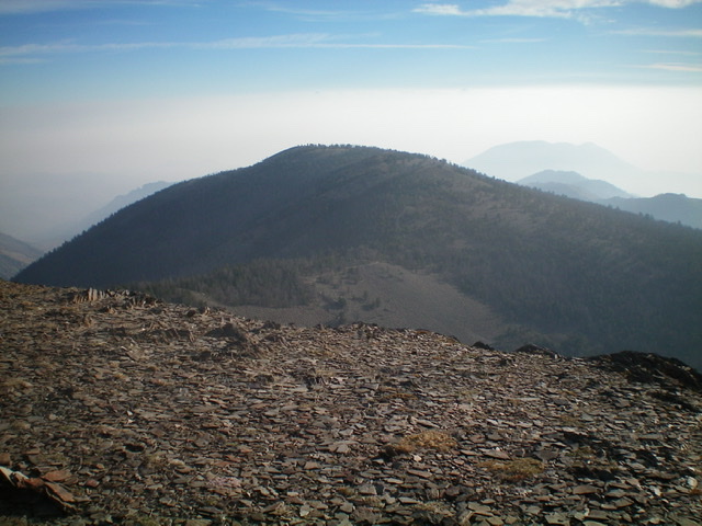
Looking northeast at Keystone Mountain (9,518 feet) from the summit of Ramshorn Mountain. Livingston Douglas Photo
Additional Resources
Regions: Eastern Salmon River Mountains->Salmon River Mountains->Southeast Corner Peaks->WESTERN IDAHO
Mountain Range: Eastern Salmon River Mountains
Longitude: -114.35739 Latitude: 44.42619