Elevation: 6,817 ft
Prominence: 387
This peak is not in the book. Published January 2023
Red Mountain is located west of the southernmost extremities of Blackfoot Reservoir. It is a short scramble from Dekay Pit Road to its west. While this area is a patchwork of private and public land, this climb is entirely on BLM land. USGS The Dip
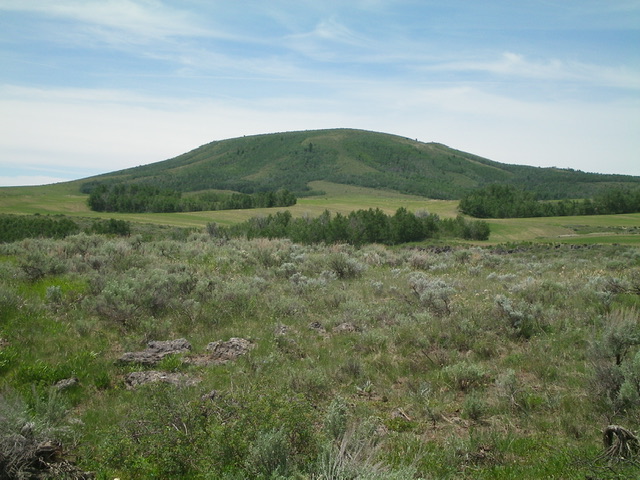
Red Mountain as viewed from Government Dam Road to its east. Livingston Douglas Photo
Access
From Exit 116 (Sunnyside Road) on I-15 in Idaho Falls, drive east on Sunnyside Road to its end at a signed “T” junction with Bond Road. This junction is 9.1 miles east of Ammon Road. Turn right/south onto Bone Road and drive 8.5 miles south to a signed junction with Blackfoot Reservoir Road, just south of Bone. Turn right/west onto Blackfoot Reservoir Road. The road quickly bends left/south and begins its journey to Blackfoot Reservoir. Drive 20.5 miles on Blackfoot Reservoir Road to a signed junction at the northwest corner of Blackfoot Reservoir.
Continue straight/south on Government Dam Road for 19.6miles to a signed junction with Sorenson Road. Turn right/west onto Sorenson Road and drive 0.9 miles to a signed junction with Dekay Pit Road (shown as Crater Road on the USGS topo map). Turn right/north onto Dekay Pit Road and drive 3.6 miles to reach the west side of Red Mountain. Park alongside the road soon after crossing a minor saddle and about 0.2 miles before reaching Dekay Pit (a cinder pit shown on the USGS topo map). Park here (6,405 feet).
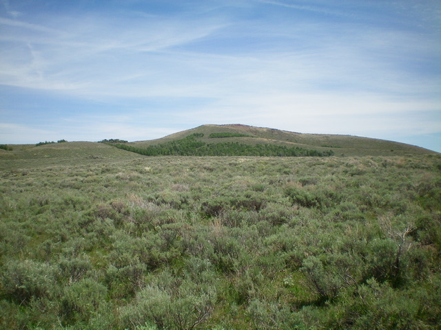
Red Mountain (dead center) as viewed from Dekay Pit Road to its west (start of hike). Livingston Douglas Photo
West Face/Southwest Ridge, Class 2
The Climb
From Dekay Pit Road, hike east up the saddle across a field of sagebrush and drop 20 feet to cross a wide, dry gully. Aim for the right/south edge of an aspen patch straight ahead. Skirt the right/south side of the aspens to climb up onto the southwest ridge. Once on the open ridge, head left/northeast and stay just left/west of another patch of aspens. There is a cattle trail on the edge of the aspens. Once past the patch of aspens, turn right/east and scramble up sagebrush then an easy, open ridgeline high up to reach the cairned summit. Yes, the rock on this mountain is RED. Hence the name Red Mountain.
Beware that local ranchers set coyote foot traps on this ridge. There was a dead coyote in such a trap high on the ridge crest. If that trap had not been sprung by the unfortunate coyote, I might have stepped into it unknowingly. Not only are such traps a cruel way to kill a coyote, they are probably illegal if hikers (or horseback riders) are using this ridge, as I was. Ranchers know how to hide them well so you won’t have any idea that one is there until you spring the trap.
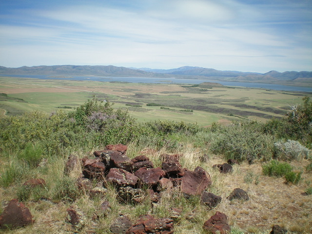
The summit cairn atop Red Mountain with Blackfoot Reservoir in the distance. Livingston Douglas Photo
Additional Resources
Regions: Blackfoot Mountains->Chesterfield Range->SOUTHERN IDAHO
Mountain Range: Blackfoot Mountains
Longitude: -111.6644 Latitude: 42.8257