Elevation: 8,193 ft
Prominence: 413
This peak is not in the book. Bing Young provided the lookout’s history. Livingston Douglas added his more detailed take on reaching the summit. Updated November 2923
Red Rock Peak, a former fire lookout site, is located in the Yellowjacket Mountains subrange of the Salmon River Mountains southeast of the Bighorn Crags. Like all fire lookout sites, it has an exceptional view. Its history as a fire lookout is recounted down the page. USGS Blackbird Mountain
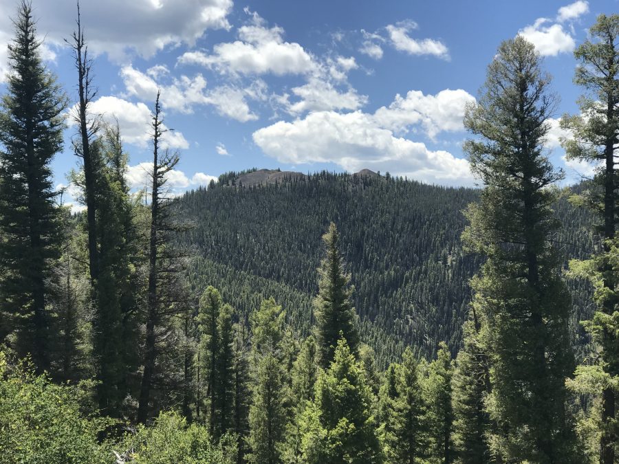
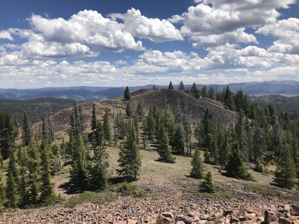
Red Rock Peak as viewed from the north
Access and Route, Class 1
The starting point for the drive to the summit begins on Panther Creek and uses FS-112, the road that leads to the Bighorn Crags [(H)(4.1) on Page 143]. Google Maps will give you good directions all the way to the summit and the signage is good. From Panther Creek, follow FS-112 west for 6.8 miles to a 4-way junction. Turn left at this junction onto FS-110 and follow it south for 2.6 miles to another junction. At this junction, there is an unnumbered road that heads up to a saddle just below the summit in 0.3 miles. From the saddle, a short trail leads to the top.
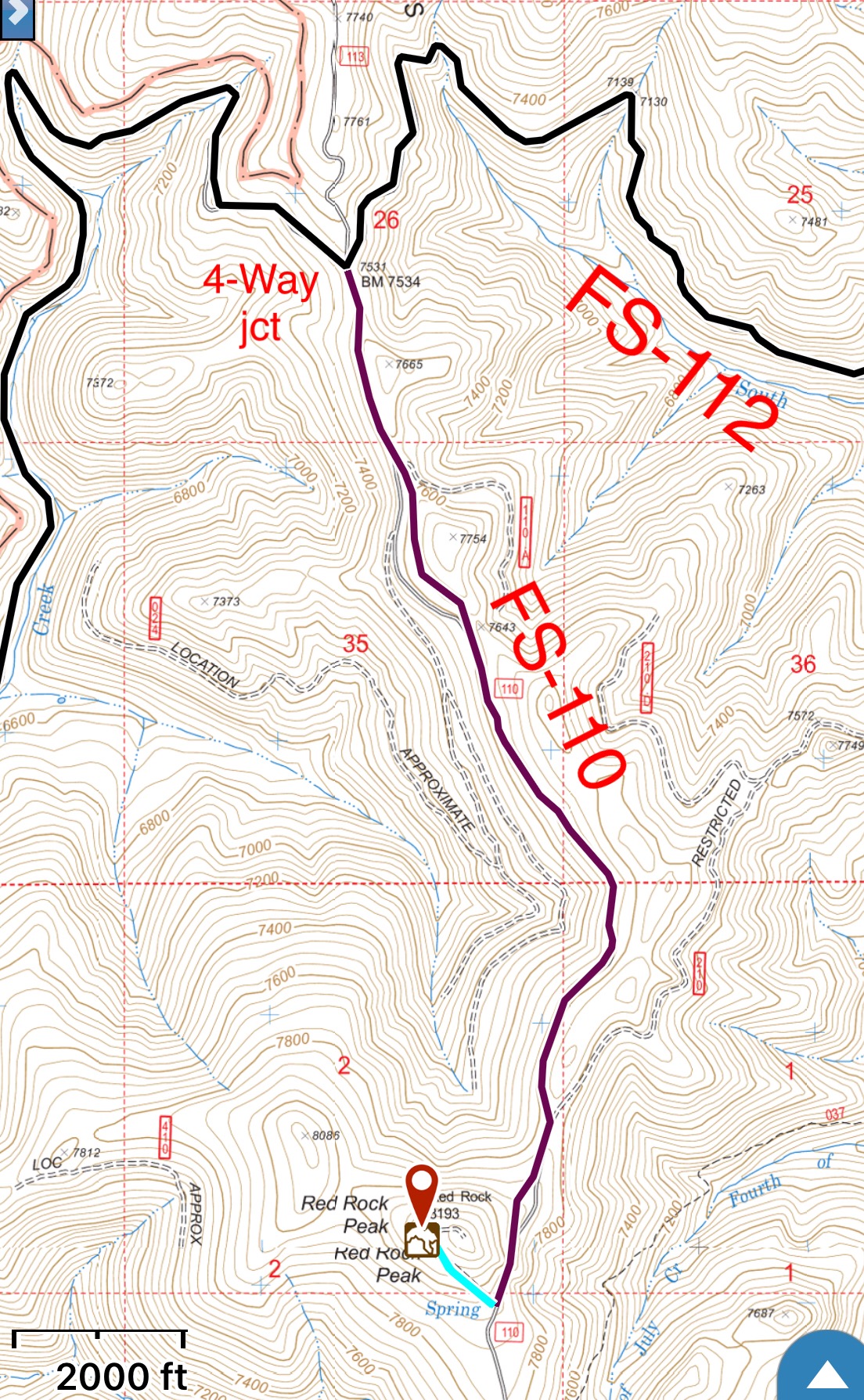
My GPS track from the 4-way junction to the summit. FS-112 is fairly decent road. The unnumbered road is a 4WD road but was blocked by a tree.
Red Rock Lookout’s History by Bing Young
Red Rock is located in the heart of the Yellowjacket Country at the head of Fourth of July Creek, directly above the old townsite of Forney. Red Rock was used as a lookout before any building was constructed. Smokechasers were stationed on Red Rock in the early 1920s. The lookout was built in 1933 against the Supervisor’s preference to build one on Duck Creek Point (which was built a year or so later).
The lookout was used at least through the 1950s as a primary lookout, but since its abandonment, it has been burned. Today nothing remains of the building. Red Rock Peak has an excellent view of the Yellowjacket Country, which no other lookout provides as effectively. Wayne O’Connor remembers that two of the seasons he was on Red Rock, he reported more “firsts” than any lookout on the Forest back in the early 1930s.
Red Rock is easily accessible in the Summer, as a road passes right over the top. The road leaves Panther Creek, then climbs up to the ridge on which Red Rock, the higher of two close points, is located. The elevation is 8,191 feet and the view is well worth the trip. —Salmon National Forest Fire Lookouts by Bing Young 1982, Page 32.
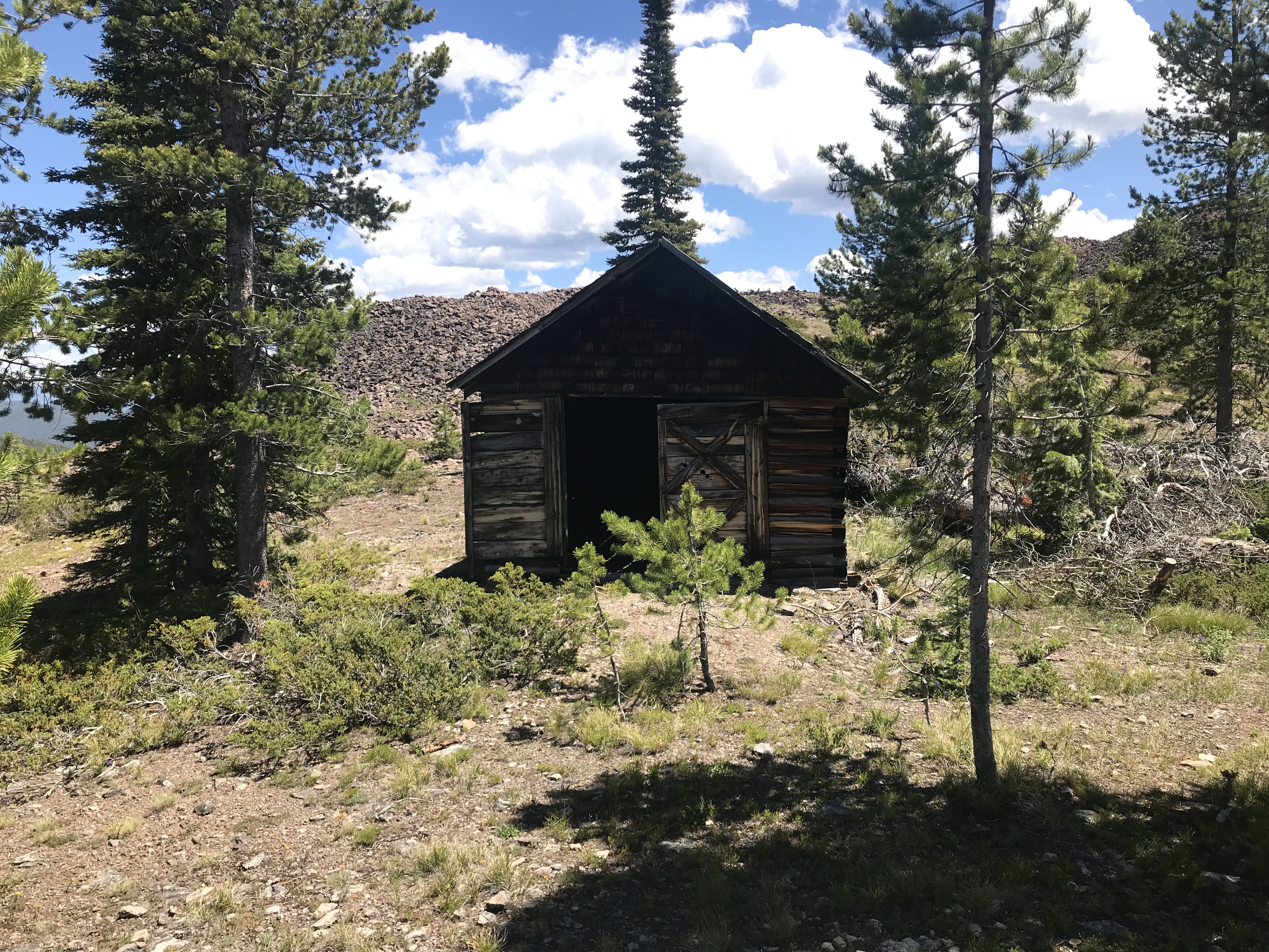
This garage-like structure is in fair condition and shows signs of recent work
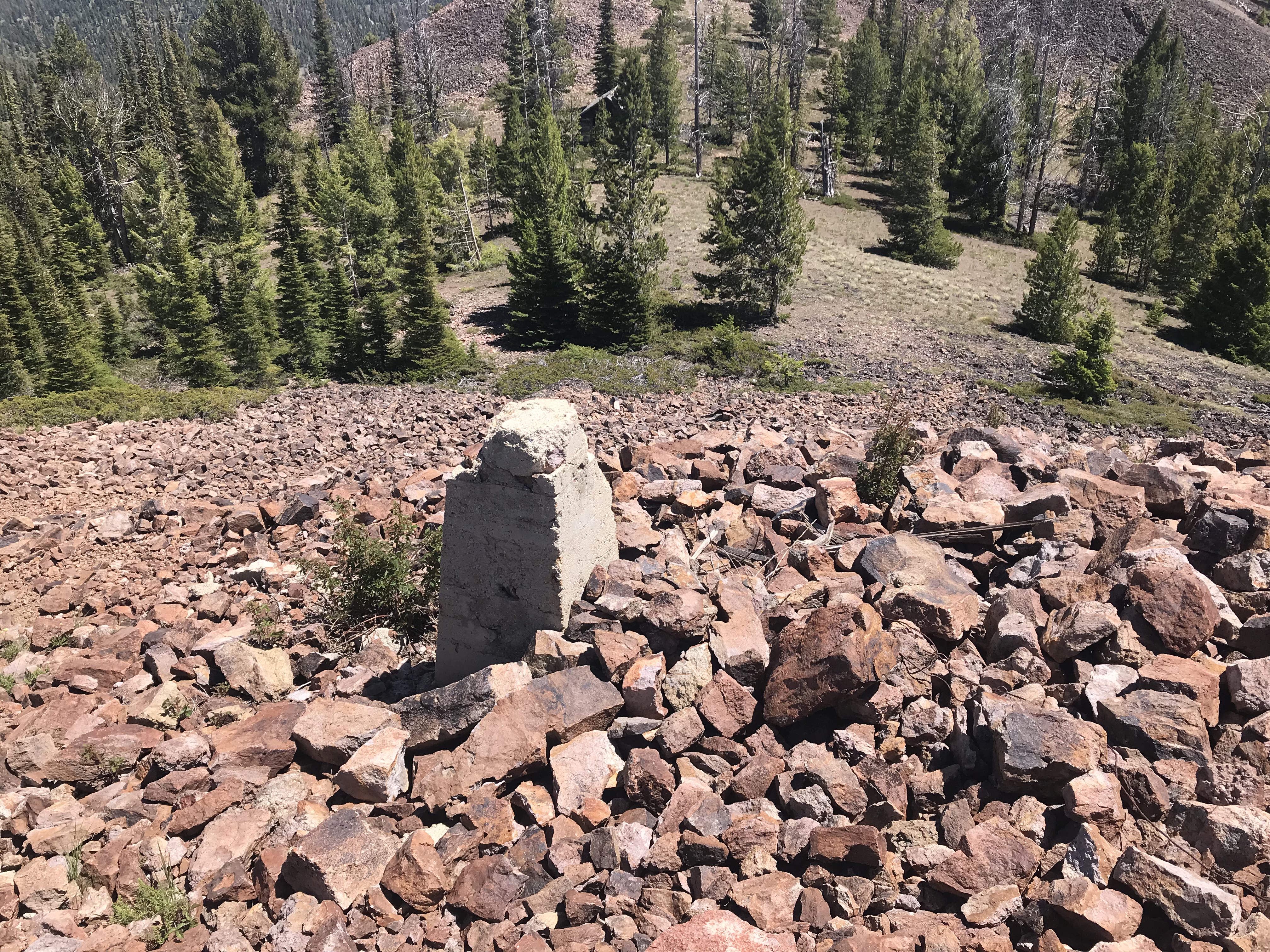
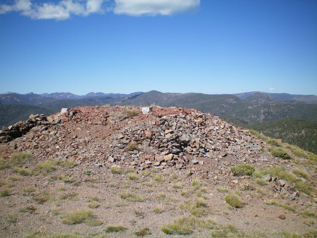
This concrete is all that remains of the lookout
Looking down from the lookout site to the saddle
South Face by Livingston Douglas
The official summit hump of Red Rock Peak, which has the USGS benchmark. Livingston Douglas Photo
Access
From a signed, 4-way junction of FSR-112, FSR-113, and FSR-110 on a saddle, head south on FSR-110/Duck Peak Road for 2.7 miles to an unsigned junction with an old side road. Park here (7,900 feet; 44⁰59’47”N, 114⁰25’34”W). This road junction is about 0.2 miles south of the Lopez Route. A large tree blocks that road and there is no place to park there. That is why I continued farther south along FSR-110 to find a parking pullout. My spur road intersects the Lopez spur road partway up the south face.
Map Errors
The USGS topo map fails to show all of the old 2-track roads in this area. These old roads are helpful in hiking to the top of Red Rock Peak.
South Face, Class 1
The Climb
From the unsigned road junction, follow an old 2-track road north for about 0.1 miles to another road junction. Head left/west here onto an ATV road that is now blocked by several fallen trees. Hike up this steep, rocky road as it climbs diagonally up the south face and then bends right (north then northeast) to pass an old cabin and continue up to the east summit, where the road ends.
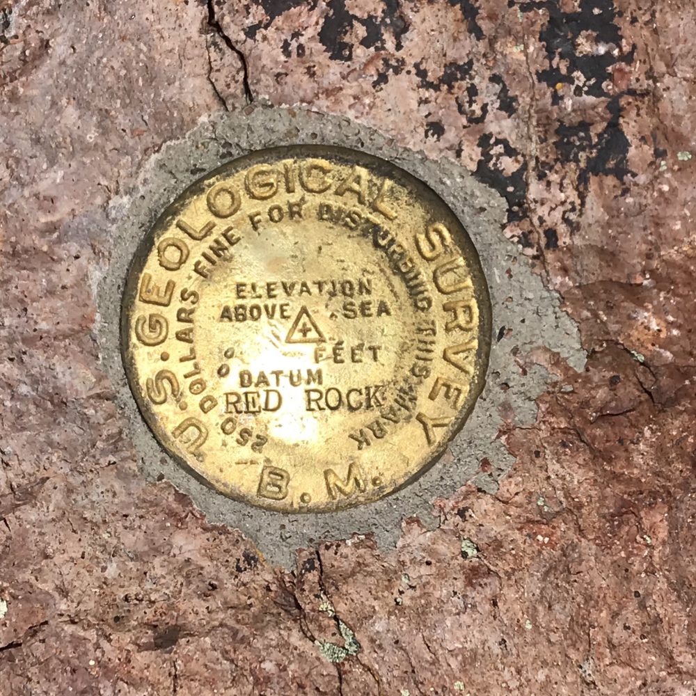
The east summit measures as the high point of Red Rock Peak. It has the remnants of an old fire tower. There is no summit cairn. It is a talus/scree hump that is next to the road. I also visited the official west summit hump. It has a footpath in the talus that leads to the rocky summit. The USGS benchmark is still there. The west summit is also a talus hump.
Stand atop both the east summit hump and the west summit hump just to be sure. The hike between them takes about three minutes. The old cabin sits in a forested patch between the two potential summit humps. The east summit has more area above the final contour line, which matches the final contour line of the west summit. Consequently, it is also logical that the east summit is likely to actually be the high point of Red Rock Peak.
The actual HP of Red Rock Peak with several concrete pilings from an old fire lookout. Livingston Douglas Photo
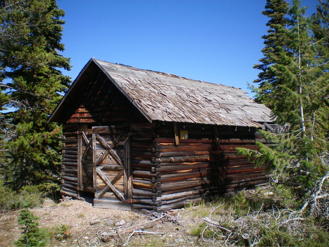
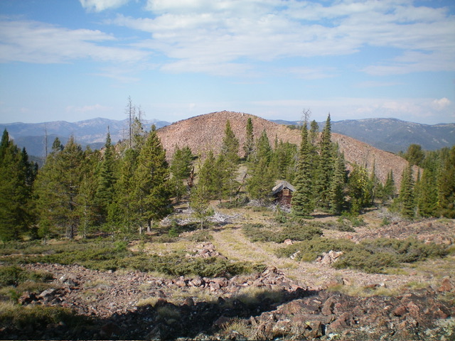
The old cabin/garage near the summit of Red Rock Peak. Livingston Douglas Photo
Additional Resources
Regions: Eastern Salmon River Mountains->Salmon River Mountains->WESTERN IDAHO->Yellowjacket Mountains
Mountain Range: Eastern Salmon River Mountains
Longitude: -114.42959 Latitude: 45.00049