Elevation: 6,779 ft
Prominence: 1,079
Climbing and access information for this peak is on Page 50 of the book, where it is called Buckhorn Mountain. It was renamed Reno Mountain in 2013. Terri Rowe and Daniel Coulter provided update information based on their 2021 climb. Updated August 2021
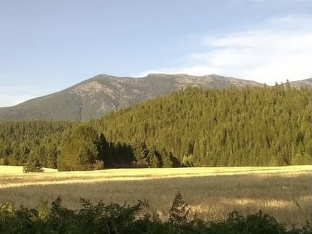
Reno Mountain is the highest point in the Idaho section of the Purcell Mountains. It is located just west of the Idaho/Montana border and Line Point which sits on the state boundary line. The summit is located northeast of Perkins Lake. The peak is named for Clinton Reno (1926-2007), World War II Navy veteran and local landowner. USGS Line Point
Reno Mountain. Terri Rowe Photo
Access and Route by Daniel Coulter
Goat Mountain Trail, FST-44 [(A)(4.1)(a) Page 51]. The trailhead is easily accessible to any vehicle and there is space for several cars. Camping is available at the trailhead.
Goat Mountain Trail, Class 2,
From the parking area, the trail starts just a bit north along the road. Trail 44 is in great condition and we followed it with ease all the way to the intersection with the Goat Mountain spur trail at 6450′. From here the trail is a bit more primitive but still very easy to follow. We continued on trail until the saddle just south of the peak, where we turned north and went cross country the rest of the way to the summit. The entire hike was almost entirely Class 1 with only a short crosscountry at the end. I have attached a GPS track of the route.The trail is in great shape and made for a very easy ascent. Also, this must be a popular hike with locals based on the geocache we found at the summit. Overall, a very nice hike. We left a register at the summit.
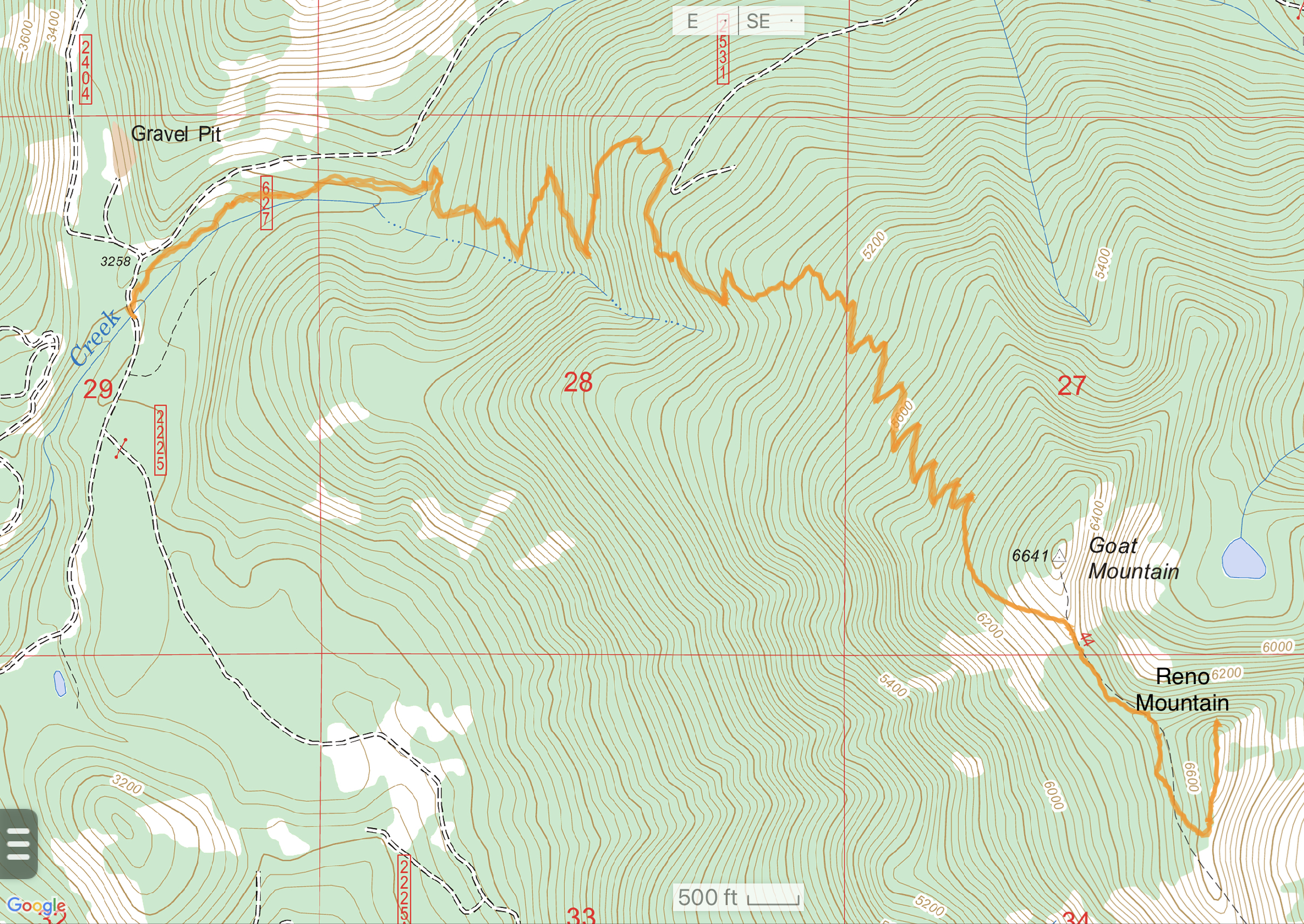
Daniel Coulter’s GPS Track. The route is 10.2 miles round trip with 3,707 feet of elevation gain.
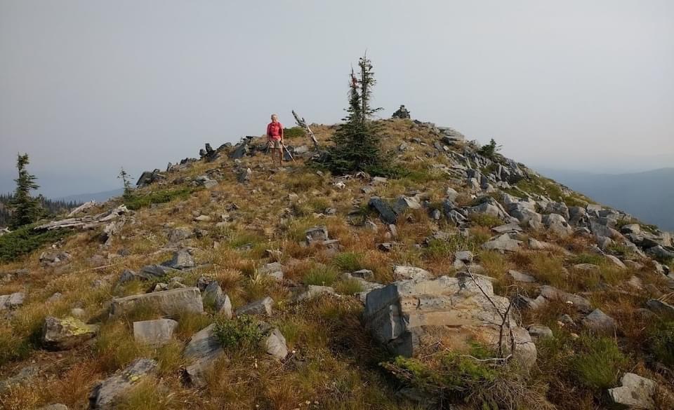
Terri Rowe just below the summit.
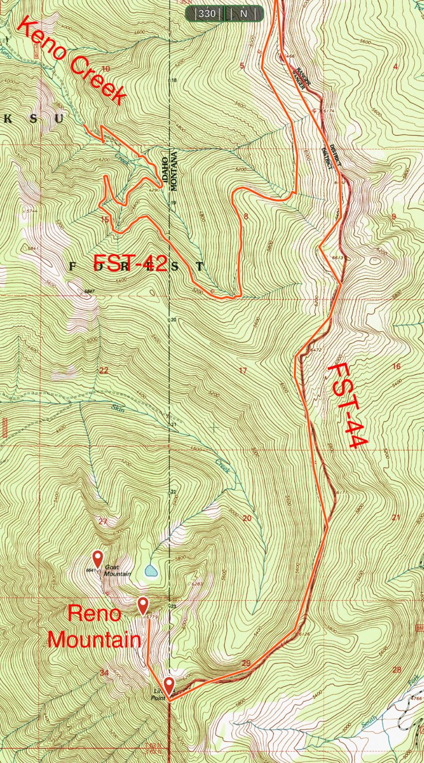
Alternative Access via Keno Creek
FST-44 follows a prominent north-south ridge just east of Reno Mountain. To reach FST-44, follow Deer Creek Road/FS-435 [(A)(4) on Page 51] to its junction with Keno Creek Road/FS-315. Turn east and follow the road up Keno Creek to its end. FST-42 leads from this point into Montana and eventually to FST-44 just south of Keno Mountain. From this point, follow FST-44 south to Line Point. The trail crosses over Line Point and then runs northwest to Reno Mountain. This route covers about 12 miles (one way) with an elevation gain of 4,900 feet.
South Ridge, Class 2
Leave FST-44 and hike up the South Ridge to the summit.
The long way to Reno Mountain.
Additional Resources
Regions: NORTHERN IDAHO->Purcell Mountains
Mountain Range: Purcell Mountains
Longitude: -116.0530 Latitude: 48.77329