Elevation: 7,141 ft
Prominence: 791
This peak is not in the book. Published January 2023
Reservoir Mountain is long, north-south ridgeline that is located west of Government Dam Road and Blackfoot Reservoir. It is an impressive sight from its east side. Due to private land issues, the easiest public access is from an old 2-track in the Bear Creek drainage to its west. USGS Reservoir Mountain
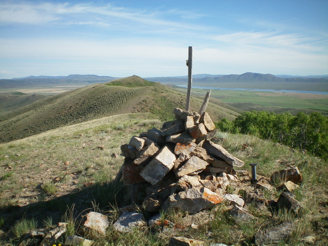
The summit cairn atop Reservoir Mountain with Point 7128 in the background to the north. Livingston Douglas Photo
Access from the North (Blackfoot Reservoir Road)
From Exit 116 (Sunnyside Road) on I-15 in Idaho Falls, drive east on Sunnyside Road to its end at a signed “T” junction with Bond Road. This junction is 9.1 miles east of Ammon Road. Turn right/south onto Bone Road and drive 8.5 miles south to a signed junction with Blackfoot Reservoir Road, just south of Bone. Turn right/west onto Blackfoot Reservoir Road. The road quickly bends left/south and begins its journey to Blackfoot Reservoir. Drive 20.5 miles on Blackfoot Reservoir Road to a signed junction at the northwest corner of Blackfoot Reservoir.
Continue straight/south on Government Dam Road for 12.8 miles to a signed junction with Skinny Dip Road. Drive west then northwest on Skinny Dip Road (a well-graded dirt/gravel road) for 2.4 miles to an unsigned junction at the mouth of the Bear Creek drainage. Park here (6,255 feet). Bear Creek Road is a weak 2-track and, while it is drivable, I do not advise it.
Access from the East (ID-34)
From ID-34 at the southeast corner of Blackfoot Reservoir, drive west on [signed] China Cap Road for 3.8 miles to a “T” junction with Government Dam Road. Turn right/north and drive 4.3 miles on Government Dam Road to a signed junction with Skinny Dip Road. Follow the directions in the previous paragraph for Skinny Dip Road.
West Rib, Class 2
The Climb
From the unsigned junction, hike north up Bear Creek Road for about 0.9 miles to a meadow just south of a meadow that has a prominent cistern in it. Leave the road here and scramble east up a scrub-covered rib, staying right/south of a prominent gully and some patches of aspens. As you approach the summit ridge crest, the terrain is a mix of short scrub and broken scree. Once atop the summit ridge, stroll a short distance north on easy scrub/scree to the official measured summit. The summit has a nice cairn with a post in it and offers magnificent views of Blackfoot Reservoir and the surrounding area. The south summit hump measures the same height as the “official” north summit. Stand atop both just to be sure.
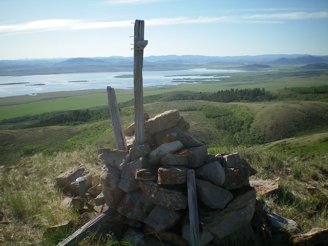
View of Blackfoot Reservoir from atop Reservoir Mountain. Livingston Douglas Photo
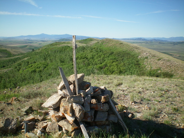
Looking south along the ridge line from the summit of Reservoir Mountain. Livingston Douglas Photo
Additional Resources
Regions: Blackfoot Mountains->Chesterfield Range->SOUTHERN IDAHO
Mountain Range: Blackfoot Mountains
Longitude: -111.6769 Latitude: 42.9070