Elevation: 6,140 ft
Prominence: 480
This peak is not in the book. Published January 2023
Ritz Benchmark is located above the hamlet of Juniper, Idaho and east of bustling I-84. It sits west of Glen Canyon and south of Saddle Horse Basin in the Sublett Range. This area is a mix of private and public land, so be careful. This hike is entirely on BLM land but you must thread the needle on this one very carefully to avoid nearby private land. USGS Juniper
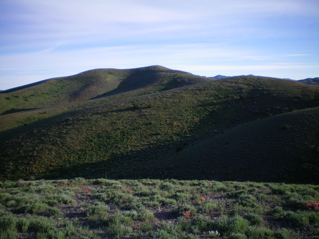
Ritz Benchmark as viewed from the south. It is in dead center. Livingston Douglas Photo
Access
From Exit 263 (Juniper) on I-84, drive northeast then northwest on [paved] Juniper Road for 0.8 miles and park alongside the road on its right/northeast side in the tall grass (5,134 feet). Unfortunately, there are no pullouts here. GPS coordinates: 42⁰09’40”N, 112⁰59’06”W. This grassy area is just west of a private residence.
South Ridge, Class 2
The Climb
Much of this route is Class 1 but the initial bushwhack from the road and up through the juniper forest is Class 2. From Juniper Road, bushwhack northeast across an open field of knee-high, thick veg to reach a juniper forest. Scramble northeast straight uphill through the somewhat-gapped junipers to quickly reach a ridge crest. Follow the ridge crest on a good use trail. The ridge heads northeast then north up through a beautiful juniper forest. The trail soon merges into a 2-track road at a right turn in the trail. This road is BLM-210.
Follow BLM-210 for a short distance until it reaches a signed “T” junction with BLM-207 (which is the continuation of BLM-210 up the ridge crest) and BLM-211 which goes downhill to the right/east. Follow BLM-207 up the ridge crest all the way to the summit. There are several ups and downs along the way on the ridge. BLM-207 soon leaves the juniper forest and is in open scrub the rest of the way to the top. The summit of Ritz Benchmark has a USGS benchmark in a round concrete slab. I built a cairn next to the benchmark. The ups and downs along the ridge add 320 feet (round trip) to the elevation gain.
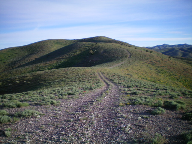
The final push to the summit of Ritz Benchmark up the south ridge. Livingston Douglas Photo
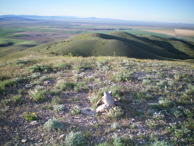
Looking down the undulating south ridge from the summit of Ritz Benchmark. Livingston Douglas Photo
Additional Resources
Regions: SOUTHERN IDAHO->Sublett Range
Mountain Range: Sublett Range
Longitude: -122.9831 Latitude: 42.1881