Elevation: 5,365 ft
Prominence: 270
This peak is not in the book. Published November 2022
Sand Mountain is perhaps the most appropriately-named peak in the entire St. Anthony Sand Dunes Complex. While the USGS topo map makes this trek look complicated, it is not. It is a combination of a sagebrush bushwhack and a climb up undulating sand dunes. Sand Mountain is heavily used by ATVs and MCs. You won’t be alone on this sandy mountain, though you will be alone on the narrow, sandy, knife-edged summit. USGS Plano
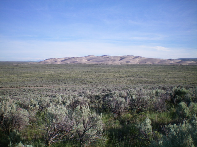
Sand Mountain as viewed from the south. Livingston Douglas Photo
Access
From Exit 337 (North Rexburg) on US-20, drive north on Salem Road (unsigned) for 5.2 miles to a signed junction with 400N. Turn left/west onto 400N and follow it (ignoring other roads that bend off of it) for 10.3 miles to an unsigned junction with a large parking area and two sandy 2-track roads on the right/north side of 400N. With an ATV or MC, you can ride almost to the summit if you know the ATV/MC trails (only one of which is shown on the USGS topo map) and the un-roaded dunes to climb to get near the top. Park at the aforementioned junction (4,880 feet). GPS coordinates: 43⁰56’32”N, 111⁰59’16”W.
Southwest Face, Class 2
The Climb
From the road junction, you have two options. Either follow the left of two 2-track roads (the left one heads northwest) for about 1.5 miles and then bushwhack northeast across sagebrush to reach the base of Sand Mountain’s sand dunes OR bushwhack north directly at the mountain. I took the former route on my ascent and the latter route on my descent. The mountain is obvious but the summit location is not. Use LOJ to spot the exact high point. It is at the northwest end of the mountain’s sandy massif. The summit is on a narrow ridge crest. This crest is knife-edged sand and is almost impossible to stand on. You have to straddle it and hope that your feet don’t slide down the steep sides of the ridge. There is a much flatter, but slightly lower, ridge area to the southeast of the true summit.
The sagebrush bushwhack has some minor ups and downs, but isn’t too bad. The sand dunes that comprise Sand Mountain are another matter. There are sand dunes, sand holes, and narrow ridges. The wind-blown sand is knife-edged on the ridges and the sand is mostly loose, though there are a few firm sand areas. When you climb up the southwest face, stick to the high ridges of the dunes and weave you way to the high point. There are one or two minor ups and downs along the way. Avoid the hidden sand holes as necessary.
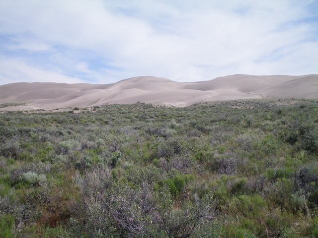
The summit hump of Sand Mountain (just left of center) as viewed from the sagebrush terrain to its southwest. Livingston Douglas Photo
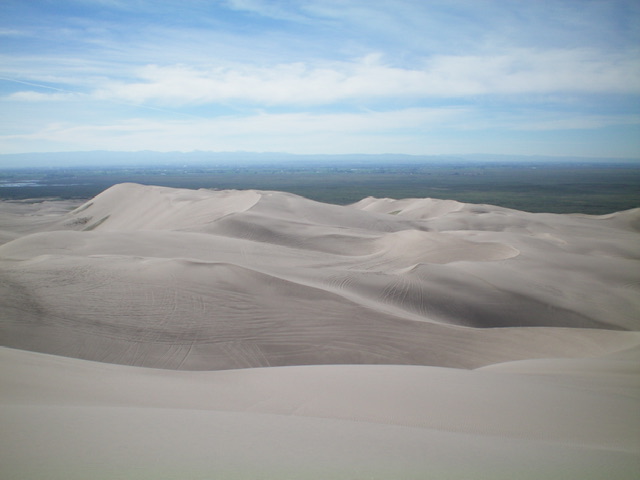
Summit view from the top of Sand Mountain. This mountain is a sea of sandy ridges, dunes, and gullies. Livingston Douglas Photo
Additional Resources
Regions: Saint Anthony Dunes->SNAKE RIVER PLAIN
Mountain Range: Snake River Plain
Longitude: -111.98079 Latitude: 43.96901