Elevation: 7,916 ft
Prominence: 576
This peak is not in the book. Published January 2023
Schmid Ridge is the high point on a magnificent ridge on the east side of Slug Creek in the Aspen Range. There is a trio of ridge summits on this ridge, all of which can be climbed in a single outing. The peaks are Schmid Ridge (7,916 feet), Dairy Benchmark (7,805 feet), and Peak 7405. USGS Harrington Peak
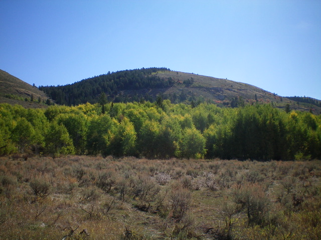
Schmid Ridge as viewed from Slug Creek Road to its northwest. Livingston Douglas Photo
Access
From ID-34 south of Wayan, drive east on [signed] Blackfoot River Road to a signed junction with Slug Creek Road. Turn right/south on Slug Creek Road/FSR-1095 and reset your odometer. At 0.2 miles, bear right at a signed junction. At 6.0 miles, reach a “T” junction with [signed] South Trail Road. Go left/east. At 12.6 miles, reach the Caribou National Forest boundary. At 13.9 miles, reach a signed junction with FSR-187 (right). Park here (6,580 feet).
West Face, Class 2
The Climb
From the road junction, walk about ½ mile south on Slug Creek Road to a large gully on the left/east side of the road. Schmid Ridge looms above you and is to the east-southeast. Your goal is to avoid the thick aspens and the cliff bands/buttresses on the west face. Leave the road and scramble briefly up a scrub shoulder on the left/north side of the gully. Cross to the right/south side of the gully and bushwhack up through thick, but open, brush and a short patch of aspens to reach the base of a notable rocky buttress on the west face. Skirt the left/north side of the buttress by climbing up steep scrub and some easy rock bands. Once above the buttress, scramble southeast up the steep scrub slope to reach the summit. The summit of Schmid Ridge is a sagebrush hump and has a decent cairn.
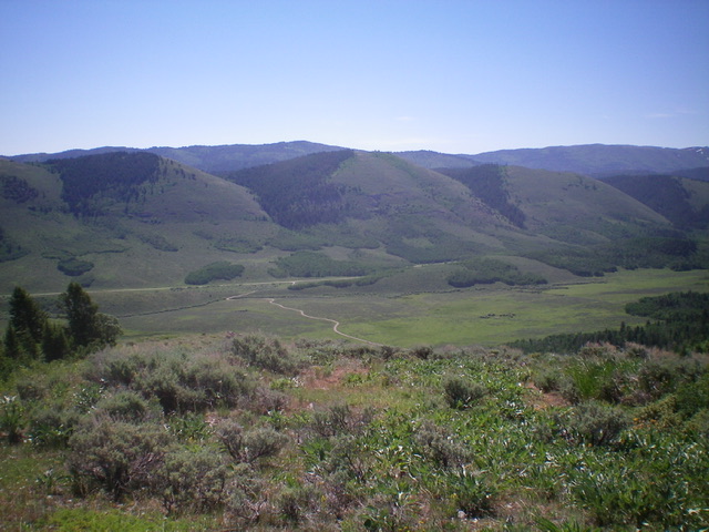
Schmid Ridge (dead center in distance) as viewed from Peak 7425 to its northwest. Livingston Douglas Photo
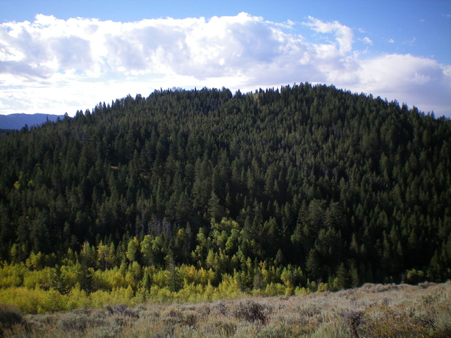
Schmid Ridge and its forested north face (my descent route). Livingston Douglas Photo
North Face, Class 2
The Descent
From the summit, descend northeast on the thick, forested ridge with no visibility and ample blowdown. Bend left/north and descend through the densely-forested face (the ridge is gone) to reach a saddle that is semi-open with aspens. The bushwhack down the north face of Schmid Ridge is difficult and is the worst of the forest bushwhacks on today’s 3-peak adventure. The 7,500-foot saddle connects Schmid Ridge to Dairy Benchmark and concludes the first leg of today’s 3-peak journey. Dairy Benchmark is up next.
Additional Resources
Regions: Aspen Range->Peale Mountains->SOUTHERN IDAHO
Mountain Range: Peale Mountains
Longitude: -111.2858 Latitude: 42.6105