Elevation: 9,950 ft
Prominence: 810
Climbing and access information for this peak is on Page 338 of the book. Published January 2023
Sheep Creek Peak is the high point on a ridgeline at the headwaters of Sheep Creek in the Snake River Range. Sheep Creek Trail/FST-096 gets you in the neighborhood but not to the summit. If combined with a climb of Sheep Mountain (9,700 feet) about 2-1/2 miles away, you can summit five (5) ranked peaks on a single climb. Sheep Creek Peak is the second-highest peak in Bonneville County. USGS Palisades Dam
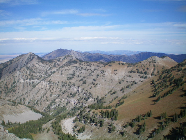
Sheep Creek Peak is the pyramidal hump in dead center in the distance. This view is from Sheep Mountain to its northwest. Livingston Douglas Photo
Access
From US-26 just north of Palisades Dam, turn left/north onto [signed] Sheep Creek Road/FSR-260. This junction is 0.1 miles north of the Riverside Campground and 9.7 miles south of the US-26/ID-31 junction in Swan Valley. Reset your odometer at this junction. At 1.6 miles, reach a signed junction. Go straight to stay on FSR-260. At 2.3 miles, reach the end of the road at a trailhead parking area. Park here (6,150 feet). GPS coordinates: 43⁰21’48”N, 111⁰10’37”W.
West Gully/North Ridge, Class 3
The Climb
From the trailhead, hike up the Sheep Creek Trail/FST-096. It is a narrow, poorly-maintained trail and is overgrown with field grass early on. In the Fall, Sheep Creek is bone dry and there is no animal activity. The trail crosses the creek drainage several times. This is grizzly country and there is a trailhead warning about bear attacks, so come prepared with bear spray and travel in a group. Sheep Creek Trail follows the Sheep Creek drainage through both forested areas and open areas of field grass, scrub, and willows. The trail bends right/southeast at about 8,150 feet and does some switchbacks in a pine forest to climb up into a high basin area.
Leave the trail at about 9,000 feet at a sharp left turn/switchback. The trail is very close to a forested shoulder on its right/south side at this point. Bushwhack a short distance up onto the semi-open shoulder and climb it southeast until it quickly ends in a large talus gully. This gully heads southeast up to the north ridge of Sheep Creek Peak at a saddle (9,660 feet). Scramble directly up the center of the talus/scree gully. The gully gets steep and loose midway up, so move onto a rib (or ridge rock) on the right/south side of the loose gully for better footing. The rib is Class 3 scrambling and it puts you on the north ridge just above, and right/south of, the saddle.
Once on the ridge, climb up an initial section of Class 3 rock then follow the rocky ridge (skirting ridge outcrops as necessary) on loose, steep-ish scree to reach a false summit. From the false summit, continue southeast to the summit of Sheep Creek Peak. There is a large cairn on top and the open summit offers magnificent views.
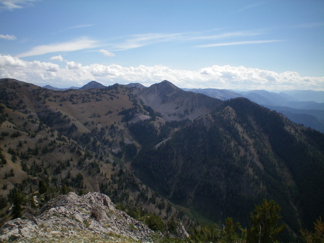
The second half of the ridge traverse to Sheep Mountain from Sheep Creek Peak. Sheep Mountain is the highest hump well left of center. Livingston Douglas Photo
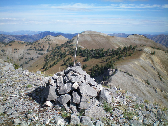
The summit cairn atop Sheep Creek Peak with the first half of the ridge traverse to Sheep Mountain in the background. Sheep Mountain is not visible in this photo and is to the left. Livingston Douglas Photo
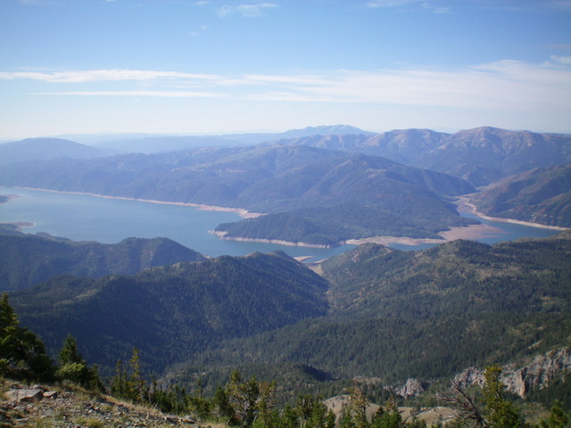
View of Palisades Reservoir from the summit of Sheep Creek Peak. Livingston Douglas Photo
North Ridge Full, Class 3
The Descent
From the summit, descend the short but steep-and-loose north ridge down to a saddle/notch, descending a Class 3 section of ridge rock on the way. From this notch, either climb over a ridge block (Class 3) or skirt its right/east side on steep, loose scree (Class 2) to reach easier ridge terrain (scrub and stable scree). Either climb up over Point 9808 or skirt its left/west side through thick brush and scattered pines with loose, angled scree underneath. Climbing over the point is much more pleasant than side-hilling in this terrain.
This is true for the entire ridge traverse from Sheep Creek Peak to Sheep Mountain. Once past Point 9808, regain the ridge crest and follow it up over a few minor humps to reach an elongated saddle with a massive trail sign and cairn. This is where Sheep Creek Trail/FST-096 ends and becomes FST-109/Waterfall Canyon Trail. Another trail (FST-206/Lake Canyon Trail) heads north from here. The elongated ridge saddle is at 9,620 feet and connects Sheep Creek Peak to Peak 9940. This concludes the first leg of today’s 5-peak adventure. Peak 9940 is up next.
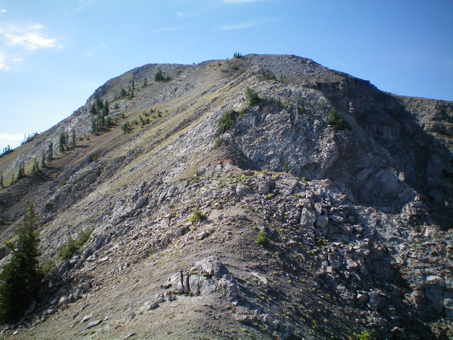
The rocky, Class 3 north ridge of Sheep Creek Peak. The summit hump is well left of center. Livingston Douglas Photo
Additional Resources
Mountain Range: Big Hole and Snake River Mountains
First Ascent Information:
- Other First Ascent: West Gully/North Ridge
- Year: 2022
- Season: Summer
- Party: Livingston Douglas
Longitude: -111.1282 Latitude: 43.3688