Elevation: 6,770 ft
Prominence: 300
This peak is not in the book. Published November 2022
Sheridan Ridge is a forested ridge that is located on the south side of Sheridan Reservoir in Clark County. It is most easily reached via Lower Sheridan Ranch Road. This area is a patchwork of private and public land. This route is almost entirely on BLM land. There is a very short patch of private land to cross at the beginning of this hike but it is not posted and seems to be heavily used by the public on ATVs. USGS Sheridan Reservoir
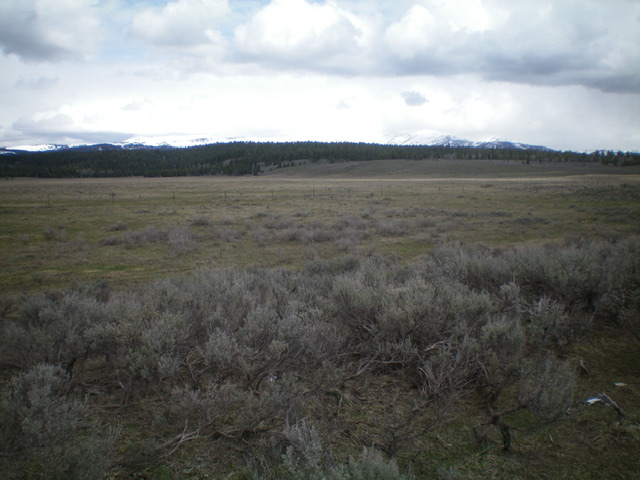
Sheridan Ridge (forested ridge in dead center) as viewed from Lower Sheridan Ranch Road. Livingston Douglas Photo
Access
From the west, take Exit 167 (Dubois) on I-15 and drive east through Dubois for 0.7 miles to a signed junction with the Yale-Kilgore Highway (signed for Kilgore and Yellowstone). Reset your odometer at this junction. At 24.9 miles, reach a junction with Kilgore Lane (left) at the east end of Kilgore. At 31.0 miles, reach a signed junction with Lower Sheridan Ranch Road (“Old Highway 22” on the USGS topo map). Turn right/east and drive 4.0 miles to an unsigned junction at a cattle guard/fence. Park here (6,425 feet). This side road sits at the base of the south ridge and is in poor condition.
From the south, take Exit 337 (North Rexburg) on US-20 and drive north on [unsigned] Salem Road (which becomes Red Road) for 32.0 miles to a junction with the Yale-Kilgore Highway. Go right/northeast onto the Yale-Kilgore Highway and drive 12.6 miles to its signed junction with Lower SheridanRanch Road. Drive 4.0 miles east on Lower Sheridan Ranch Road to the aforementioned cattle guard/fence and park. The final 4.5 miles of the Yale-Kilgore Highway is on well-graded gravel after being paved all the way from Dubois.
South Ridge, Class 2
The Climb
From the cattle guard/fence, follow the fence row north on good cattle trails. Ignore any 2-track roads in this area. When the fence row crests on a side ridge and drops to cross a gully, leave it and bushwhack right/northeast through an easy pine forest on a ridge that leads to the south ridge. Turn left/north and follow the south ridge (note that there is ANOTHER south ridge to its right/east) uphill to rejoin the fence row after the fence row has crossed two gullies. Follow the fence row on a good cattle trail up to its crossing of a 2-track road (shown on the USGS topo map). Leave the fence row here and follow the 2-track road northwest then north up the ridge to its crest in a semi-open, flattish area. Leave the road here and head northwest for 100 yards or so to reach the high point of Sheridan Ridge (which is only 15 feet higher than the road’s crest). There is no summit cairn on top and no views due to the forested terrain.
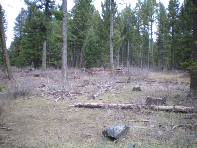
The forested summit area of Sheridan Ridge. Livingston Douglas Photo
Additional Resources
Regions: Centennial Range->EASTERN IDAHO
Mountain Range: Centennial Range
Longitude: -111.71129 Latitude: 44.44839