Elevation: 9,820 ft
Prominence: 160
Climbing and access information for this peak is on Page 332 of the book.
Slide Mountain is located on the Continental Divide in the Western Centennials. It sits south of a sharp turn in the Divide at Baldy Mountain (9,900 feet). One might legitimately consider Slide Mountain to be a ridge bump on the LONG south ridge of Montana’s Baldy Mountain. This new route climbs Slide Mountain from just south of Hancock Lake via a challenging, steep spur ridge. USGS Slide Mountain
Slide Mountain and its gentle west ridge (center) as viewed from the northwest. Livingston Douglas Photo
Access
From the north side of Kilgore, ID, drive north on [signed] Cottonwood Creek Road/FSR-026. At 3.9 miles, reach a [signed] junction with East Camas Creek Road. Continue straight on Cottonwood Creek Road. At 5.8 miles, reach the NF boundary. At 6.3 miles, reach a [signed] road junction just after a bridge crossing of Cottonwood Creek. Go right onto Aldous Lake Road/FSR-027. Reset your odometer here. At 4.3 miles, reach a [signed] junction with Moose Creek Road/FSR-564. Continue straight on Aldous Lake Road/FSR-027. At 5.2 miles, reach the Aldous Lake/CDT trailhead and the end of the road. Park in the large trailhead parking lot (7,040 feet). There is a bathroom and campsite here as well.
Southwest Spur/South Ridge, Class 2
The Climb
From the Aldous Lake/CDT trailhead, hike north up FST-039 to Aldous Lake and a junction. Continue north toward Hancock Lake. Just before reaching Hancock Lake, the trail crosses two shoulders. Each of these shoulders merge into the southwest spur of Slide Mountain. I chose to climb the first shoulder and I descended the second shoulder when I returned to FST-039. Having done both, the second shoulder is a bit easier than the first.
Leave FST-039 when it crosses the first shoulder at 7,960 feet. Bushwhack north then northeast up through the thick pine forest with copious blowdown, dead limbs, and veg to make your life miserable. By 8,400 feet, the southwest spur becomes well defined and the terrain less bothersome. However, the ridge soon becomes quite steep and has loose gravel/sand/scree with pines, blowdown, and krummholz to slow you down. Stay on the ridge crest to minimize the difficulties. The Continental Divide is now visible above you.
Reach the CD where the southwest spur tops out, just west of Point 9040+. Skirt the west side of this ridge hump and struggle through a nightmarish mess of rocky outcrops, thick brush, blowdown, and pines/krummholz with a few sandy sections in between. Work your way north to an equally-awful saddle at 8,940 feet. From the saddle, climb a visible, forested hump in a somewhat-tedious combination of forest, loose rock, and krummholz.
Once atop this hump, the slope is gentle and the going is much easier and faster. You still have rocky/sandy areas of mini-ridges and krummholz to navigate in semi-open terrain. The final push to the summit of Slide Mountain has only scattered trees, easy tundra, and broken rock. The summit has an ID/MT boundary post/cairn and a nice view of Upper Red Rock Lake (MT). It also has an excellent view of the curved, up-and-down ridge traverse to Baldy Mountain.
West Ridge, Class 2
The Descent
From the summit, descend easy tundra and broken rock to reach the 9,620-foot connecting saddle with Baldy Mountain. Continue on to Baldy Mountain (MT) via the connecting up-and-down ridge (the Continental Divide) and return to the 9,620-foot connecting saddle. Ascend the west ridge to the summit of Slide Mountain then descend the previously-detailed ascent route back to Hancock Lake and FST-039.
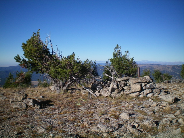
The boundary post and cairn atop Slide Mountain. Livingston Douglas Photo
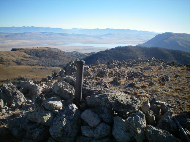
The summit of Slide Mountain with Upper Red Rock Lake (MT) in the background. Livingston Douglas Photo
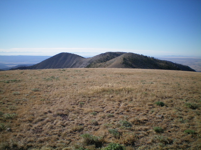
Slide Mountain (the hump left of center) as viewed from the south summit of Baldy Mountain. Notice the weaving, rolling ridge traverse required to get there. Livingston Douglas Photo
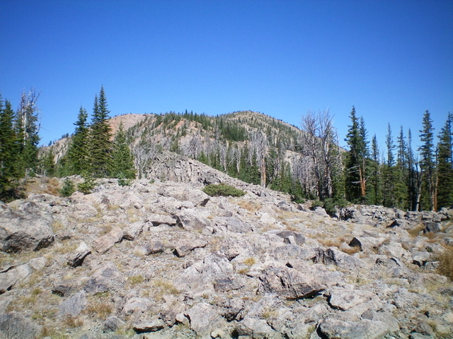
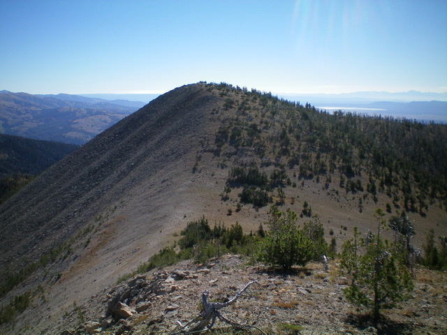
Slide Mountain (summit is right of center) as viewed from its south ridge. Livingston Douglas Photo
Additional Resources
Regions: Centennial Range->EASTERN IDAHO
Mountain Range: Centennial Range
Longitude: -111.85739 Latitude: 44.54929