Elevation: 7,373 ft
Prominence: 528
This peak is not in the book. Published November 2023
Slug Benchmark is the northernmost of several ranked peaks on lengthy Schmid Ridge in the Aspen Range. Thanks to the ACCESS YES program, this climb is publicly accessible on “Private Association” land. Slug Benchmark is most easily climbed from Slug Creek Road to its west. It has a repeater station just below the high point. USGS Lower Valley
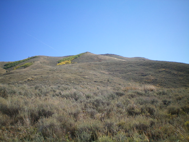
Slug Benchmark as viewed from Slug Creek Road (start of climb). My ascent route climbs to the rocky point just left of center then continues to the summit, which is not yet visible. Livingston Douglas Photo
Access
From ID-34, drive east on Blackfoot River Road to a signed junction with Slug Creek Road. Head south on Slug Creek Road for 2.6 miles to a rise in the road. This rise is also 3.4 miles north of a major “T” junction with [signed] Trail Canyon Road. Park along the road just south of this rise (for safety reasons) since there are no established pullouts in this area. This parking spot is at 6,375 feet and 42⁰45’01”N, 111⁰23’38”W.
West Shoulder, Class 2
The Climb
From the parking spot, cross a cattle fence on the east side of the road and scramble east then southeast through thick grass/scrub across the head of a dry gully to reach the toe of the west shoulder. From here, aim for a rocky ridge point (visible from the road) that is on the crest of the west shoulder. Bushwhack east-southeast up through thick grass/scrub (with a short section of short, easy scrub along the way) to reach a patch of aspens midway up the shoulder in a flattish ridge area. Skirt the left side of the aspens, using a cattle trail to get through the thick sagebrush.
The ridge bends left-ish/east at about 6,640 feet. The ridge steepens here but the scrub is shorter and easier. Pass the rocky ridge point and cross a 2-track road (not shown on maps) that follows the west side of the ridge high up. Reach a repeater station (just to the right/south) just below the summit. Continue a short distance east then north to reach the high point. There is no summit cairn, so look around for the “Slug” USGS benchmark in the sagebrush. There is a triangulation post and wiring laying on the ground next to it. The summit is wide open and offers magnificent views of Slug Creek Valley to the west and Dry Valley to the east.
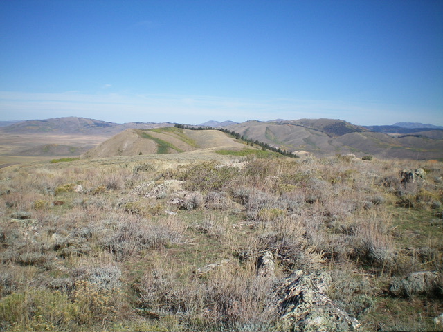
Looking north along the high ridge crest of Schmid Ridge from the summit of Slug Benchmark. Livingston Douglas Photo
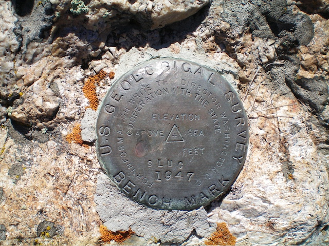
The USGS benchmark atop Slug Benchmark. Livingston Douglas Photo
Additional Resources
Regions: Aspen Range->Peale Mountains->SOUTHERN IDAHO
Mountain Range: Peale Mountains
Longitude: -111.3784 Latitude: 42.7506