Elevation: 8,693 ft
Prominence: 184
This peak is not in the book. Published January 2023
Smoky Benchmark is a handsome, rocky outcrop that sits above Smoky Canyon in the Webster Range. It is the namesake USGS benchmark in this area, with nearby Smoky Canyon and the active Smoky Canyon Phosphate Mining Operation. Smoky Benchmark is most easily climbed by a forested bushwhack from a saddle at the head of Smoky Canyon Road to its north. USGS Stewart Flat
Access
From the signed junction of Smoky Canyon Road/FSR-110 and the Smoky Canyon Phosphate Mining Road (7,196 feet), drive 1.3 miles west up FSR-110 to a saddle and a trailhead with a large parking area. This is the signed trailhead for FST-101/Webster Ridge Trail, an ATV trail. Park at a dispersed campsite across from the trailhead parking area (7,765 feet). GPS coordinates: 42⁰42’37”N, 111⁰09’26”W.
Map Errors
There are so many map errors in this area, it is ridiculous and navigationally confusing. Both the USGS topo map and the Caribou-Targhee National Forest map fail to show numerous old logging and phosphate mining roads (and road beds) that diagonally criss-cross these mountains. The USGS topo map fails to show ANY roads on the south side of Smoky Canyon Road, including FSR-219 and FSR-213 (which ARE shown on the Caribou-Targhee National Forest map). There are foot trails that follow some of the old road beds. The USGS topo map mis-positions Smoky Canyon Road around the Webster Ridge trailhead. The road crosses a saddle just north of Point 7800+, not just south of it as the map indicates.
North Ridge, Class 2
The Climb
From the dispersed campsite, bushwhack north through somewhat-thick pine forest down to a minor saddle then up over a hump then down to a large, open field/camping area with a jeep road in it. This is FSR-219 which comes up from Smoky Canyon Road/FSR-110 about 0.2 miles east of the Webster Ridge trailhead and the road saddle there. While the spur road is a bit rutted, you may be able to drive from Smoky Canyon Road to this open field and eliminate some mileage and bushwhacking.
From the open field, an unsigned spur road heads left/east but is gated and closed to motor vehicles just above the open field. This spur road is shown on the Caribou National Forest map but only as far as the gated closure. The road continues beyond that point but is overgrown and is not maintained. Where it goes is anyone’s guess. FSR-219 heads southwest then west then south from the open field. It eventually climbs up to an open saddle/meadow and an unsigned junction with FSR-213 (shown on the Caribou National Forest map). This junction sits just below Peak 8730. FSR-213 continues east then north up to the summit of Peak 8730. I discovered all of this by climbing Peak 8730 and Peak 8570 after climbing Smoky Benchmark. I stumbled onto these forest service roads high up.
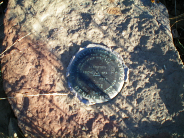
Let’s get back to Smoky Benchmark. From the open field, head south up into the thick pine forest on an ill-defined, rounded ridge to reach Smoky Benchmark, an open hump with a minor rock wall to climb just below it (Class 2+/3 but can be skirted at Class 2). The forest bushwhack up the north ridge is thick with lots of blowdown initially. It is a bit easier higher up and has game trails and less-difficult underbrush. The summit of Smoky Benchmark is somewhat rocky and still has the USGS “Smoky” benchmark (see photo). If you descend the north ridge from Smoky Benchmark and you veer too far to the right/east, you will reach the aforementioned unmaintained spur road that leads west back to the gated closure and the open field previously discussed. Follow it west to the camping area/open field.
The USGS benchmark atop Smoky Benchmark. Livingston Douglas Photo
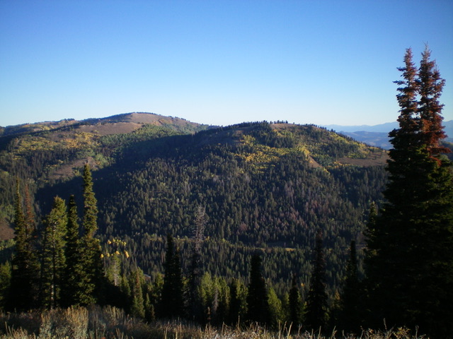
View of Peak 8780 (left of center) and Point 8724 (right of center) from the summit of Smoky Benchmark. Livingston Douglas Photo
South Ridge, Class 2
The Descent
From the summit, bushwhack south through the thick pine forest on a narrow ridge to reach Saddle 8509. This is the connecting saddle with Peak 8730 and concludes the first leg of today’s 3-peak adventure. Peak 8730 is up next.
Regions: Peale Mountains->SOUTHERN IDAHO->Webster Range
Mountain Range: Peale Mountains
Longitude: -111.1552 Latitude: 42.6998