Elevation: 5,625 ft
Prominence: 75
This peak is not in the book. Published November 2023
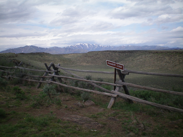
Snowdrift Crater is located at the north end of Laidlaw Park and is due southwest of North Laidlaw Butte. The crater is impressive and has a nice BLM parking area/campsite on its southwest rim. It is difficult to identify the exact high point on the southwest rim amongst several rocky outcrops. USGS North Laidlaw Butte
Snowdrift Crater as viewed from its southwest corner. Livingston Douglas Photo
Access
From US-20 east of Carey, turn right/south onto [signed] North Laidlaw Road. This junction is 0.2 miles west of Fish Creek Road, which is well-signed. Drive south on North Laidlaw Road for 1.2 miles to an unsigned “T” junction. This is Laidlaw Park Road. It can also be approached directly from farther west on US-20 and the road quality should be fine. Turn left/southeast onto Laidlaw Park Road and drive 13.6 miles to reach a signed 4-way junction (5,078 feet on the USGS map).
From this junction, turn left/north and drive just over 0.1 miles to cross a cattle guard. Just past the cattle guard, the road forks. Ant Butte is to the left. Go right/northeast here to stay on the main road. Continue driving northeast then north on the road as it passes Big Blowout Butte (left) at 2.7 miles then heads north-northeast past Hollow Top (right) at 4.4 miles. The 2-track road never seems to end. It reaches a major right/east bend to head directly at [obvious] Snowdrift Crater. The road finally bends right-ish/southeast and gets very close to the southwest rim of the crater.
Park along the road (5,575 feet) at about 0.3 miles north of the signed pullout/parking area for “Snowdrift Crater.” This parking spot is 6.9 miles from Laidlaw Park Road. The signed pullout/parking area for Snowdrift Crater is 7.2 miles from Laidlaw Park Road. It is 4.4 miles from the pullout southward directly to Laidlaw Park Road but this road (the “east road”) is much more primitive than the road (the “west road”) that comes up from the southwest.
South Ridge, Class 2
The Climb
From the roadside pullout, bushwhack north through thick-ish sagebrush to reach the crater rim. Head northwest then north along the rim through a mix of boulders and sagebrush to reach the first potential HP. Continue north to two more potential HPs. After the third potential HP, the ridge clearly starts to descend. Each of the potential HPs measures the same elevation. There is no obvious winner, no summit cairn on any of them, and no benchmark or triangulation wreckage with which to identify the official HP. Stand on all three potential HPs just to be sure. The scrambling time from the first HP to the third HP is only three minutes so they aren’t too far apart.
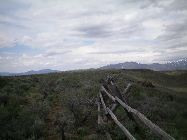
The west rim of Snowdrift Crater as viewed from its south end. The high point is on this rim. Livingston Douglas Photo
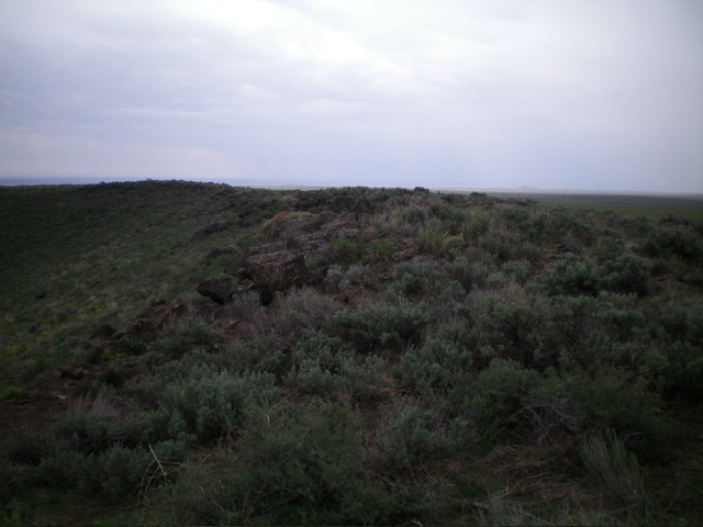
The summit area of Snowdrift Crater, looking south along the southwest rim. Livingston Douglas Photo
Additional Resources