Elevation: 8,605 ft
Prominence: 825
This peak is not in the book. Published June 2022
It is almost universally true that if the USGS places a benchmark on a mountain peak, the views from that spot will be outstanding. Spar Benchmark proves this point. From its summit, the expansive view includes the Lost River Range, the White Knob Mountains, the White Cloud Peaks, the Salmon River Mountains, the Lemhi Range, a sliver of the Beaverhead Range, and many Boulder Mountain peaks. Spar Benchmark is located in the center of the Northern Boulder Mountains due south of massive Lone Pine Peak. USGS The Paint Pot
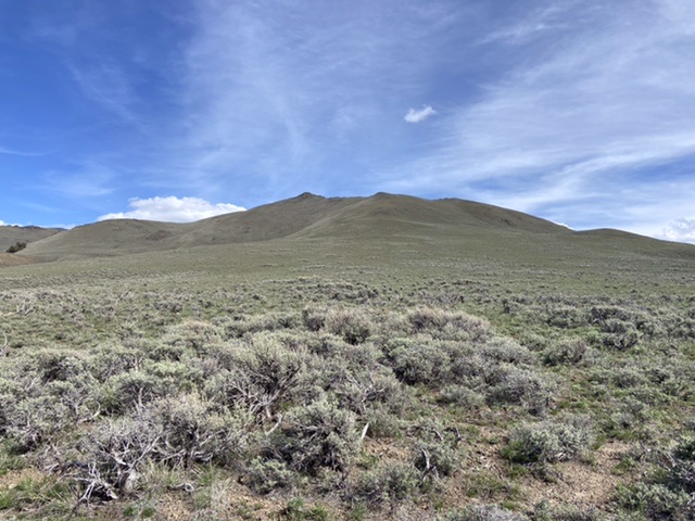
Spar Benchmark as viewed from the north
Access
Spar Canyon Road is the primary access for the Northern Boulder Mountain peaks [(D)(1) on Page 243]. Spar Canyon Road can be accessed from US-93 in the east or from East Fork Salmon River Road in the west. The road is maintained except during the Winter. It is subject to occasional flash floods and can be difficult to drive when wet. All of the side roads departing from the Spar Canyon Road require high-clearance vehicles and 4WDs are recommended.
To reach Spar Benchmark from US-93, follow Spar Canyon Road west for 7.4 miles and turn left on to a 2-track that heads north up an unnamed drainage. To reach this junction from the west, follow East Fork Salmon River Road south from ID-75 for 4.1 miles, turn left/east, and follow Spar Canyon Road east for 7.3 miles. Follow the 2-track south for 1.7 miles past an abandoned homestead. Turn right, cross the creek, and follow this 2-track road west. This road leads toward Gossi Springs. Follow it for 1.9 miles to a large flat area at the base of the peak’s northwest rib, passing one junction. Stay right. Do not take the left-hand fork to Gossi Springs. Park at this point.
Northwest Rib, Class 2+
Spar Benchmark can be easily climbed from any direction. Ease of access is the determining factor that recommends choosing this route. From the parking area, climb the peak’s broad northwest rib to the summit ridge. Follow the summit ridge west to the craggy summit. There are many ways to climb the boulder-infested summit block. None of them are difficult.

Looking toward the summit from high on the peak’s northwest rib
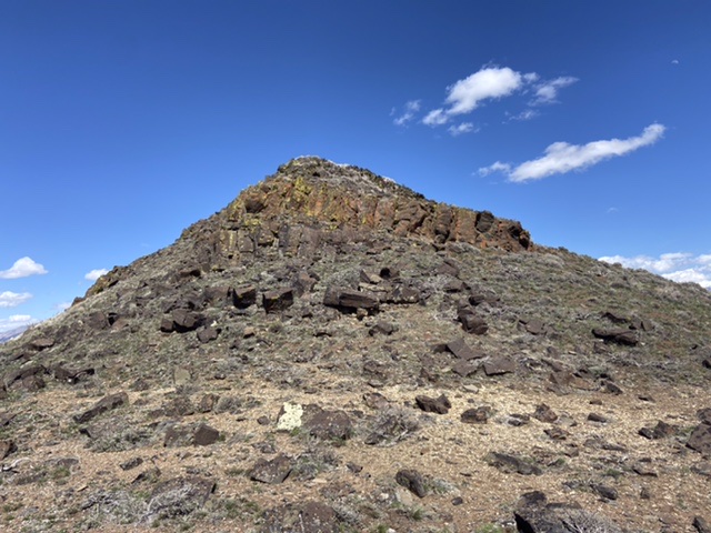
The summit of Spar Benchmark
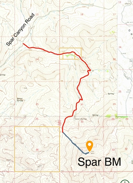
This map shows the road approach from Spar Canyon Road in red and the climbing route in blue. The route is 1.6 miles with 870 feet of elevation gain round trip.
Additional Resources
Regions: Boulder Mountains->EASTERN IDAHO
Mountain Range: Boulder Mountains
Year Climbed: 2022
Longitude: -114.1382 Latitude: 44.2382