Elevation: 6,104 ft
Prominence: 160
This peak is not in the book. Published November 2022
Square Mountain is an impressive block that separates Camp Creek from Tolmie Creek. It is located south-southwest of Richardson Summit in the Smoky Mountains. This area is a mix of private and public land, so be careful. This hike is entirely on public land. USGS Beaver Creek
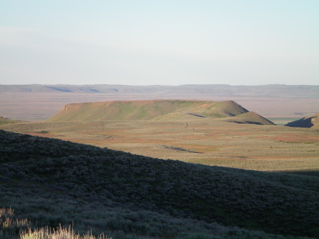
Square Mountain (appropriately named) as viewed from the north-northeast. Livingston Douglas Photo
Access
From US-20 exactly 12.7 miles east of Main Street in Fairfield, turn north onto County Line Road and reset your odometer. At about 2.0 miles, turn right/north onto [signed] Camp Creek Road. At 5.4 miles, park along Camp Creek Road in a narrow canyon next to Camp Creek (5,750 feet). GPS coordinates: 43⁰23’58”N, 114⁰29’56”W.
West Face/North Ridge, Class 2+/3
The Climb
From Camp Creek Road, bushwhack east across Camp Creek (a small stream) then scramble east then southeast up the west face (a canyon wall) to reach the crest of the north ridge. This is a brutal climb and is very steep and loose (Class 2+/3). It is the crux of the climb up Square Mountain. The headwall is a mix of brush, loose scree, boulders, and minor cliff bands. It is about a 200 vertical-foot climb from the road. Alternatively, you can climb up to the north ridge from a sharp turn in Camp Creek Road about 0.2 miles south of my chosen spot. The headwall is a bit less steep but the bushwhack across the Camp Creek drainage is wider and much more problematic. Choose your poison.
Once on the north ridge, head south then southwest to drop to a saddle and skirt Point 6000+ on its left/east side. The terrain is gapped sagebrush and includes an old 2-track road for part of the journey. Follow the 2-track road briefly up a lateral ridge that is just east of the north ridge proper. Leave the 2-track as it crests and begins a southward descent to God-knows-where. Bushwhack right/west across a dry gully via a connecting saddle of easy grass and sagebrush. Once on the north ridge proper, follow it briefly southwest to reach the open summit of Square Mountain. There is no summit cairn.
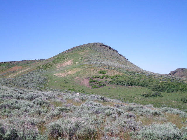
The summit hump of Square Mountain. Livingston Douglas Photo
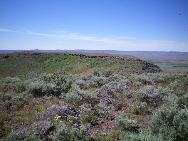
Looking south from the official summit of Square Mountain. The long ridge in mid-ground is slightly lower. Livingston Douglas Photo
Return to the flat, saddle-like area east of Point 6000+ to begin the cross-country trek to Peak 6180, the next objective in today’s 2-peak adventure.
Additional Resources
Regions: Smoky Mountains->WESTERN IDAHO
Mountain Range: Smoky Mountains
Longitude: -114.5031 Latitude: 43.3915