Elevation: 6,660 ft
Prominence: 480
This peak is not in the book. Published December 2019
Stinson Hill is a difficult-to-find hump that barely exceeds the height of some surrounding hills. It sits over 1-1/2 miles west of Fish Creek Reservoir. It is a ranked summit, however, and can be reached via an access road through private land and on BLM land after that point. The easiest ascent route is via the north ridge, mostly on roads and trails. USGS Fish Creek Reservoir
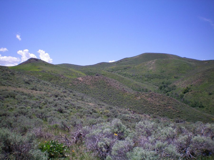
The upper northeast ridge of Stinson Hill. The false summit is right of center. The true summit is not visible yet. Livingston Douglas Photo
Northeast Ridge, Class 2
Access
From US-20, drive north up Fish Creek Road for 5.5 miles to a junction signed for the “Boat Ramp.” This is West Fork Fish Creek Road. West Fork Fish Creek Road is a curvy, narrow dirt road with some blind curves, so be very careful when driving it. Turn left/west here onto West Fork Fish Creek Road and drive 2.7 miles to a meadow with an unsigned road junction and a gated cattle fence on the left/west side of the road. This is the old Stinson Canyon Road. Park in a large parking/pullout area near the gate. Public access is allowed on the gated road but only by foot or horse travel. The elevation here is 5,350 feet.
The Climb
From the parking area, cross the locked cattle gate and follow a jeep road for 0.3 miles to an unsigned junction. The left fork (better quality jeep road) goes to a private ranch. The weak right fork (barely visible) goes up Stinson Canyon and is the correct choice. These roads are shown on the USGS topo map. Follow the weak 2-track road for 0.3 miles to a cattle fence. This is the boundary between private land and BLM land. Jump the fence and enter public lands.
Continue hiking up the old road to the mouth of Stinson Canyon after crossing under power lines. Leave the road here (5,600 feet) and climb south up a scrub/sagebrush face that becomes a shoulder higher up. The terrain on the shoulder is decent sagebrush and field grass. Cross a minor ridge hump and descend right/southwest to a minor saddle. Scramble south up over much larger ridge hump and drop southwest to a marshy area (“Springs” on the USGS topo map).
Skirt the left/east side then the south side of the marsh to climb west up a sagebrush/grass shoulder to reach the final section of ridge. Find a cattle fence here and follow it southwest up to the summit plateau. The summit area is covered with sagebrush and has two small rocky outcrops of ground boulders, neither of which is the high point. A clump of tall sagebrush appears to be the high point and is at the northeast end of the summit plateau. There were no signs of previous ascent.
North Slopes, Class 2
Access
Same as for the northeast ridge
The Descent
From the summit, descend north then northwest on a shoulder (sagebrush/grass and scree) down to an area where you can see a good 2-track jeep road below you heading due north from a saddle up and over Point 6262. At 6,400 feet, the shoulder forks. Follow the right/north fork here and descend to a saddle that sits just below, and south of, Point 6262. You will find an intersection of two jeep roads here. Hike straight/north up a good 2-track jeep road, climbing up over Point 6262 and down to another 2-track jeep road junction.
At this second road junction, go right/east. This is Stinson Canyon Road. Follow the road east then northeast as it drops into Stinson Canyon. The road eventually bends right/east to exit the canyon. Continue down the road all the way to its unsigned junction with a private road. Go straight/east here and hike 0.3 mile on this road to get back to your parked vehicle at the base of this road just outside the locked cattle gate.
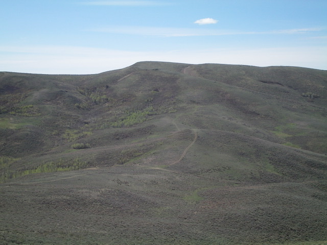
View of Stinson Hill from the northwest. Livingston Douglas Photo
Additional Resources
Regions: EASTERN IDAHO->Pioneer Mountains
Mountain Range: Pioneer Mountains
Longitude: -113.86169 Latitude: 43.43469