Elevation: 6,324 ft
Prominence: 1,544
This peak is not in the book. Published March 2021
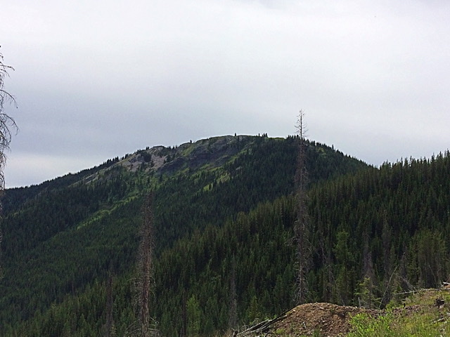
Striped Peak is a former fire lookout site located on the Saint Joe Mountain crest due south of Osborn, Idaho. In 1936, the lookout was destroyed by a wildfire. Although the lookout was never rebuilt, the view from the top is still worth the hike to the summit. USGS Wallace
Striped Peak. Ryder Irvine Photo
Access
Primary access is from I-90. There are a number of potential access points. The best road is the Elsie Lake Road. Google Maps provides good directions to the lake. From Exit 54, it is 12 miles to the lake. Ryder Irvine accessed the peak via a road that leaves Osborn and climbs up Farren Gulch. From Elsie Lake, hike FST-106 east to the saddle on Striped Peak’s southwest ridge.
Southwest Ridge, Class 2
The ridge can be followed to the summit, occasionally using the tread of the abandoned trail to the lookout.
North Ridge, Class 2
Ryder Irvine reports that he climbed the peak from the northwest, “right where a trail leaves the road (just past Point 5740 below). It was a decent trail too, given that it hasn’t been maintained.”
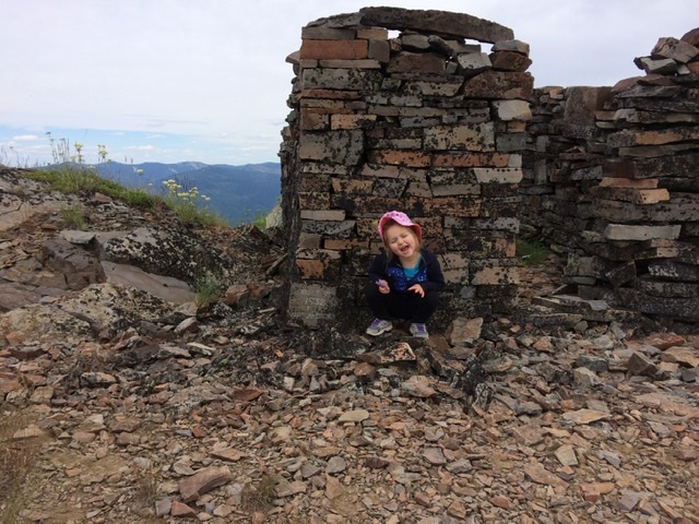
Ryder Irvine’s 3-year-old daughter, Aubrey, on the summit in 2016. Ryder Irvine Photo.
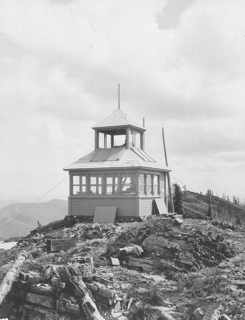
The lookout before the fire. USFS Photo
Additional Resources
Regions: NORTHERN IDAHO->Saint Joe Mountains
Mountain Range: Saint Joe Mountains
Longitude: -115.99529 Latitude: 47.43729