Elevation: 9,333 ft
Prominence: 393
This peak is not in the book. Published November 2021
Summit Rock is a beautiful chunk of rock that is located above the Custer Motorway, north of Mill Creek Summit and northwest of nearby Peak 9319. USGS Bayhorse Lake
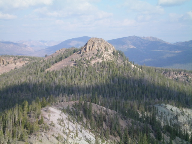
Summit Rock as viewed from the southeast. Livingston Douglas Photo
Access
Same as for Peak 9319. This is the second leg of a 2-peak journey that includes Peak 9319 and Summit Rock. It covers 3.0 miles with 1,375 feet of elevation gain round trip.
Southeast Face, Class 3
The Climb
From the 8,980-foot connecting saddle, scramble northwest up through pine forest then steep talus/scree to reach the base of the summit block. Climb a chute on the right/northeast side of the southeast face to reach easier, blocky terrain just prior to reaching the summit high point. The summit of Summit Rock has a USGS benchmark but no summit cairn.
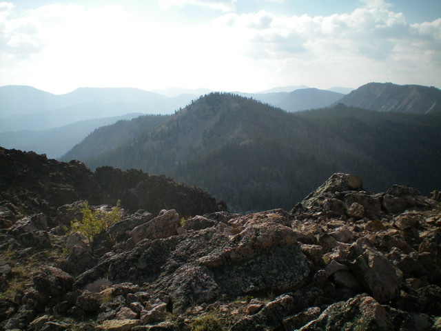
The rocky summit of Summit Rock with Peak 9319 in the distance (hump just left of center). Livingston Douglas Photo
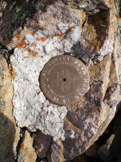
The USGS benchmark atop Summit Rock. Livingston Douglas Photo
South Face, Class 3
The Descent
From the summit, descend the ascent route to the base of the summit block. From here, scramble south through dense pine forest with copious blowdown to reach the Custer Motorway and your parked vehicle. You avoid the unpleasant connecting saddle with this descent route, but you still have a lot of awful blowdown and steep, loose scree/gravel to contend with. It is a more direct route back to the Custer Motorway but it is no picnic.
Additional Resources
Regions: Eastern Salmon River Mountains->Salmon River Mountains->Southeast Corner Peaks->WESTERN IDAHO
Mountain Range: Eastern Salmon River Mountains
Longitude: -114.49709 Latitude: 44.49339