Elevation: 7,681 ft
Prominence: 414
This peak is not in the book. Published November 2022
Sun Benchmark is a handsome, ridgeline peak that sits above Trail Creek Road near the popular Hemingway Memorial trailhead. It also sits above the equally-popular Sun Valley Gun Club which has active shooting practice going on seven days a week. This area is a mix of private and public land, so be careful. There is a mislabeled (but well-beaten) trail that climbs the south ridge from Trail Creek Road to the summit. That trail gets you across a short section of private land at the base of the south ridge. USGS Sun Valley
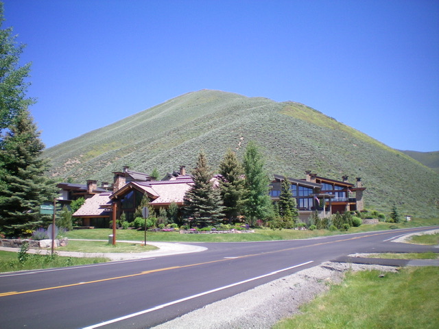
Sun Benchmark and its south ridge (coming at the camera) as viewed from Trail Creek Road just below the signed trailhead (which is just to the right of the condo complex). Livingston Douglas Photo
Access
The Bald Mountain Trailhead is located at a private condo complex along Trail Creek Road 1.1 miles up from its junction with Dollar Road and 0.5 miles south of the Hemingway Memorial trailhead parking area. There is no parking at the Bald Mountain Trailhead so you must find a place to park along Trail Creek Road and then walk to the well-signed trailhead. The Bald Mountain Trail actually goes to the summit of Sun Benchmark. Bald Mountain is on the opposite side of Ketchum, not even close to Sun Benchmark. So don’t be fooled by the trailhead sign.
South Ridge, Class 1
Hike up the well-beaten, steep Bald Mountain Trail to the summit of Sun Benchmark. The summit has no cairn or USGS benchmark but the south ridge does offer a splendid aerial view of Sun Valley. Paragliders use this trail to launch from the upper part of the south ridge and glide down into Sun Valley. I encountered one such glider on my early morning hike up Sun Benchmark.
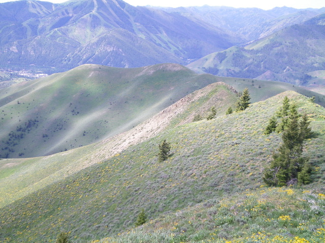
Sun Benchmark (the ridge in mid-ground) as viewed from Peak 8398 to its northeast. Livingston Douglas Photo
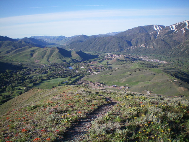
View of Sun Valley from high on the south ridge of Sun Benchmark. Livingston Douglas Photo
Additional Resources
Regions: Boulder Mountains->EASTERN IDAHO
Mountain Range: Pioneer Mountains
Longitude: -114.34979 Latitude: 43.72459