Elevation: 6,298 ft
Prominence: 678
This peak is not in the book. Published November 2023
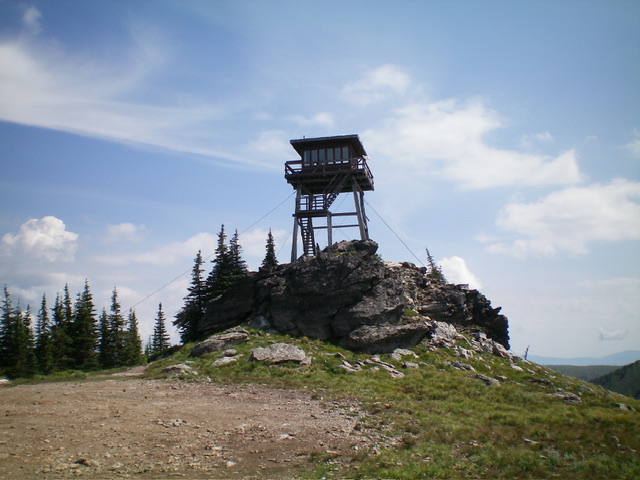
Sundance Mountain is a magnificent peak that sits east of the south end of Priest Lake. It has a fire tower on top and can be reached by a rugged 4WD road from the valley floor. USGS Coolin
The fire tower atop Sundance Mountain. Livingston Douglas Photo
Access
From ID-57 southwest of Priest Lake, turn right/east onto paved Dickensheet Road (signed for “Coolin”). Drive 3.6 miles to a road junction signed for “Sundance Lodge.” This is Substation Cutoff Road. Turn right/east onto Substation Cutoff Road and drive 0.3 miles to a “T” junction with [signed] East River Road. Turn right/south and drive 1.7 miles south on East River Road to a signed junction with Lost Creek Road.
Turn hard left and drive northeast up Lost Creek Road for about 2 miles to reach a signed junction at 2,640 feet (map). Go left here to stay on Lost Creek Road. Stay right at a road fork about 0.1 mile north up the road (the left fork is for the Sundance Lodge). The road crosses a short section of private land (for 0.2 miles) and continues another 0.5 miles or so to an unsigned road junction. Go right/east here. This is the Sundance Mountain Lookout Road.
Reach a signed junction at 3,680 feet and go left (signed for “Warming Hut”). Reach a final unsigned junction at 4,480 feet (map). Go right/northeast here and immediately cross an open road gate. This road is much rougher, steeper, and rockier so you may want to park at the road closure gate and hike the rest of the way to the summit. The National Forest Map and USGS topo map suggest that this road is still good from here up to the summit, but it is most certainly NOT. It is rough.
Drive 2.0 miles up from the road closure gate and park in a minor pullout (or continue to the summit if your 4WD vehicle will get you there) at 5,970 feet, which is about 0.2 miles above a high junction with another 4WD road (not shown on maps) that also goes to the summit.
West Face, Class 1
The Climb
From the parking pullout, hike up Sundance Mountain Lookout Road to the summit. The road hike from here is 0.5 miles round trip with 325 feet of elevation gain. The summit of Sundance Mountain has a fire tower.
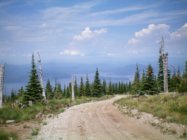
View of Priest Lake from high on Sundance Mountain. Livingston Douglas Photo
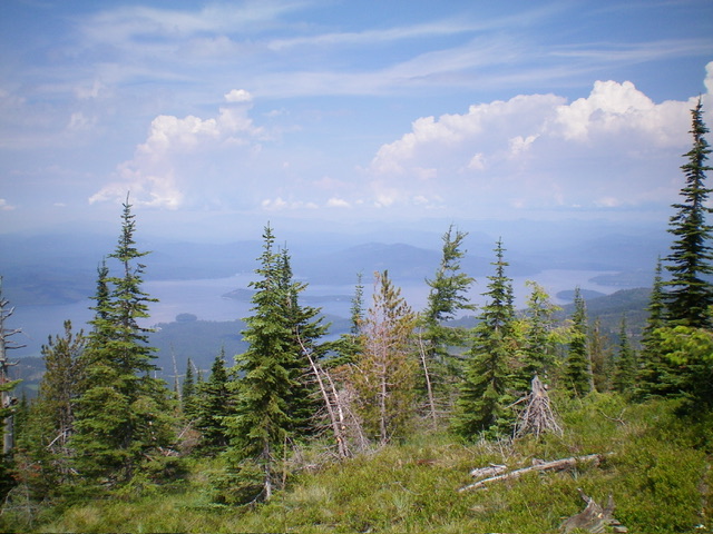
Another view of Priest Lake from Sundance Mountain. Livingston Douglas Photo
Additional Resources
Regions: NORTHERN IDAHO->Selkirk Mountains
Mountain Range: Selkirk Mountains
Longitude: -116.7514 Latitude: 48.4908