Elevation: 7,185 ft
Prominence: 515
This peak is not in the book. I added my route for the upper north ridge below Livingston’s route. Published November 2019
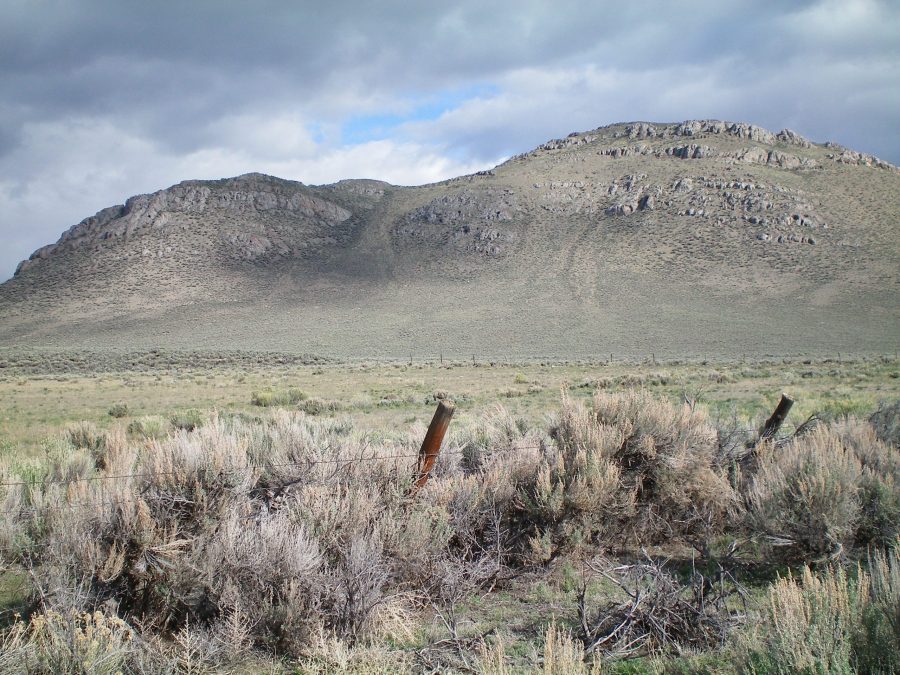
Swensen Butte is one of a number of buttes near Trail Creek Road. The southeast gully/south ridge is a fun scramble from a jeep road that gets you to the base of the butte. Swensen Butte has impressive rock strata on its southeast face, which is clearly visible from Trail Creek Road. USGS Chilly Buttes
Swensen Butte as viewed from the 2-track jeep road. The summit is just right of center. The southeast gully/south ridge climbs the gully leading up to the saddle and then follows the ridge to the top. Livingston Douglas Photo
Access
From US-93 north of Mackay, drive west on Trail Creek Road for 7.3 miles to a fence row and a 2-track jeep road on the right/north side of Trail Creek Road. Pull off and park here (6,525 feet). For some vehicles, the 2-track road is drivable and would shorten the hike considerably.
Southeast Gully/South Ridge, Class 2
From the parking spot, hike north on the 2-track jeep road which follows the right/east side of a fence row. The road (and fence) turn sharply left/west. Hike a short distance west on the road. Leave the road here to scramble cross-country through sagebrush to reach the base of a wide, prominent gully that leads up to a ridge saddle left/southwest of the summit. Climb up easy grass/scrub/scree to the saddle. From the saddle, follow the ridge right/northeast to the top on a mix of grass/scrub, scree, and some rock ribs. The summit of Swensen Butte is rocky and has a nice cairn with a stick in it.
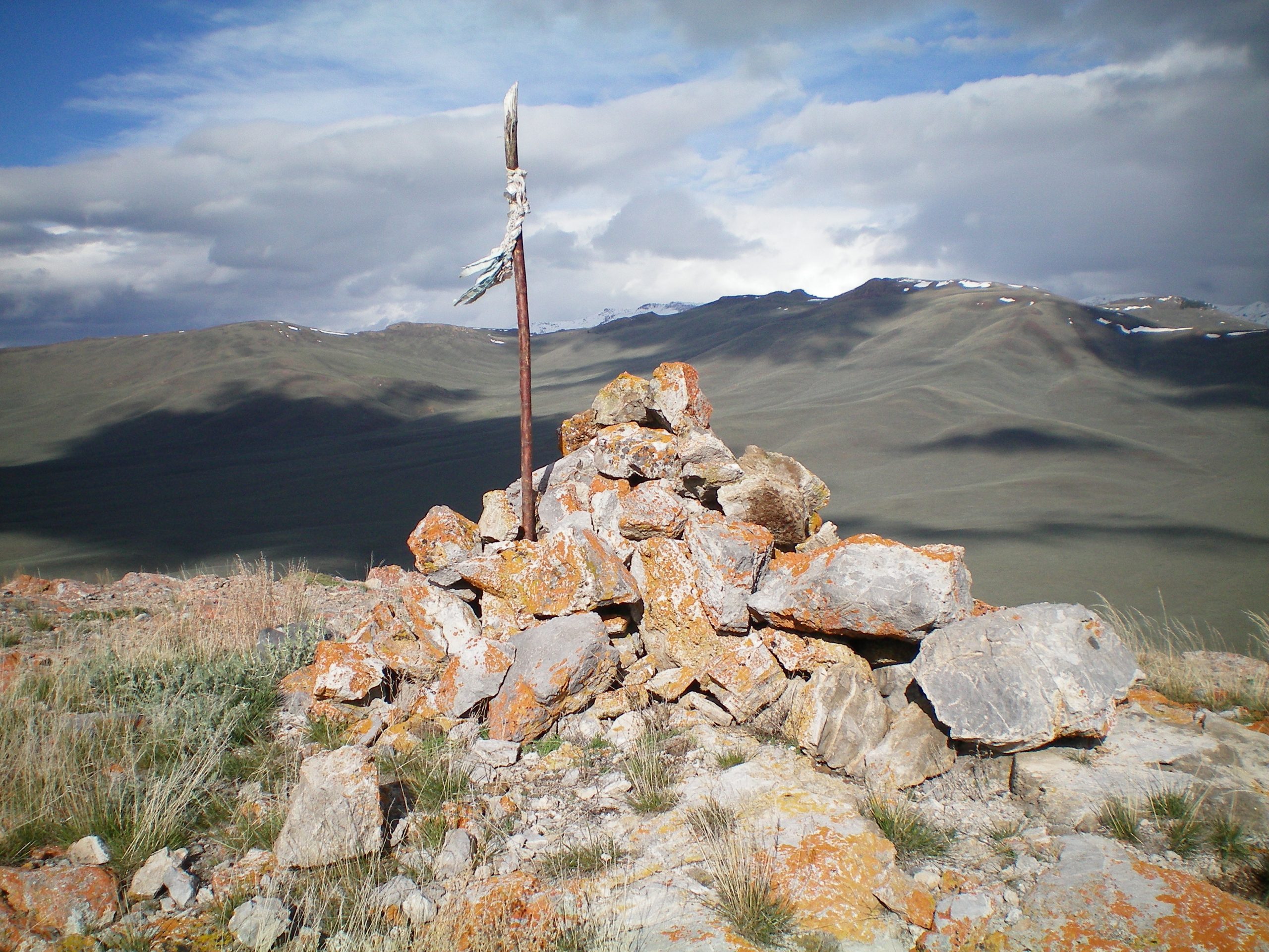
The summit cairn atop Swensen Butte, looking northwest. Livingston Douglas Photo
Upper North Ridge, Class 2+
Access
From US-93, drive west on Trail Creek Road for 7.3 miles to a fence row due north of the butte. Turn onto a 2-track jeep road on the right/north side of Trail Creek Road and drive south (as shown on the map below) until you reach the 4WD road shown in black below. Turn left/east. If you lack a 4WD vehicle, park here. If you have a 4WD vehicle, you can continue to the spot where I parked (the black line).
Route
The route climbs below a series of rocky towers and outcrops to a saddle on a rib. From this point, climb south-southwest to the ridge top north of the summit. Once on the ridge head due south to the summit, bypassing a couple of short cliffs on the west side of the summit ridge.
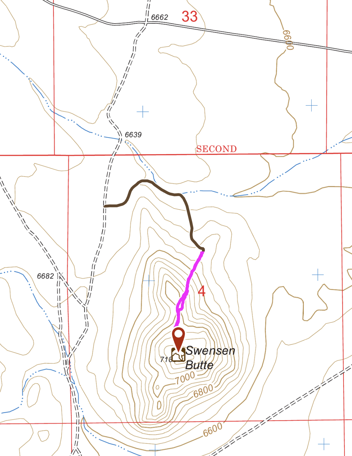
My GPS track. Round trip stats: 0.85 miles with 444 feet of elevation gain.
Additional Resources
Regions: Boulder Mountains->EASTERN IDAHO
Mountain Range: Boulder Mountains
Year Climbed: 2019
Longitude: -113.98129 Latitude: 44.04801