Elevation: 6,130 ft
Prominence: 760
This peak is not in the book. Published November 2018
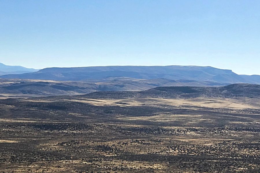
Swisher Mountain is comprised of a massive 6-mile long ridgeline that is located northeast of Jordan Valley, Oregon, and just east of the Idaho/Oregon border. There is an abandoned repeater station and USGS benchmark on the western edge of the peak’s large, rounded summit. The highest point is east of the benchmark. USGS Swisher Mountain
Swisher Mountain as viewed from the northwest.
Access and Route, Class 1
Access the peak from US-95 at its junction with the signed road to Silver City, ID. If you are coming from the north, the junction is 33 miles south of the US-95/ID-55 junction, which is located just west of Marsing, ID. If you are coming from the south, the junction is 9.3 miles north of Jordan Valley, OR.
At the junction, turn east and follow the good gravel road for 0.7 miles. Turn right/south and follow another good gravel road for 0.6 miles. Turn left/east onto the Silver City Road. Follow this good road east for 3.2 miles to the unsigned junction with the Posey Creek Road. The Posey Creek road is a 4WD road by all measures. Follow the Posey Creek Road south for roughly 2.65 miles. Just after you cross Palmer Creek, you reach a junction with the Swisher Mountain Road.
The Swisher Mountain Road runs all the way to the old repeater station just west of the true summit. While the Posey Creek Road is bad, the Swisher Mountain Road is steeper, rougher, and rocky. If you want to drive the entire way, you will need not only a true 4WD but also, skid plates and expensive all-terrain tires. I drove 0.7 miles up the road to a flat spot and walked the final 1.5 miles.
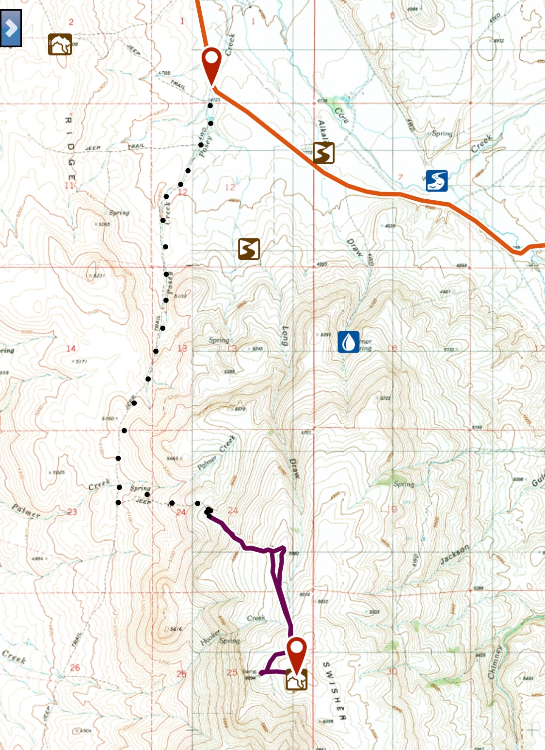
The dotted line shows the 4WD road that leads to the summit of Swisher Mountain. The purple line shows the section I hiked.
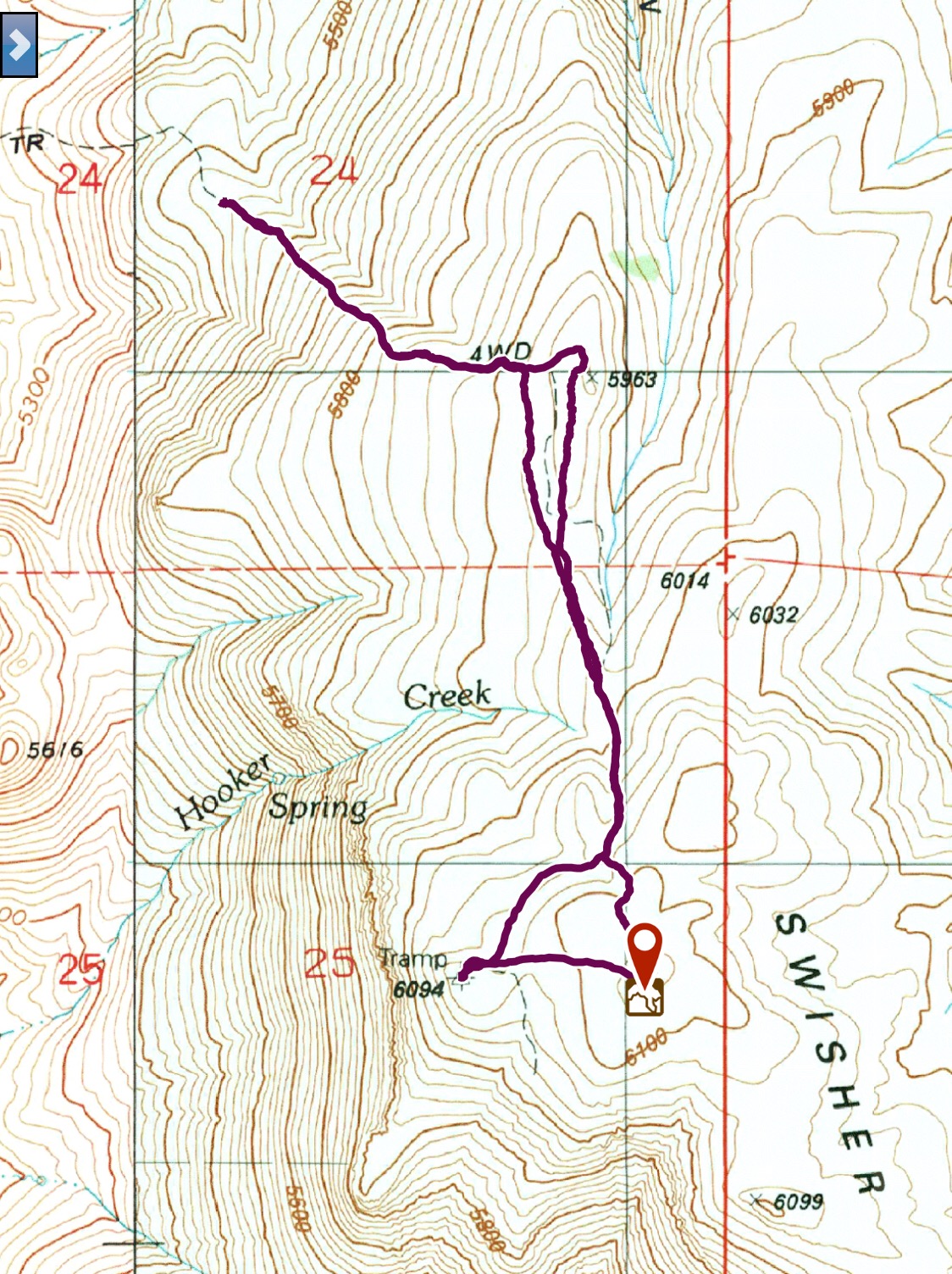
The GPS track showing the walking portion of the ascent, which was 3 miles round trip with 555 feet of elevation gain.
The Posey Creek and Swisher Mountain roads both cross private property. The route, as demonstrated in the photo below, is currently open to the public but this could change if the private land is damaged. Please respect this private land and stay on the road when crossing through this area.
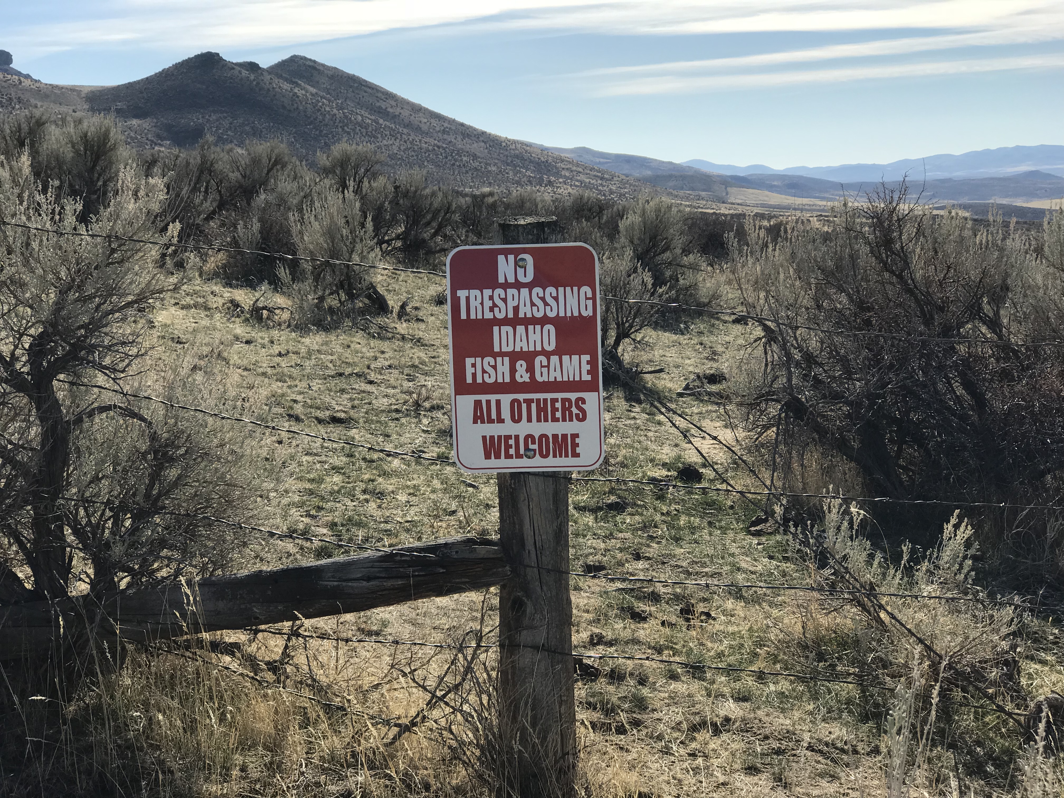
This sign marks the beginning of the private land on the Posey Creek Road. Thank you to the landowner who has a good sense of humor and the generosity to allow people to cross their land.
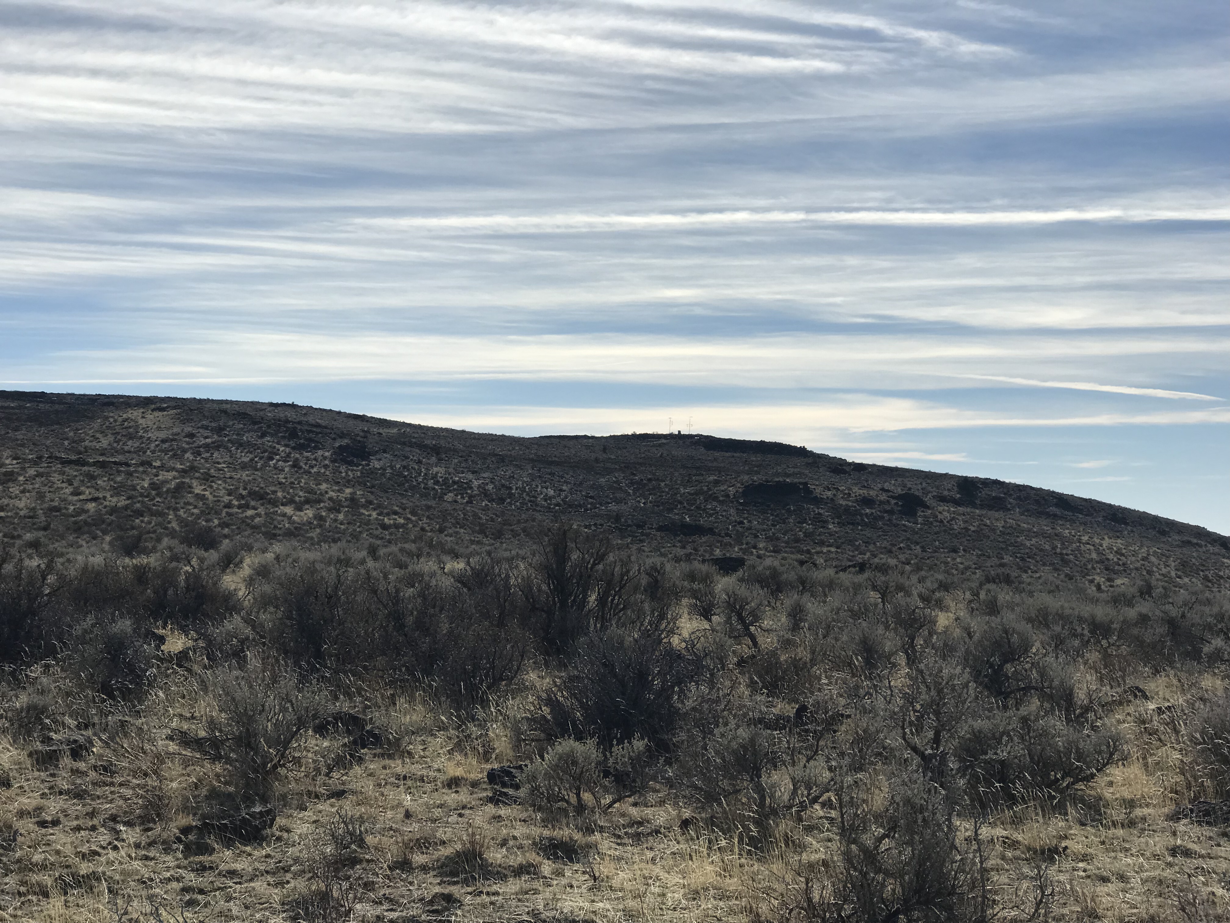
Looking west from the summit to the abandoned repeater station. The summit area burned in 2018.
Additional Resources
Regions: Owyhee Mountains->SOUTHERN IDAHO
Mountain Range: Owyhee Mountains
Year Climbed: 2018
Longitude: -116.98819 Latitude: 43.04601