Elevation: 5,385 ft
Prominence: 335
This peak is not in the book. Margo Mandella and Livingston Douglas provided the following information based on separate climbs. Updated December 2020
Table Legs Butte is located approximately three miles southeast of Atomic City, Idaho on public land managed by the Bureau of Land Management (BLM). This butte and several other buttes are visible from US-26. The butte’s summit block is actually made up of a number of small “summits,” which is probably why it is named Table Legs Butte. It appears to be an upside-down table with several “legs” pointed upward. As shown at ListsOfJohn (link below), the southeast leg is the true summit, though even with a GPS, the small difference in height between a couple of the butte’s legs will make you question whether you are on the high point. However, it is a quick, fun scramble to explore and climb on top of each of the prominent table legs. USGS Atomic City. —Margo Mandella
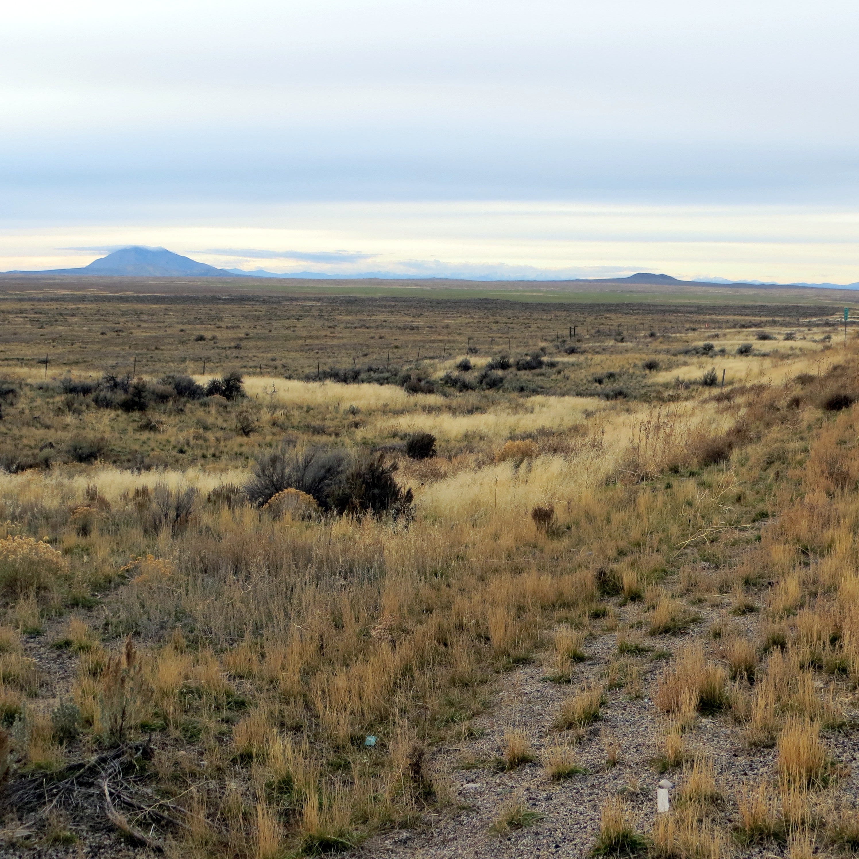
Table Legs Butte (far right) and Big Southern Butte (far left) as viewed from US-26.
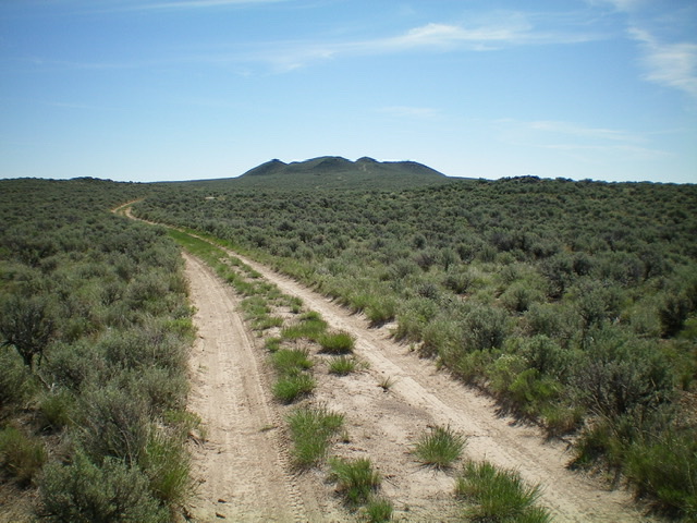
Table Legs Butte as viewed from the primitive 2-track road leading up into its crater from the west. Livingston Douglas Photo
Northwest Face by Livingston Douglas
Access
Table Legs Butte is best accessed from Atomic City, ID. Atomic City is most easily reached on paved roads from the junction of US-20 and US-26 to the north. From that well-signed junction, drive south on US-26 for 6.7 miles to a [signed] right turn for Atomic City. Turn right and drive 1.3 miles on a paved road to reach Atomic City. The paved road ends at a road junction with 2650W in bustling downtown Atomic City. Turn left/south onto 2650W and reset your odometer. Please note that 2650W should be labeled at “Taber Road” but is not.
At 1.3 miles, reach a [signed] junction with Cedar Butte Road (right turn). Continue straight south on 2650W. At 1.7 miles, reach an unsigned junction with Table Legs Butte Road (left turn). Park here (5,085 feet) or drive up the primitive jeep road as far as you’d like and park. The road goes all the way into the crater in the center of the four infamous “legs” of Table Legs Butte. Please note that 2650W does NOT reach a rise prior to reaching Table Legs Butte Road. It is still ascending at a very gradual pace. Do not continue driving south looking for a saddle or ridge crest. The side road you want is before that point.
Northwest Face, Class 2
The Climb
Hike (or drive) to the end of Table Legs Butte Road in the crater. Scramble southeast up a rocky face to reach the summit ridge of the southeast high point of Table Legs Butte (5,385 feet). A short rocky scramble along the ridge crest southward gets you to the large summit boulders. There is no summit cairn.
Southwest Approach by Margo Mandella
The best access to the butte is from Tabor Road, which begins at the south end of Atomic City. Travel on Tabor Road for approximately 1.5 miles, reaching a slight, but noticeable, rise in the road. Just past this rise, at approximately 1.73 miles, an unmarked road heads east. This road is not shown as an allowed travel way on the BLM map (reviewed on the Interactive Trail Map on 1/22/17). However, the road is clearly and routinely traveled all the way to, as well as among, the butte’s legs, most likely by vehicles, part of the way, and motorcycles and all terrain vehicles.
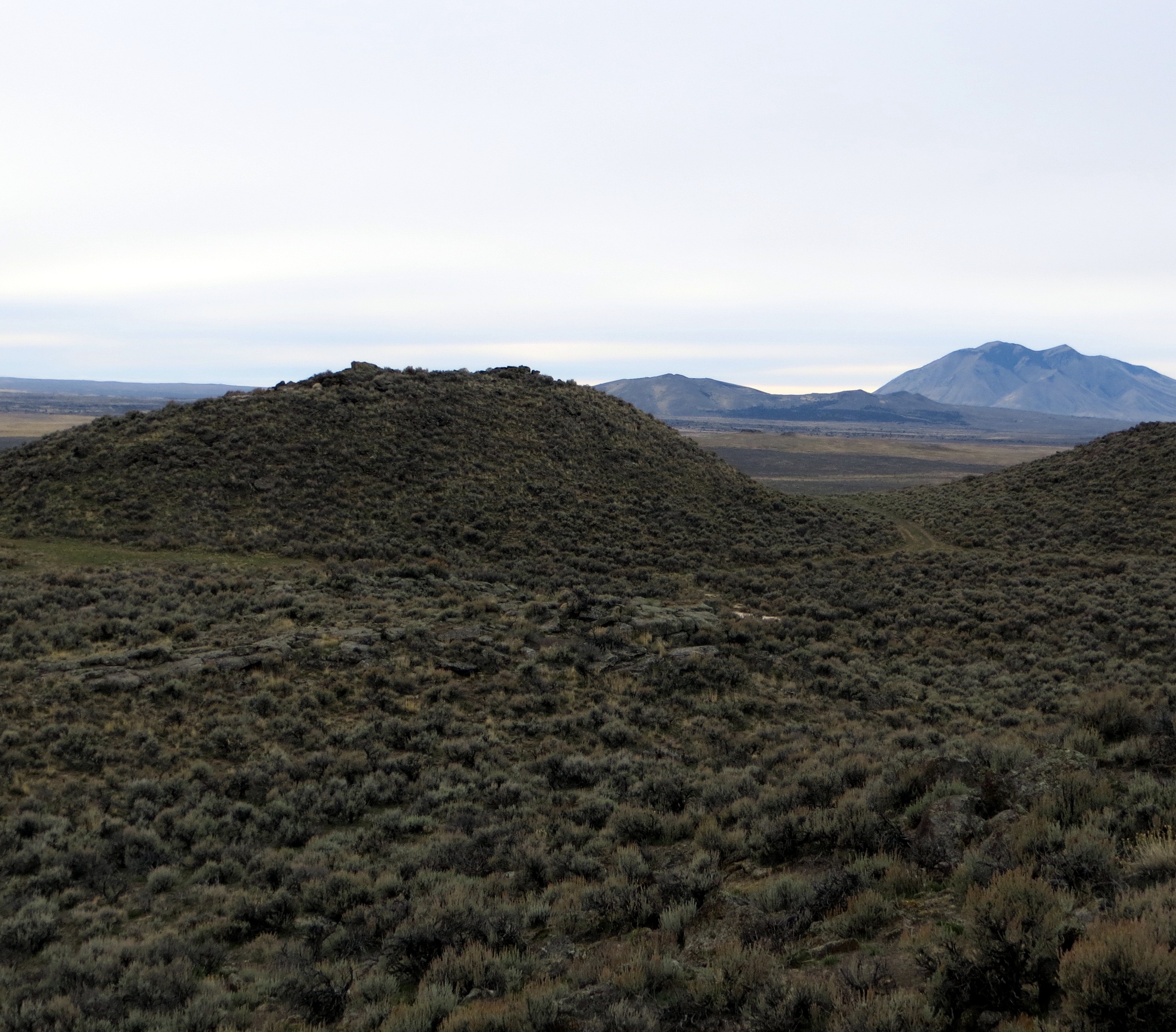
View from the summit of Table Legs Butte: one of the table legs (mid-ground), Cedar Butte (far center), and Big Southern Butte (far right). Steve Mandella Photo
Regardless, it is a relatively short and gradual 1.5-mile hike from Tabor Road to the summit block. However, in the summer, it could be quite hot and there is no water available.
The views from the summit(s) include the surrounding buttes and expansive lava flows patterns, as well as the Lemhi, Eastern Lost River Range, and Pioneer Mountains.
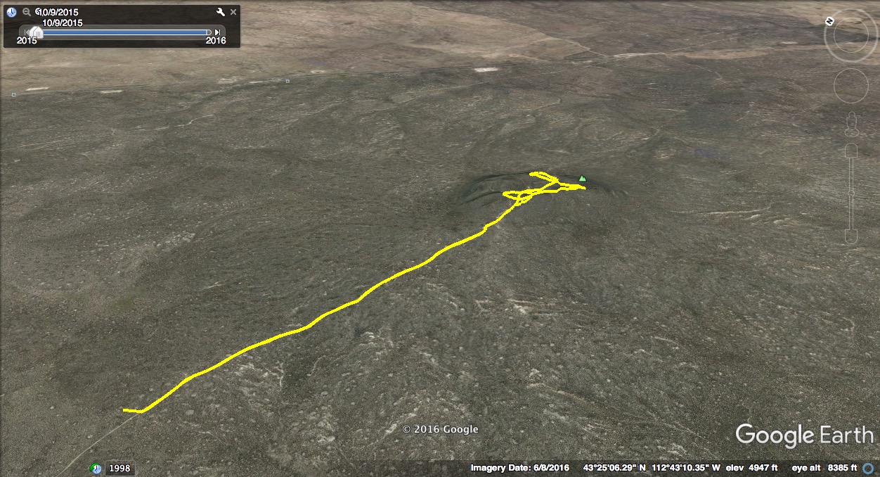
Partial approach route to Table Legs Butte. Margo Mandella GPS track
Additional Resources