Elevation: 3,658 ft
Prominence: 168
This peak is not in the book. Published November 2020
Table Rock stands over the northeast corner of Boise. It has a large lighted cross on its summit. Table Rock is very popular with Boisiens. A few notes for those not familiar with it. The high point on the map no longer exists as the quarry on the east side has expanded greatly and cannibalized the high point. The new high point is located behind “No Trespassing” signs. Most people count the area at the large cross as their high point. USGS Boise South
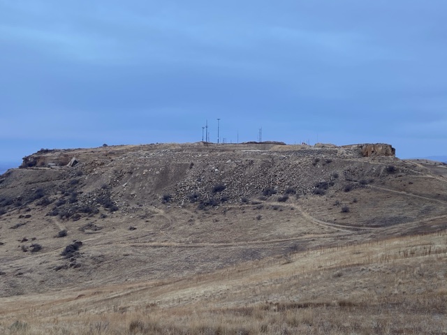
Table Rock viewed from Homers Nipple. The rock quarry that has cannibalized the highest point of Table Rock has been mined for nearly 100 years.
Access
A road leads to the top. For much of the year, the road is closed about a half-mile below the top. Recently, the parking area was closed and turned into a “Tow at Owner’s Expense” zone. There are a few parking spots roughly 0.5 miles down the road.
Routes
The most popular route for hikers and runners starts on the peak’s south side in a large parking lot by the Old Idaho Penitentiary. This trail is part of the Ridge-to-Rivers trail system (linked below). The trail system can also be accessed from a trailhead at the Warm Springs Golf Course. The trail starts across the street from the parking lot entrance. Be careful when crossing the busy street.
Additional Resources
Regions: Boise Mountains->WESTERN IDAHO
Mountain Range: Boise Mountains
Longitude: -116.13689 Latitude: 43.58949