Elevation: 8,219 ft
Prominence: 639
This peak is not in the book. With a prominence of 639 feet, Temple Peak was calculated as the steepest of the 19 peaks in Teton County, Idaho by Tim Worth. This mountain is one of several located in the core area of the Big Hole Mountains. A quick glance at the Targhee National Forest travel plan map shows the area is crisscrossed by motorized routes. Don’t be fooled. Most of these are challenging trails only passable to expert riders in dry conditions. If in doubt, walk. Updated October 2025
Temple Peak sits above the headwaters of Thousand Springs Valley and Castle Lake in the Big Hole Mountains. It is most easily approached via FST-077 (an ATV trail). The northeast ridge is a challenging bushwhack from the ATV trail. USGS Temple Peak. USGS Temple Peak
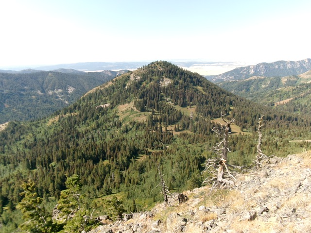
Temple Peak as viewed from the northeast. Livingston Douglas Photo
Access
From the north end of Idaho Falls at the Caribou-Targhee National Forest office on US-26, drive 13.6 miles east on US-26 to a signed junction for the Kelly Canyon Ski Area. Turn L/N onto a paved road. Set your odometer to 0.0 here. At 1.9 miles, go right at an unsigned junction. At 3.1 miles, cross the Snake River on a bridge then immediately reach a “T” junction. Go right/east here onto Heise Road. At 5.4 miles, go left at a signed fork in the road.
At 7.9 miles, enter the Caribou-Targhee National Forest. You are now on FSR-218. At 8.9 miles, reach a signed junction with FSR-217 (the “Y” junction). Go straight here to stay on FSR-218. At 19.4 miles, reach a signed junction with FSR-651 (right). Go right onto FSR-651 and drive 1.8 miles east on FSR-651 to its end at the trailhead parking area for FST-077 (an ATV trail). The trailhead is at 7,290 feet and 43°40’11.7”N, 111°26’42.8”W.
Northeast Ridge
The Approach (Class 1)
From the trailhead, hike up FST-077 for 1.2 miles to a signed junction with FST-121. Go left to stay on FST-077. Hike another 0.8 miles northeast up Hilton Creek to a signed junction with FST-067/Hilton Creek Trail. Go right to stay on FST-077. Follow the trail east then southeast for another 2.3 miles to reach a saddle and signed trail junction at the base of the northeast ridge of Temple Peak.
The Climb (Class 2)
Leave the trail here and hike southwest up a steep old road (of sorts) to its quick end. Follow a foot path for a short distance after the road’s end. The foot path ends at about 250 vertical feet above the saddle. The northeast ridge steepens considerably now. It is a mess of pines, thick willows, underlying scree/gravel, and a few open spots of scrub. Bushwhack southwest, moving right-ish/west for easier going.
Skirt the left side of an open rock gully and just grind it out. The narrow ridge is very steep and loose with thick willows to torment you. Eventually, reach the small summit area of Temple Peak. The summit is brushy but open. I rebuilt the torn-down summit cairn and enlarged it. The climb up the northeast ridge of Temple Peak is short but is not an easy bushwhack. Anyone who suggests other than that is a liar.
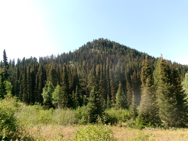
Temple Peak as viewed from the valley floor to its north. Livingston Douglas Photo
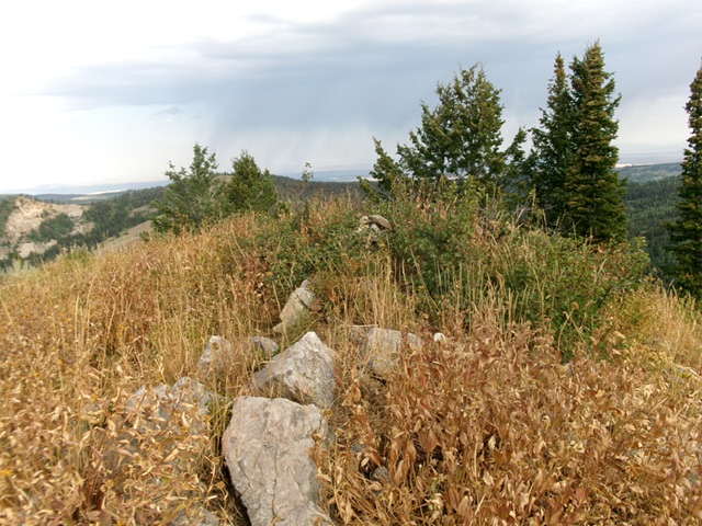
The brushy summit of Temple Peak. Livingston Douglas Photo

The view south to Temple Peak from Thousand Springs Valley (7/12/01). The Northeast Ridge is on the left. From US-26 along Antelope Flat, you get one good fleeting view of Temple Peak. Otherwise, this is a shy one, preferring to stay hidden. Rick Baugher Photo
Additional Resources
Mountain Range: Big Hole and Snake River Mountains
Longitude: -111.39411 Latitude: 43.65059