Elevation: 7,580 ft
Prominence: 560
Climbing and access information for this Granite Peak (one of 12 Idaho mountains named either Granite Peak or Granite Mountain) is on Page 68 of the book.
Granite Peak is located in an area where the Idaho/Montana border forms a “U”-shaped curve, running south then east then north. There is a lot of granite-based country to explore in this stretch of the Bitterroot Mountains. Thanks to Dan Saxton for his important update. Granite Peak is listed in the book as 7,551 feet, but the highest contour line is 7,560 feet. The Lists of John website assigns an elevation of 7,580 feet. The guidebook rating is wrong in its Class 2 rating. This peak has a hard Class 4 summit block. USGS Granite Pass
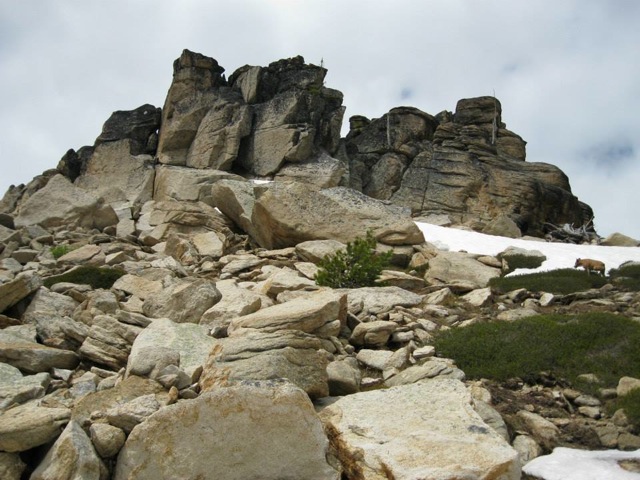
The best way to approach this peak is from the Crooked Fork Road/FS-595 where it crosses the Crooked Fork. Follow the trail/FST-35 up the creek to the saddle southeast of Granite Peak and go through open woods toward the peak. As you get closer, you will find that the top is a serrated crest of pinnacles. The chief one is about 40 feet tall and requires steep Class 3 scrambling to the base of the final block, where an extremely-exposed Class 4 “pull-up” ledge move is required up the last 10 feet to attain the peak. I could not make the move. Granite Peak is a difficult peak to summit.
The summit pinnacle of Granite Peak. Dan Saxton Photo
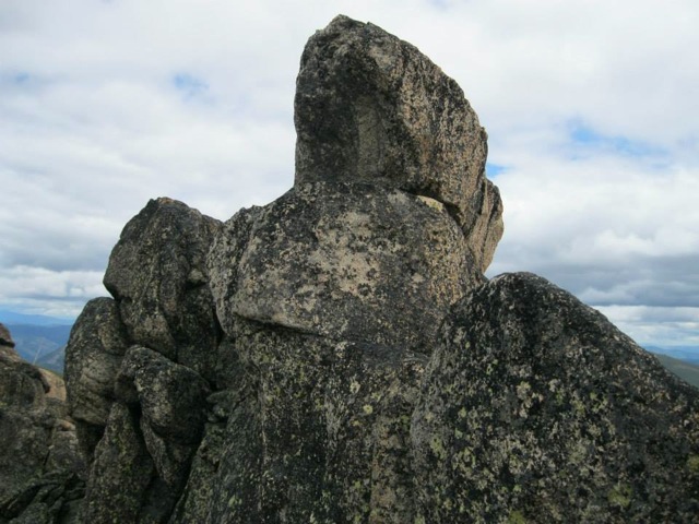
The summit block with the “pull-up” ledge below the top, which one must use to traverse around to the left and up the last block. There is an exposed 30-40 feet dropoff to the left. Dan Saxton Photo
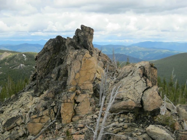
The summit crags as viewed from below. Dan Saxton Photo
Additional Resources
Regions: Bitterroot Mountains->NORTHERN IDAHO
Mountain Range: Bitterroot Mountains
Longitude: -114.71219 Latitude: 46.71629