Elevation: 9,965 ft
Prominence: 110
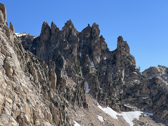
There is limited climbing and access information for this formation and its neighbors (Steeple Tower and Splinter Tower) on Page 176 of the book. Brian Westphal with on the ground reconnaissance from Kaden Platt has carefully evaluated the LiDAR data, researched the historical record, and pinned down the exact location, elevation, and prominence of all three towers. He has significantly updated the information found in the book. I have included Brian’s report for all three towers on the Splinter Tower page and in the website’s Climbing History section. Kaden Platt updates are set out below. Updated June 2026
Thimble Tower is one of three rarely visited formations collectively known as the Splinter Towers. These towers are located just southwest of the West Pinnacle. USGS Mount Cramer
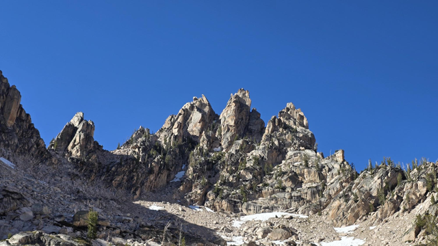
Splinter Towers. Kaden Platt Photo
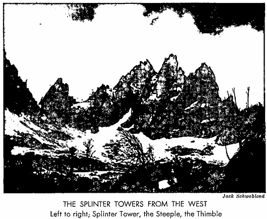
Summit Block, Class 5
This formation was climbed in 1948 by H. King and Fred Beckey. Exact details are unknown. Beckey reported that Thimble Tower had 200 feet of “high angle slab” requiring at least two pitons for the last 40 feet.
Kaden Platt Updates
The 2020 earthquake very likely altered the Splinter Towers structure. Thus, the current high points may be different than the historical high points.
Approach Gully
The easiest access is from the unnamed lake located west of Quartzite Peak. Affected by the earthquake or not, the main approach gully for Splinter Tower and The Steeple requires moving around two large chockstones.
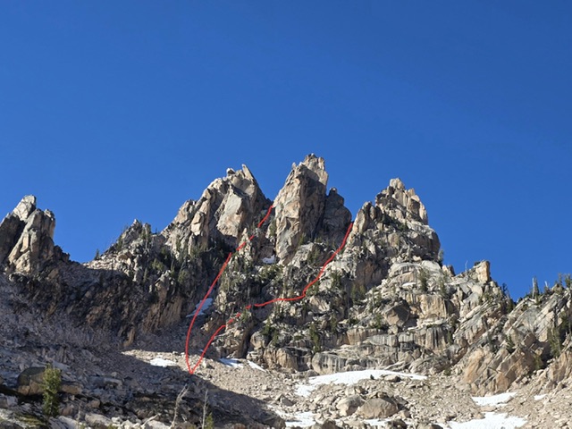
Line to the left is best for accessing the HP and The Steeple, on the right for The Thimble. Both class 4 approaches. Kaden Platt Photo
The Thimble, 5.9?
As mentioned in the literature, this is the lowest of the group. Easy stemming and offwidth until the last 15 or so feet. Then either a run-out squeeze chimney, or throw in some ballnutz and climb the near blank West face. Single rack .5-#3, nuts and ballnutz in smallest sizes. 40m rope, slings for lowering.
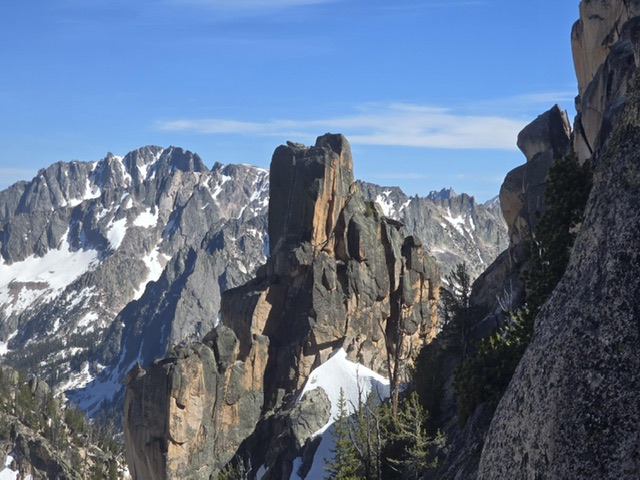
Thimble Tower. Note small cairn on summit. Kaden Platt Photo
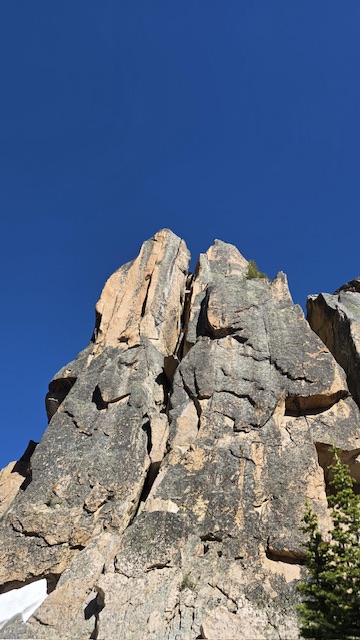
Wide split down tower, possibly from earthquake as not mentioned in literature? Kaden Platt Photo
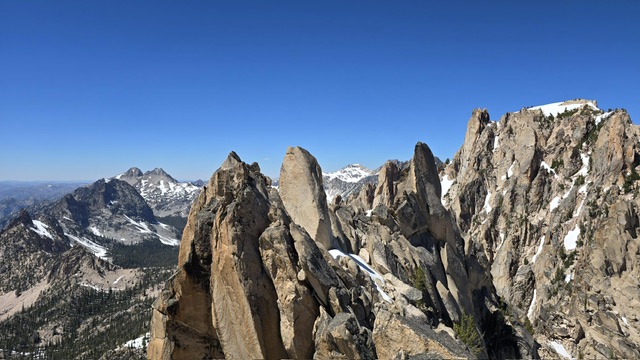
This photo was taken of the higher points of the ridge, current HP far right. Kaden Platt Photo
Additional Resources
Regions: Heyburn Divide->Sawtooth Range->WESTERN IDAHO
Mountain Range: Sawtooth Range
First Ascent Information:
- First Ascent Year: 1948
- Season: Summer
- Route: Summit Block
- Party: H. King and Fred Beckey
Longitude: -114.9972956 Latitude: 44.08667528