Elevation: 4,451 ft
Prominence: 449
This peak is not in the book. Published November 2023
Thomas Hill is a ridgeline hill with four distinct summit humps. It is located west of Graham Mountain in the Coeur d’Alene Mountains north of I-90. The high point of Thomas Hill is NOT the official/measured southeast summit but is the northwest summit. The northwest summit has the wreckage of a structure (perhaps a triangulation station) atop it but the southeast summit is barren. It appears that the surveyors also found the northwest summit to be the high point. Perhaps the USGS placed the 4,451-foot measured point on the wrong hump. USGS Kellogg West
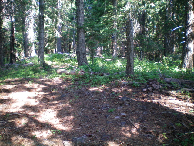
The official/east summit of Thomas Hill. Livingston Douglas Photo
Access
From Exit 43/Kingston on I-90 southeast of Coeur d’Alene, go north on CR-9 for 8.0 miles to an unsigned junction with a gated road on the right/east side of the paved road. Go sharply right onto this dirt road as it heads south then north then southeast up a series of switchbacks. The road is narrow but is decently maintained due to logging activity. Ignore any side roads until the road reaches a 3-way junction.
Park at a gated road closure just past this junction at a 2-track road that heads west. This is old FSR-606 (still shown on the USGS topo map) but has been closed to motor vehicles for years. This gated closure is at 4,005 feet and 47⁰35’46”N, 116⁰09’47”W. This is the first leg of a 2-peak adventure that includes Thomas Hill and Linfor Hill (4,327 feet). It covers 4.2 miles with 1,100 feet of elevation gain round trip.
Map Errors
FSR-606 is blocked by private property on the valley floor and does not even exist anymore there anyway. It is blocked by a gated closure just east of Thomas Hill high up on the ridgeline. Based on the road’s current condition, it probably has not been open to motor vehicles in many years.
East Ridge, Class 1
The Climb
From the gated road closure, walk about 50 feet east to an unsigned junction with an old 2-track that heads west-southwest up the forested ridge crest and soon ends at a campsite. From here, follow a decent unsigned trail (FST-17) up the crest of the east ridge. It soon reaches the southeast summit of Thomas Hill at 4,451 feet. There were no signs of previous and, believing that it was the true summit of Thomas Hill, I built a small cairn here. From the southeast summit (the first of four summits on Thomas Hill), follow FST-17 northwest along the ridge crest and skirt two more ridge points, each of which is lower than the southeast summit.
FST-17 climbs 50 vertical feet to skirt close to the final ridge point (the northwest summit). Leave the trail and bushwhack a short distance to investigate the top of this ridge point. It measures 10 feet higher than the official/southeast summit, according to my altimeter. But, more importantly, this forested hump has wreckage of some type of structure (see photo). It also has an old 2-track road leading up to it from FSR-606. All of this leads me to believe that the northwest summit (the final hump of four potential high points) IS the high point of Thomas Hill. I suppose that you should stand on all four humps (as I did) just to be sure that you can put Thomas Hill on your completion list.
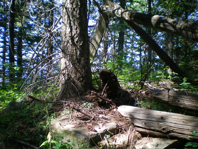
The actual HP (west summit) of Thomas Hill. Notice the remains of a fire tower (or cabin) here in the forest. An old 2-track road leads up to this point. Livingston Douglas Photo
Northwest Ridge, Class 1
The Descent
From the northwest summit, descend the steep-ish ridge on the 2-track road and intercept FSR-606. Go left/west on FSR-606 briefly and cross underneath a set of power lines. Once past the power lines, find an old, overgrown 2-track road heading right-ish/west on the ridge into a thick pine forest. This is FST-1319 but is unsigned. Follow FST-1319 down to a saddle where it changes from a 2-track road to a foot trail. This is the 4,020-foot connecting saddle with Linfor Hill. It concludes the first leg of today’s 2-peak adventure. Linfor Hill is up next.
Additional Resources
Regions: Coeur d'Alene Mountains->NORTHERN IDAHO
Mountain Range: Coeur d'Alene Mountains
Longitude: -116.1741 Latitude: 47.5947